Sophisticated base station receiver

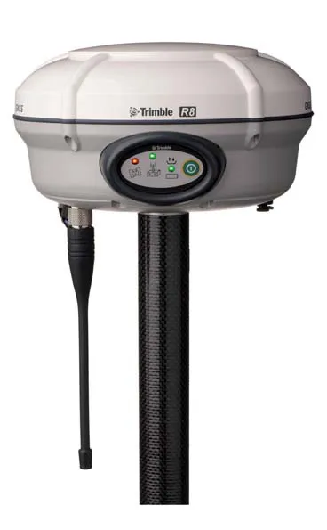
Trimble has introduced the R750 GNSS Modular Receiver, a connected base station for use in civil construction and geospatial applications. The R750 is said to provide improved base station performance, giving contractors and surveyors more reliable and precise positioning in the field.
March 1, 2022 Read time: 2 mins
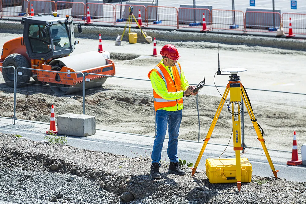
Trimble is now offering a sophisticated new base station receiver system

The R750 can be used to broadcast Real-Time Kinematic (RTK) corrections for a wide range of applications, including seismic surveying, monitoring and civil construction. Access to available satellite signals is said to provide improved performance and reliability when used with a Trimble ProPoint Global Navigation Satellite System (GNSS) rover. ProPoint can boost performance in challenging GNSS conditions, with groundbreaking signal management.

Featuring a built-in LTE modem, the R750 offers corrections via the internet, making it easier to extend the range of a base station with cellular coverage. The built-in modem also provides remote access and management, delivery of email alerts and notifications, and data transfer capabilities between the field and the office.

The R750 is said to deliver better satellite tracking and connectivity. It offers the ability to manage a base station remotely and receive status notifications about the unit while in the office. This reduces downtime and the need to travel to the site.

For monitoring applications, the R750 provides precision capabilities for construction and geospatial customers deploying automated systems. Combined with Trimble 4D Control real-time monitoring software, users can capture high-frequency 3D positions for alarming and reporting on movement. The R750 offers multiple communication methods that provide flexibility for customers on how they deploy their monitoring system.

For more information on companies in this article

Related Content

  • Conference focuses on road design software
    February 23, 2012
    Trimble Dimensions 2009 takes a hard look at opportunities in a tough economy If attendance is the standard by which user conferences are measured, then Trimble Dimensions 2009 should be considered a success. The conference, which took place from 23-25 February at the Mirage Hotel in Las Vegas, USA, hosted more than 2,400 attendees, slightly exceeding last year. The strong attendance, in the face of global economic concerns, was seen by Trimble CEO Steven Berglund as a show of support for the company's tech
  • Conference focuses on road design software
    April 12, 2012
    Trimble Dimensions 2009 takes a hard look at opportunities in a tough economy If attendance is the standard by which user conferences are measured, then Trimble Dimensions 2009 should be considered a success. The conference, which took place from 23-25 February at the Mirage Hotel in Las Vegas, USA, hosted more than 2,400 attendees, slightly exceeding last year. The strong attendance, in the face of global economic concerns, was seen by Trimble CEO Steven Berglund as a show of support for the company's tech
  • Goodyear’s solution saves big euros on off-highway tyre costs
    April 23, 2018
    Goodyear has staged the European launch of its new data-based solution which enables precise, real-time monitoring of tyres. TPMS (Tyre Pressure Monitoring System) Heavy Duty will, in combination with Goodyear premium tyres and services, help OTR fleets optimise tyre performance, reduce downtime and improve total cost of ownership. The prevention of tyre-related incidents through the use of TPMS Heavy Duty reduces breakdown costs and is said by Goodyear to increase dump truck, wheeled loader and mobile cr
  • Accurate utilities detection
    November 26, 2024

    Trimble and Radiodetection are collaborating to improve the technology used in the utility measurement and mapping process. Integrating the Trimble Catalyst DA2 GNSS system and Radiodetection’s RD MapTM+ application and precision locator products helps to streamline utility-locating workflows to provide accurate measurement capabilities and generate underground utilities maps in a single field operation.