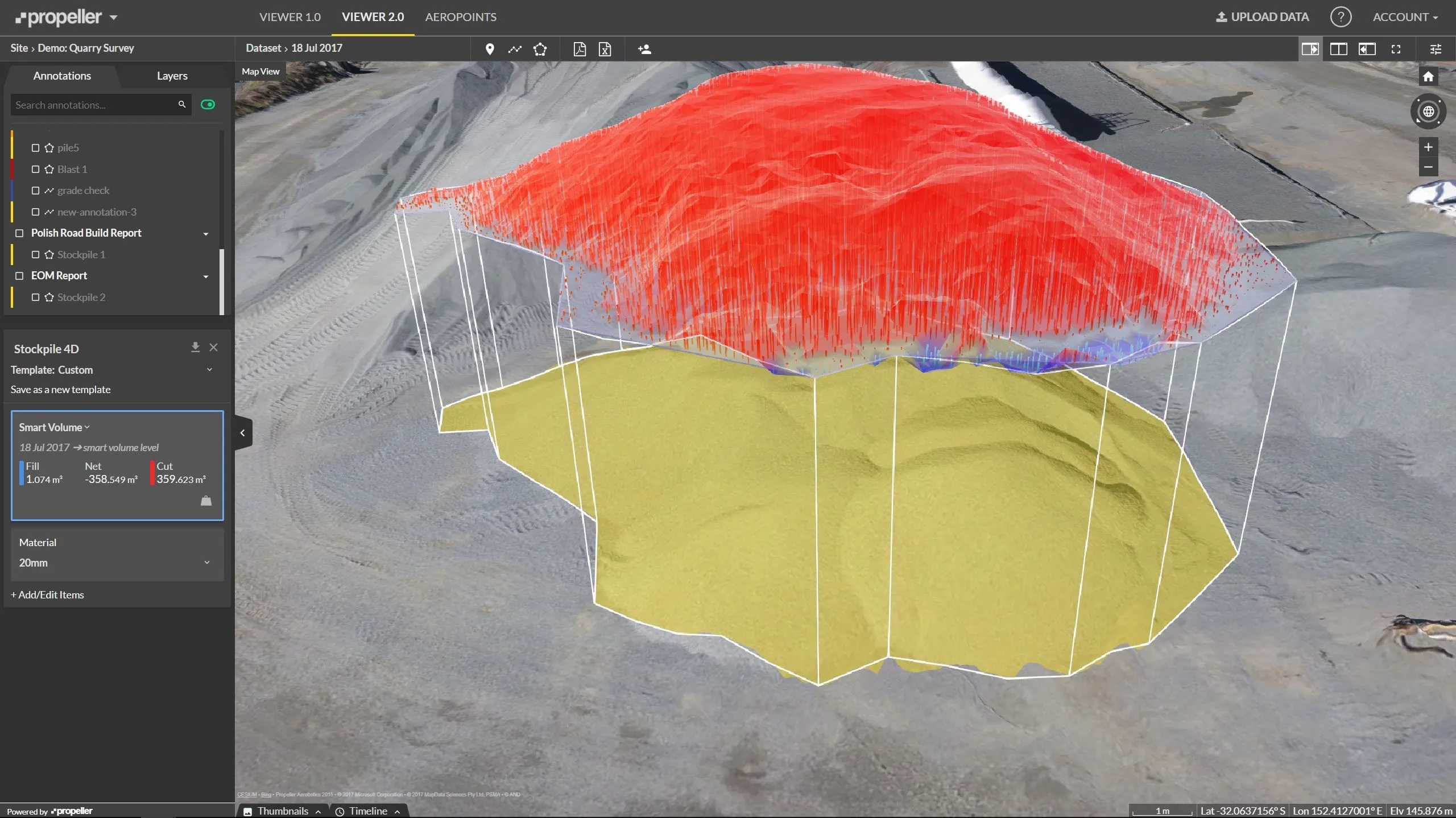
The combined software enables data interoperability between survey and construction workflows for more efficiency, time savings and data quality.
The firm says that the package simplifies workflows and licensing for its customers, saving them time and money by providing a complete office software solution across the project life cycle.
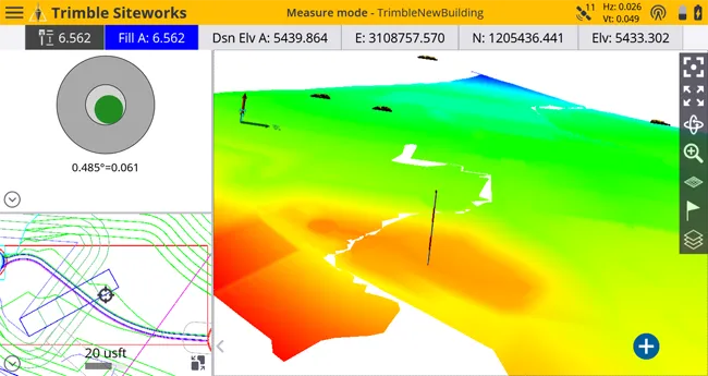
This version includes new tools for the creation of Computer Aided Design (CAD) and Geographic Information System (GIS) deliverables, corridor inspection reports and tunnel as-built analysis from complex 3D point clouds. The addition of automated feature extraction, powered by Trimble eCognition software, reduces the time to extract features, such as trees, poles and signs, from point cloud data. New multi-slice capabilities, combined with cutting plane workflows, allow users to extract cross sections from point clouds at intervals along a linear geometry, streamlining corridor redesign and maintenance reporting.
The new Trimble Macro Language (TML) allows survey and construction professionals to customise data computations and add new CAD and GIS workflows to fit specific local requirements.