Safer construction sites with Leica Geosystems

The PA10 system is intended to highlight the location of construction personnel on working sites to machine operators.
By Mike Woof April 16, 2024 Read time: 1 min
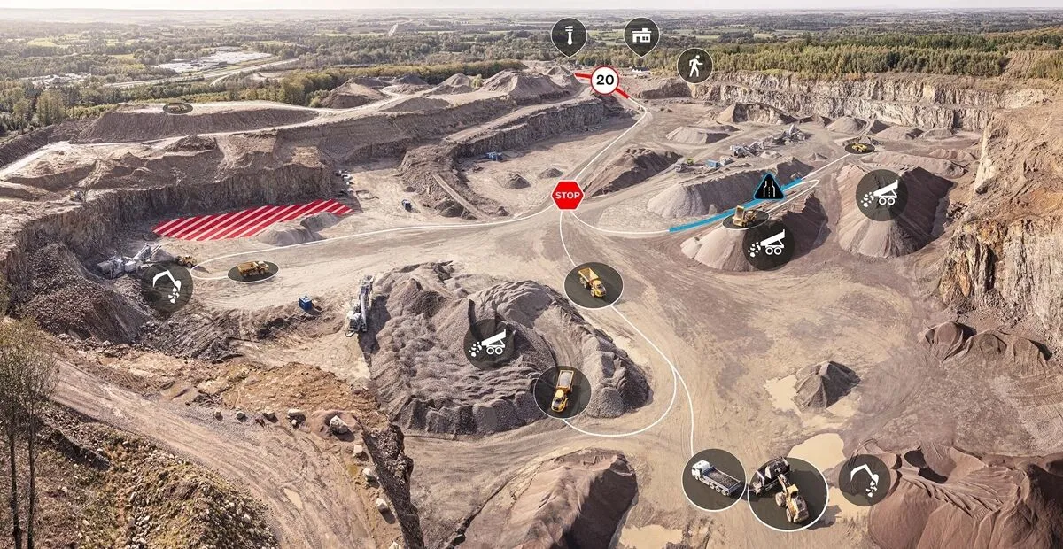
Leica Geosystems has developed a safety system for onsite use

A new package from Leica Geosystems is said to help boost safety for personnel on construction sites.

The PA10 system is intended to highlight the location of construction personnel on working sites to machine operators, as well as alerting workers as to where equipment is in use.

“It’s a personal awareness system,” said Thomas Bonvalot of Leica Geosystems. “Everybody onsite will know where a machine is working and the machine operator will know there is a pedestrian.”

For more information on companies in this article

Related Content

  • GKD’s audible warning system for sites
    April 10, 2018
    GKD Technologies has developed the SensorZone proximity warning system (PWS), which alerts thane operator when personnel are in dangerous proximity to the machine. The system is designed to reduce the risk of collisions between workers and construction machines. It operates using radio frequency identification detection (RFID), and provides vibration, audio and visual alerts to warn pedestrians and vehicle operators, when they are in danger of colliding with each other. Active RFID detection systems do not
  • Satellites for site safety
    February 10, 2012
    Mobexx is offering a satellite communications capability for its Mentor Ranger in-vehicle computer intended to improve lone worker safety. The system switches automatically between cellular and satellite networks depending on the available coverage. This package is said to maximise connectivity between site personnel and the office, providing improved monitoring and communication whenever they are operating in high risk situations or isolated sites. The new satellite interface allows the Work Alone system t
  • Versatile machine control package from Leica Geosystems
    April 25, 2024

    Leica Geosystems is widening its array of 3D machine control solutions with the introduction of its Leica iCON gps 120. This smart antenna offers customers a versatile machine control solution.

  • Leica Geosystems’ tools for site monitoring and handling GPR data
    October 11, 2017
    Leica Geosystems is offering new tools for construction firms for remote monitoring and for handling data from ground penetrating radar. With the GeoMoS Imaging package, users can stay up-to-date on remote monitoring; the live view allows observation and recording of areas of interest. A joystick provides remote access to the total station so that personnel can increase productivity and reduce time in the field.