Real time site monitoring technology

Leica Geosystems is broadening its site monitoring technology with the introduction of the GeoMoS package. This can be linked to the firm's existing GNSS Spider software to offer an array of TPS and GNSS monitoring tools. Combined, these tools provide a web-based service for visualisation and analysis of monitoring. Authorised users can access a monitoring project using a web browser, pocket PC or mobile phone. Using the GeoMoS Web service, graphs and views can be customised and be tailored to the needs of
July 19, 2012 Read time: 2 mins
265 Leica Geosystems is broadening its site monitoring technology with the introduction of the GeoMoS package. This can be linked to the firm's existing GNSS Spider software to offer an array of TPS and GNSS monitoring tools. Combined, these tools provide a web-based service for visualisation and analysis of monitoring. Authorised users can access a monitoring project using a web browser, pocket PC or mobile phone. Using the GeoMoS Web service, graphs and views can be customised and be tailored to the needs of each project. Multiple monitoring projects or sites can be included in GeoMoS Web, allowing authorised personnel to view sensitive data. Configuration tools bring the data to the web and interactive graphics allow an overview of the monitoring data, providing warnings when a project exceeds specified tolerances.

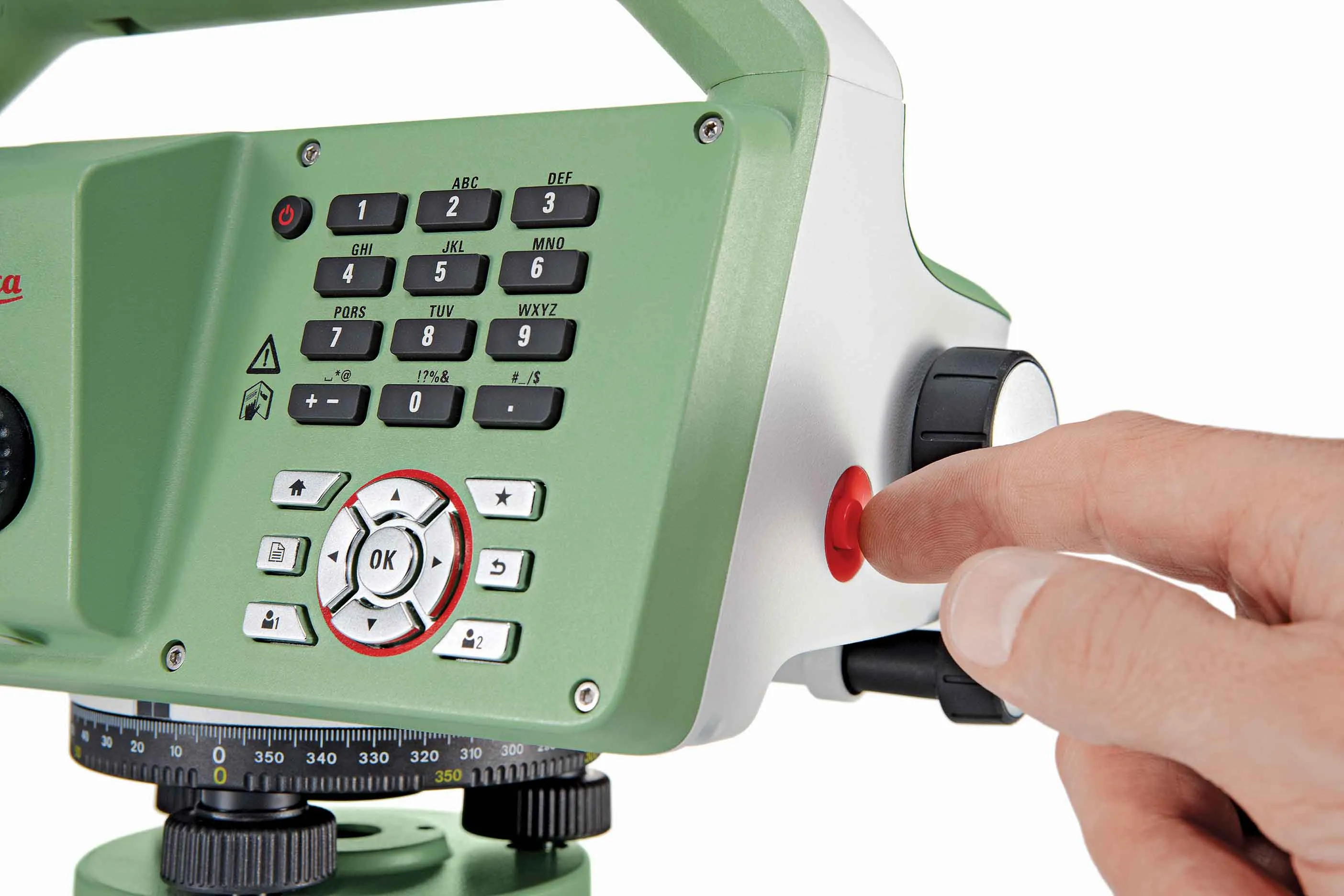
Meanwhile, improved surveying capabilities are claimed for the latest Total Stations product from Leica Geosystems. The new Leica FlexLine units are modular in design and hardware and software options can be selected to meets customer requirements. Purchasers can opt for pre-configured products or add specific hardware and software options to a base model and there are three pre-configured instruments within the FlexLine range. The Leica FlexLine TS02 is designed for standard measurement tasks, with a set of application software, a Bluetooth option, USB option and alpha-numeric keyboard option. The Leica FlexLine TS06 is versatile and comes with an alpha-numerical keyboard and a complete set of application software as standard while options include Bluetooth technology and a USB connection. The Leica FlexLine TS09 Total Station includes all FlexLine features from removable USB memory, Bluetooth technology, Emitting Guide Light and application software. Customers can also choose from a wide selection of additional hardware and software features.

For more information on companies in this article

Related Content

  • Asset management can be optimised with new technology
    August 22, 2013
    An array of asset management technologies and capabilities are now available to help clients optimise infrastructure assessments. Global survey and geotechnical group, Fugro, has signed a multi-year agreement with Dutch pavement consultant, KOAC•NPC. This move will see the firms combine capabilities to undertake highway surface condition contracts in the Netherlands. Under the agreement, Fugro will collect surface condition data using its ARAN road scanning vehicle. KOAC•NPC, will carry out the post pro
  • Leica’s new Digicat xf-Series cable locators and transmitters
    April 3, 2013
    Leica Geosystems has launched the latest additions to the Digisystem product range: the Leica Digicat xf-Series. With Leica Geosystems’ new xf-Series cable locators and transmitters, users are said to be able to accurately detect and trace utilities faster and over a greater distance. The Leica Digicat xf-Series is said by the Swiss firm to have been speci?cally designed with long distance tracing in mind. The ability to trace transmitter frequencies of 512Hz and 640Hz provides users with a greater tracing
  • Faster surveying with Leica Geosystems
    June 16, 2016
    Leica Geosystems says that the new LS15 tool can be used to complete all the key stages for levelling. The system has a high accuracy of 0.2mm, which can be achieved by aiming at the target via the colour touch display and pressing the measuring button. Key working features include an electronic bubble and tilt checks prior to each measurement and autofocus. These are said to help to reduce fatigue over a shift and help minimise the risk of working errors, ensuring consistently high accuracy of measureme
  • Topcon’s action station
    October 31, 2012
    Topcon Europe Positioning (TEP) has launched a new, professional-grade robotic total station – the PS series – which the firm says is designed to surpass the power, accuracy and capabilities of its peers. The PS is said to utilise Topcon’s new PowerTrac technology to increase the prism tracking power. “Using new optics, laser system and advanced algorithms, PowerTrac provides the PS with the ability to keep tracking a moving prism even under the toughest environmental conditions,” said Leighton Davies, surv