
Precision pinpointing

Leica Geosystems says that its TS30 package is a new high precision Total Station that meets highest standards in all surveying applications. Distances can now be measured with Leica Geosystems' proven PinPoint EDM Technology with an unprecedented precision of 0.6mm + 1ppm on prisms. On natural surfaces a high accuracy of 2mm + 2ppm up to 1,000m can be achieved.
March 1, 2012 Read time: 2 mins
Precise positioning is possible with the new TS30 package from Leica Geosystems
265 Leica Geosystems says that its TS30 package is a new high precision Total Station that meets highest standards in all surveying applications. Distances can now be measured with Leica Geosystems' proven PinPoint EDM Technology with an unprecedented precision of 0.6mm + 1ppm on prisms. On natural surfaces a high accuracy of 2mm + 2ppm up to 1,000m can be achieved.

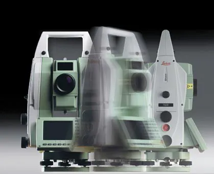
New direct drives using piezo technology were developed for the Leica TS30, allowing high tracking performance, with maximum acceleration and speed while maintaining accuracy under demanding conditions. This new technology allows automated one-person surveying and higher productivity.

Combined with the firm's Leica SmartWorx software, users can set the package up as a Leica TS30 SmartStation with the latest future proof GNSS antenna to provide immediate station coordinates. With the GNSS antenna on top of the 360° prism as a SmartPole, quick and accurate set-up can be achieved on-the-fly.

Features of the TS30 include long service intervals and low power consumption as well as a durable construction to withstand severe environments. The piezo drives allow for longer operation through low power consumption with sophisticated power management.

For more information on companies in this article

Related Content

  • Straight to the point for measurement
    February 6, 2018
    Leica Geosystems says it is introducing a major advance in site surveying. This offers a novel tilt compensation system, so that users are no longer required to hold the pole vertical. The new Leica GS18 T is claimed to be the world’s fastest GNSS RTK rover, while the firm is also offering the latest versions of Leica Captivate field software and Leica Infinity office software. With the addition of calibration-free GNSS and various upgrades to the Captivate field software and Infinity office software, use
  • AibotX6 Version 2 uses High Precision GNSS
    January 19, 2016
    Kassel-based company Aibotix has presented a solution for high-precision surveying with Version 2 of its tried and tested surveying hexacopter AibotX6: High Precision GNSS. Aibotix, based in Kassel, in the middle of Germany, develops and manufactures multi-copters for applications in the industrial sector. The company's name is a combination of Ai for artificial intelligence and botix for robotics.
  • Automatic control
    February 7, 2012
    Leica Geosystems says that sophisticated PowerDigger 2D guidance system for excavators offers automatic slope control. The system expands on its PowerSnap technology and is said to make excavating easier and more productive. The system uses a standard panel whether fitted to a dozer, excavator or grader, which is also said to save money on training and equipment, as well as reducing down time. Leica PowerDigger 2D system allows multiple elevations and slopes to be constructed at any orientation, witho
  • Earthmoving in advance – new technologies for shifting dirt
    February 9, 2018
    Earthmoving machine manufacturers are developing innovative new solutions for customers - Mike Woof reports. In the separate markets for excavators, wheeled loaders, graders and dozers, new models are being unveiled from several key firms. The excavator market is one of the most competitive and it is no surprise that some of the most innovative machines are being developed for this segment. Excavating One of the most significant excavator launches has been for the latest Hitachi hybrid model, which i