
Positioning tools from Topcon

Topcon is offering an array of new tools that can improve surveying and machine control capabilities for contractors. Light and compact, the B110 dual-frequency positioning receiver board features the new Vanguard ASIC system and can support 226 universal channels for GPS, GLONASS and Galileo tracking and scalable positioning. The B110 board’s small size, low power consumption and versatile communication interfaces make it easy to integrate into any precise positioning application. It features a high perfor
November 15, 2012 Read time: 2 mins
Topcon’s HiPer SR package is said to offer accurate positioning in a compact format
342 Topcon is offering an array of new tools that can improve surveying and machine control capabilities for contractors.

Light and compact, the B110 dual-frequency positioning receiver board features the new Vanguard ASIC system and can support 226 universal channels for GPS, GLONASS and Galileo tracking and scalable positioning.

The B110 board’s small size, low power consumption and versatile communication interfaces make it easy to integrate into any precise positioning application. It features a high performance RTK engine and a position update rate of 100Hz, as well as SD/MMC card interfaces for quick and easy support for data logging.

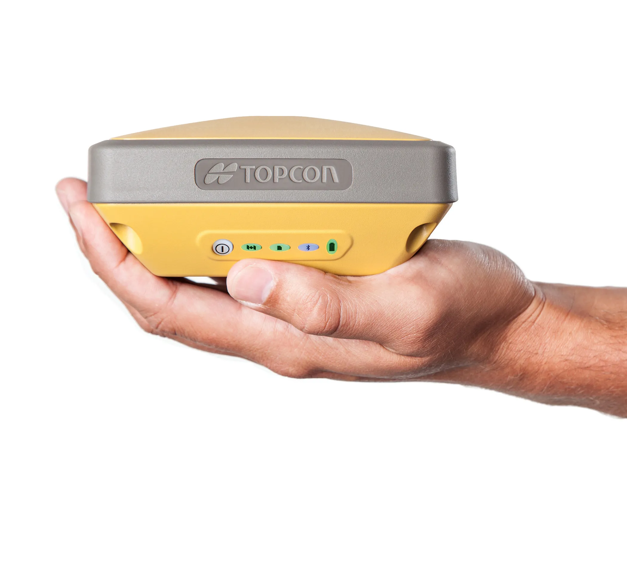
The new HiPer SR is an advanced GNSS RTK receiver and is also compact and lightweight. This high-accuracy RTK technology is cable-free and simple to operate, delivering a 300m working radius through Topcon’s new LongLink technology. Rugged and durable, the system provides reliable and interference-free RTK base-to-rover communications that do not require an FCC license to operate. Topcon’s Vanguard GNSS chip offers support for all modernised GNSS constellations and incorporates the firm’s patented Universal Tracking Channel technology. This capability allows multi-constellation tracking but with lower power consumption and system weight compared with earlier generation systems.

For more information on companies in this article

Related Content

  • From Topcon comes a sophisticated mapping system
    February 8, 2013
    Topcon Europe Positioning says that its new IP-S2 Compact+ package is an innovative mobile mapping system that can accurately measure objects even in adverse weather conditions and enclosed job sites such as tunnels and mines. This replaces the earlier Topcon’s IP-S2 system, launched in 2009. The new vehicle-mounted system has improved scanner orientation to optimise visibility of roadside assets and is packaged in an affordable, compact system that fits on a car or truck. It offers full-colour, high-resolu
  • Invisible detection
    February 6, 2012
    A self-contained, ground penetrating radar system (GPR) is now available from US Radar. The system is said to be technologically-advanced and simple to use, with a touch screen operating system and a variety of antenna frequency options. The Seeker GPR can be used in numerous surface materials such as soil, clay, concrete and brick. It integrates a complete imaging system into a single unit and can be used in application such as underground construction, road and bridge building, structural and civil engine
  • The concrete option
    July 31, 2012
    Concrete highway construction techniques and technology continues to evolve. Mike Woof reports The recent increases in oil costs are having a knock-on effect for the road construction sector, as asphalt prices have increased noticeably and faster than those for concrete. This has spurred renewed discussion over which construction technique now offers the best long term solution for road building. The debate between those in favour of concrete and those preferring asphalt for highway construction has been on
  • Sophisticated deformation monitoring system from Topcon
    January 17, 2018
    Key upgrades are now available for the Delta Solutions deformation monitoring system from the Topcon Positioning Group. The improvements include software management upgrades and advanced modular configurations. The Delta Solutions package now benefits from new configuration choices employing either robotic total stations or GNSS with the ability to add leveling sensors.