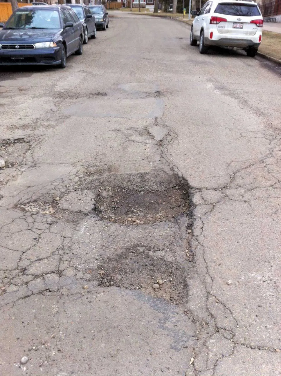
Researchers at Nottingham Trent University in the UK are developing smart scanning technology using existing cameras to detect early signs of pothole development
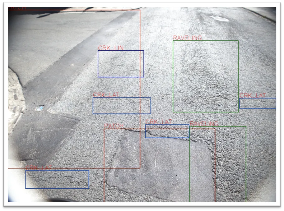
The technology scans roads for ravelling - the loss of aggregates from the asphalt which leads to potholes and cracks.
Combined with 2D and 3D scanners on a pavement monitoring vehicle, a computer vision algorithm can examine the road with accuracy at traffic speed during day or night.
The system works by detecting different textures of th
Researchers at Nottingham Trent University in the UK are developing smart scanning technology using existing cameras to detect early signs of pothole development
The technology scans roads for ravelling - the loss of aggregates from the asphalt which leads to potholes and cracks.
Combined with 2D and 3D scanners on a pavement monitoring vehicle, a computer vision algorithm can examine the road with accuracy at traffic speed during day or night.
The system works by detecting different textures of the road to identify ravelling and distinguishes it from shadows and blemishes such as tyre marks, oil spills and recent pothole repairs.
“It’s imperative for authorities across the world to be able to monitor road conditions efficiently and safely,” said Dr Senthan Mathavan, a research fellow of the School of Architecture, Design and the Built Environment. “For the first time, academic research has addressed the issue of detecting ravelling in an automated way, which has led to the development of this novel software which can be used across the industry.”
During the research, the team found that the technology detected road surfaces correctly in all 900 images tested. It took around 0.65 seconds to create a 3D vision of the ravelling measurements. But the researchers believe this time could be further reduced.
The research has been published in Transportation Research Record, a leading academic journal for transportation infrastructure research. It also involves Dr Mujib Rahman of Brunel University, Martyn Stonecliffe-Jones of2597 Dynatest UK, and Dr Khurram Kamal of the National University of Sciences and Technology in Pakistan.
“Potholes, in their worst potential form, can create dangerous driving conditions and cause costly damage to vehicles,” said Rahman.
“What this technology allows us to do is capture better quality information on road conditions, without disrupting the flow of traffic or incurring unnecessary costs. This could be a significant step forward in the way that potholes are managed, helping improve the timeliness and efficiency of repairs.”
The technology scans roads for ravelling - the loss of aggregates from the asphalt which leads to potholes and cracks.
Combined with 2D and 3D scanners on a pavement monitoring vehicle, a computer vision algorithm can examine the road with accuracy at traffic speed during day or night.
The system works by detecting different textures of the road to identify ravelling and distinguishes it from shadows and blemishes such as tyre marks, oil spills and recent pothole repairs.
“It’s imperative for authorities across the world to be able to monitor road conditions efficiently and safely,” said Dr Senthan Mathavan, a research fellow of the School of Architecture, Design and the Built Environment. “For the first time, academic research has addressed the issue of detecting ravelling in an automated way, which has led to the development of this novel software which can be used across the industry.”
During the research, the team found that the technology detected road surfaces correctly in all 900 images tested. It took around 0.65 seconds to create a 3D vision of the ravelling measurements. But the researchers believe this time could be further reduced.
The research has been published in Transportation Research Record, a leading academic journal for transportation infrastructure research. It also involves Dr Mujib Rahman of Brunel University, Martyn Stonecliffe-Jones of
“Potholes, in their worst potential form, can create dangerous driving conditions and cause costly damage to vehicles,” said Rahman.
“What this technology allows us to do is capture better quality information on road conditions, without disrupting the flow of traffic or incurring unnecessary costs. This could be a significant step forward in the way that potholes are managed, helping improve the timeliness and efficiency of repairs.”