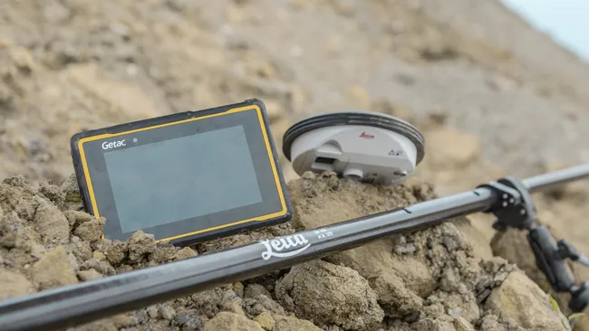
Leica Geosystems has developed a range of new software and hardware including its Zeno Mobile data collection app and Zeno GG04 plus smart antenna to capture accurate geospatial data in the field. Combining these innovative products with Getac’s fully rugged ZX70 Android tablet, Leica Geosystems offers a solution with measurement accuracy, connectivity and durability in a single package.
Said to be compact and powerful, the Getac ZX70 fully rugged Android tablet is easy to hold and comfortable to use with just one hand, making it ideal for demanding field surveying work. The Android operating system supports Leica’s Zeno Mobile software, allowing for GNSS position data to be used in the field. The system can also collect data in the field. Additional key features include the IPS display. The Getac ZX70’s integrated 4G modem can transmit large data files quickly and easily, even from remote locations. The data connection also allows users to effectively utilise Hexagon Geosystems’ HxGN SmartNet correction service, enabling accurate GNSS measurement to within one centimetre.