New tablet solution for Leica Geosystems

Leica Geosystems is now using the rugged ZX70 Android tablet from Getac as the hardware for its new Leica Zeno GG04 plus Tablet Solution. The new partnership allows Leica Geosystems to bring geospatial data collection capabilities to customers in all terrains and weather conditions such as utilities, public services, transportation and construction. Leica Geosystems has developed a range of new software and hardware including its Zeno Mobile data collection app and Zeno GG04 plus smart antenna to capture a
December 12, 2018 Read time: 2 mins
Leica Geosystems now offers the Getac tablet as a tool for site use

265 Leica Geosystems is now using the rugged ZX70 Android tablet from Getac as the hardware for its new Leica Zeno GG04 plus Tablet Solution. The new partnership allows Leica Geosystems to bring geospatial data collection capabilities to customers in all terrains and weather conditions such as utilities, public services, transportation and construction.

Leica Geosystems has developed a range of new software and hardware including its Zeno Mobile data collection app and Zeno GG04 plus smart antenna to capture accurate geospatial data in the field. Combining these innovative products with Getac’s fully rugged ZX70 Android tablet, Leica Geosystems offers a solution with measurement accuracy, connectivity and durability in a single package.

Said to be compact and powerful, the Getac ZX70 fully rugged Android tablet is easy to hold and comfortable to use with just one hand, making it ideal for demanding field surveying work. The Android operating system supports Leica’s Zeno Mobile software, allowing for GNSS position data to be used in the field. The system can also collect data in the field. Additional key features include the IPS display. The Getac ZX70’s integrated 4G modem can transmit large data files quickly and easily, even from remote locations. The data connection also allows users to effectively utilise Hexagon Geosystems’ HxGN SmartNet  correction service, enabling accurate GNSS measurement to within one centimetre.

For more information on companies in this article

Related Content

  • Leica’s high-tech 5
    August 14, 2012
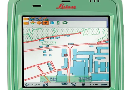
    The new Leica Zeno 5 is said to be an entrylevel, rugged personal digital assistant (PDA) for organisations that require a durable compact device with integrated modem and high-sensitive GPS. The Leica Geosystems technology supports field workers by combining a mobile phone with asset collection and management capabilities. The Leica Zeno 5 is said to be shock resistant, withstands a drop from to 1.8m, and is protected against water and dust. The large 9.4cm screen is optimised for sunlight readability and
  • Latest GIS and software tools improve operations
    February 24, 2012
    Innovative GIS and software solutions are coming to market from the three key market players - Mike Woof reports Competition is strong in the field for GIS and surveying systems as well as the associated software. The three major players in the sector, Leica Geosystems, Topcon and Trimble, all invest heavily in research and development and continue to roll out new solutions for construction customers that will boost the efficiency of surveying as well as overall project implementation.
  • Machine control advances boosting quality
    June 12, 2017
    The latest developments in machine control technology will deliver major gains in quality and productivity. Machine control technology plays an increasingly important role in construction. The pace of development has been fast, with new systems offering major gains in both productivity and quality across a range of applications. At the recent CONEXPO-CON/AGG 2017 exhibition in Las Vegas, key advances were unveiled in machine control technologies suited to markets such as earthmoving, concrete paving and pil
  • Key technology moves for Leica Geosystems
    July 9, 2024
    Leica Geosystems is developing its product offerings with key moves.