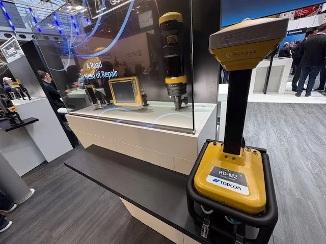
New surveying tool from Topcon

Topcon Positioning Group is introducing its top-of-the-range GT Series robotic total stations for survey, construction, and machine control applications.
January 12, 2021 Read time: 2 mins
Sophisticated surveying technology package from Topcon

The GT-1200 and GT-600 total stations are offered in multiple accuracy levels and form part of a full workflow solution, including a new field computer, an update to Topcon field and office software, as well as GNSS receivers. The system is designed to work in sync for improved performance and better data handling with built-in, field-to-office connectivity.

The new total stations perform at a faster 10Hz positioning update rate. Combining the GT Series with the new field computer and software improvements, this system is said to make layout easier, and guidance more fluid, within an intuitive map view according to Topcon. This package also allows more layout and survey points to be collected in less time.

Advanced UltraTrac prism tracking combines optical sensing with a new ultrasonic motor control algorithm designed to maintain superior prism-lock. From a software perspective, MAGNET improves field-based quality reporting and data handling for larger files, graphical processing, and 3D models.

An optional upgrade incorporating Hybrid Positioning technology helps advanced users get instant location updates via GNSS receivers so positioning data points can be captured, even with the loss of line of sight from jobsite obstructions.

The GT Series workflow solution, MAGNET software, FC-6000 field computer, and HiPer Series GNSS receivers, combines for digital processes designed to increase precision, reduce rework, and improve quality control.  

For more information on companies in this article

Related Content

  • Surveying software
    February 6, 2012
    A new CAD-based package is available for surveying and job site information editing and plotting from Topcon Europe Positioning. Called SurveyMaster Lite, this software is a cost-efficient surveying office package suited to cadastral surveying and construction stakeout duties. The product has been developed from Topcon's SurveyMaster software program, SurveyMaster Lite and features survey specific
  • Get highly detailed 3D point road surface data from Topcon’s new RD-M2 scanner
    April 11, 2025

    Topcon Positioning System’s new RD-M2 laser scanner has been purpose-built for road resurfacing applications.

    The vehicle-mounted downward-facing RD-M2 delivers precise surface conditions over long and complex roads, which means no road closures are needed.  

    Millions of points are collected by the vehicle operator from safety of his or her cab.

    The 3D point data from the RD-M2 scanner serves as the basis for detailed road surface designs using the Topcon Office Suite.  

    These ground-truth surfaces are a part of the company’s SmoothRide system workflow.

  • Leica Geosystems’ tools for site monitoring and handling GPR data
    October 11, 2017
    Leica Geosystems is offering new tools for construction firms for remote monitoring and for handling data from ground penetrating radar. With the GeoMoS Imaging package, users can stay up-to-date on remote monitoring; the live view allows observation and recording of areas of interest. A joystick provides remote access to the total station so that personnel can increase productivity and reduce time in the field.
  • In control, with advanced technology
    August 15, 2019
    Machine control technology continues to advance, with new systems offering contractors major gains in working efficiency The latest developments in machine control technology once again push the bar in terms of advancements. The latest systems allow contractors to work even more effectively and efficiently than before. Doosan has unveiled one of the first uses globally of 5G technology to remotely control construction and quarrying machines. The firm has coined the term ‘TeleOperation’ to describe the