New project software developed by Bentley

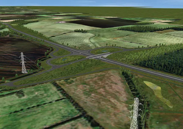
Bentley Systems claims that its OpenRoads ConceptStation modelling package allows highway engineering professionals to quickly build conceptual road and bridge models. The software allows rapid conceptual and preliminary design, using information obtained through point clouds, reality meshes, GIS, and other sources. OpenRoads ConceptStation combines engineering drawing tools and project costs to improve decision-making in the design phase. Benefits include increasing design productivity, identifying
February 8, 2018 Read time: 2 mins

4019 Bentley Systems claims that its OpenRoads ConceptStation modelling package allows highway engineering professionals to quickly build conceptual road and bridge models. The software allows rapid conceptual and preliminary design, using information obtained through point clouds, reality meshes, GIS, and other sources.

OpenRoads ConceptStation combines engineering drawing tools and project costs to improve decision-making in the design phase. Benefits include increasing design productivity, identifying potential high-risk items, and minimising development costs. Once the optimal design is identified, the user can upload the model to OpenRoads and OpenBridge to streamline highway and bridge design. OpenRoads ConceptStation models can be brought forward for detailed design work into OpenRoads Designer, ensuring that both the work and the data already generated is used as the project moves from concept through construction.

The package allows GeoCoordination services to find, download, import, and georeference contextual information to support 3D design modeling workflows, including point clouds, 3D reality meshes, terrain data, images, and GIS information. Engineering sketching tools can be used to create 3D models rapidly, and to design roads, bridges, ramps, guardrails, retaining walls, and other infrastructure designs. It offers automated generation of costs for the design, allowing engineers and planners to identify high-cost items or potential risks in the project, extract quantities, and analyse project costs. Integration of Bentley’s LumenRT visualisation and reality modelling software means that the user can produce real-time, realistic scenes without the need for intensive and lengthy pre-rendering. And the integration of PTV VISSIM also allows users to incorporate traffic analysis and planning for OpenRoads conceptual or detailed design.

Related Content

  • Conquer technology interoperability gaps with DCW’s productivity-focused and digitally-connected platform
    July 14, 2022
    Digital Construction Works is all about the “transformative power of digital.” It is designed to be a leading integrator of construction technology services… a power that will help to deliver your projects smoothly, on time, and on budget. DCW’s mission is to “create innovative solutions to complex challenges by understanding the pressure firms are under to increase productivity, reduce risk… and deliver reliable, efficient project results.” Are you connected?
  • Bentley acquires C3global, provider of web-based Amulet software
    February 5, 2015
    US construction software provider Bentley Systems has acquired UK-based C3global, a provider of web-based Amulet software for operational analytics for an undisclosed sum. Amulet is a data collection validation, analysis and modelling system used by many industries around the world to manage mission-critical activities. The system is used by organisations that generate large amounts of data, such as in the sectors of water and wastewater, oil and gas, energy production and transmission, retailing, commun
  • Construction Software Supplement: Software for Road Infrastructure is now available
    January 16, 2015
    Construction software is developing at a rapid pace today. World Highways’ special supplement, Software For Road Infrastructure, takes a close look at key technological developments within this sector.
  • Smart constructioon with GIS, GPS design technology
    February 16, 2012
    A UK highway project has benefited from the latest software, GIS and GPS technology, Mike Woof reports. Sophisticated software, GIS and GPS technology has played an important role in a large highway upgrade project in the UK and helping to increase efficiency and drive down construction costs.