More accurate mapping

By MJ Woof July 31, 2024 Read time: 1 min
Trimble and Radiodetection have established a collaboration to develop better digital maps of underground utilities

Trimble and Radiodetection have established a collaboration to improve the technology used in the utility measurement and mapping process. Through the integration of the Trimble Catalyst DA2 GNSS system and Radiodetection’s RD MapTM+ application and precision locator products, the software and hardware integration streamlines utility-locating workflows. This can provide high-accuracy measurement capabilities for the generation of underground utilities maps in a single field operation. 

Traditionally, field technicians mark their measurements onsite manually or rely on data entries to provide to office staff for map creation after a site visit. Data collected with the Trimble Catalyst DA2 GNSS system can now be synced with Radiodetection RD Map+ and precision locators that find and mark buried utilities. By streamlining this connection, workers can digitise utility-line locations and reduce costly reporting errors.  

This integration advances utility measurement workflows by giving personnel the capability to accurately represent the utility asset in a digital format. This streamlines the operation, maintenance and construction process whenever utilities are involved. 

For more information on companies in this article

Related Content

  • Yunex tunnel management in Israel
    November 29, 2022
    The new Route 16 opens another gateway to Jerusalem and connects Highway 1 with the western and southern neighbourhoods
  • A magnet for building work
    June 21, 2012
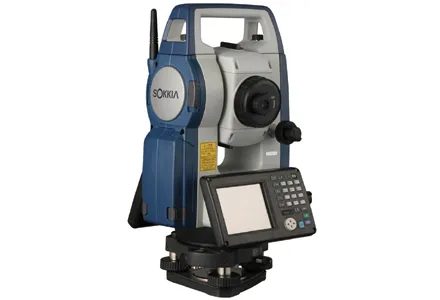
    Sokkia has launched its new FX reflectorless total station – said to come with the construction industry’s most complete package of innovative technologies. The FX includes on-board Magnet Field application software, the TSshield telematics-based communications module, and a long-range wireless communications system using Bluetooth Class 1 technology.
  • Leica Geosystems new machine control tool
    February 7, 2017
    Leica Geosystems is aiming to improve compaction quality with its new machine control tool. The Leica iCON roller package can deliver benefits to both compaction quality and productivity. The package provides the compactor operator with an on-screen visualisation of completed passes, displaying where they have occurred and where more are needed for consistent results. The different colours on the display show the operator where work has been carried and to what degree. Using this system means that costly
  • High-accuracy receiver
    September 29, 2022
    Trimble is introducing its advanced BD9250, a dual-frequency OEM GNSS receiver module that supports Trimble RTX correction services. The receiver is designed to deliver high-accuracy positioning for a range of high-volume, autonomous-ready applications used in the construction sector.