More accurate mapping

By MJ Woof July 31, 2024 Read time: 1 min
Trimble and Radiodetection have established a collaboration to develop better digital maps of underground utilities

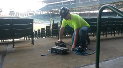
Trimble and Radiodetection have established a collaboration to improve the technology used in the utility measurement and mapping process. Through the integration of the Trimble Catalyst DA2 GNSS system and Radiodetection’s RD MapTM+ application and precision locator products, the software and hardware integration streamlines utility-locating workflows. This can provide high-accuracy measurement capabilities for the generation of underground utilities maps in a single field operation. 

Traditionally, field technicians mark their measurements onsite manually or rely on data entries to provide to office staff for map creation after a site visit. Data collected with the Trimble Catalyst DA2 GNSS system can now be synced with Radiodetection RD Map+ and precision locators that find and mark buried utilities. By streamlining this connection, workers can digitise utility-line locations and reduce costly reporting errors.  

This integration advances utility measurement workflows by giving personnel the capability to accurately represent the utility asset in a digital format. This streamlines the operation, maintenance and construction process whenever utilities are involved. 

For more information on companies in this article

Related Content

  • Safe construction amidst challenging times
    August 24, 2020
    Taking a steer on health and safety is crucial in these challenging times
  • The use of concrete cutting tools and tips for users
    October 8, 2015
    Despite the proven importance of identifying metal targets and electrical lines before cutting into concrete, every day there are stories about mishaps that happen when the necessary reconnaissance is not done. In this article, a few firms that provide concrete scanning services weigh in on the critical importance of locating embedded and or buried obstructions by scanning for these features using ground penetrating radar (GPR). Also offered are tips for selecting the best GPR equipment and best practices f
  • Delivering the smoothest road surfaces
    May 26, 2021
    Roads and highways have to be monitored and maintained regularly to ensure they are safe for use, and surface smoothness is a key factor for road quality. However, for racetracks (and airport runways) surface smoothness is even more important for safety and performance
  • Smart system for recording road repairs
    May 25, 2016
    The new Site-Track system is said to offer a sophisticated tool for tracking road repairs. The system can be used for identifying new installation or repairs for utilities and recording all utilities in the immediate area of the installation. The package offers a method of relocating previously recorded information rapidly, without the need for advanced skills or technologies such as GPS and is said to be invaluable for night-time or emergency works. The package can provide accurate location of critica