Monitoring field activities accurately

Boschung says that its bMoves tool is a novel digital solution for managing field services.
March 14, 2022 Read time: 1 min
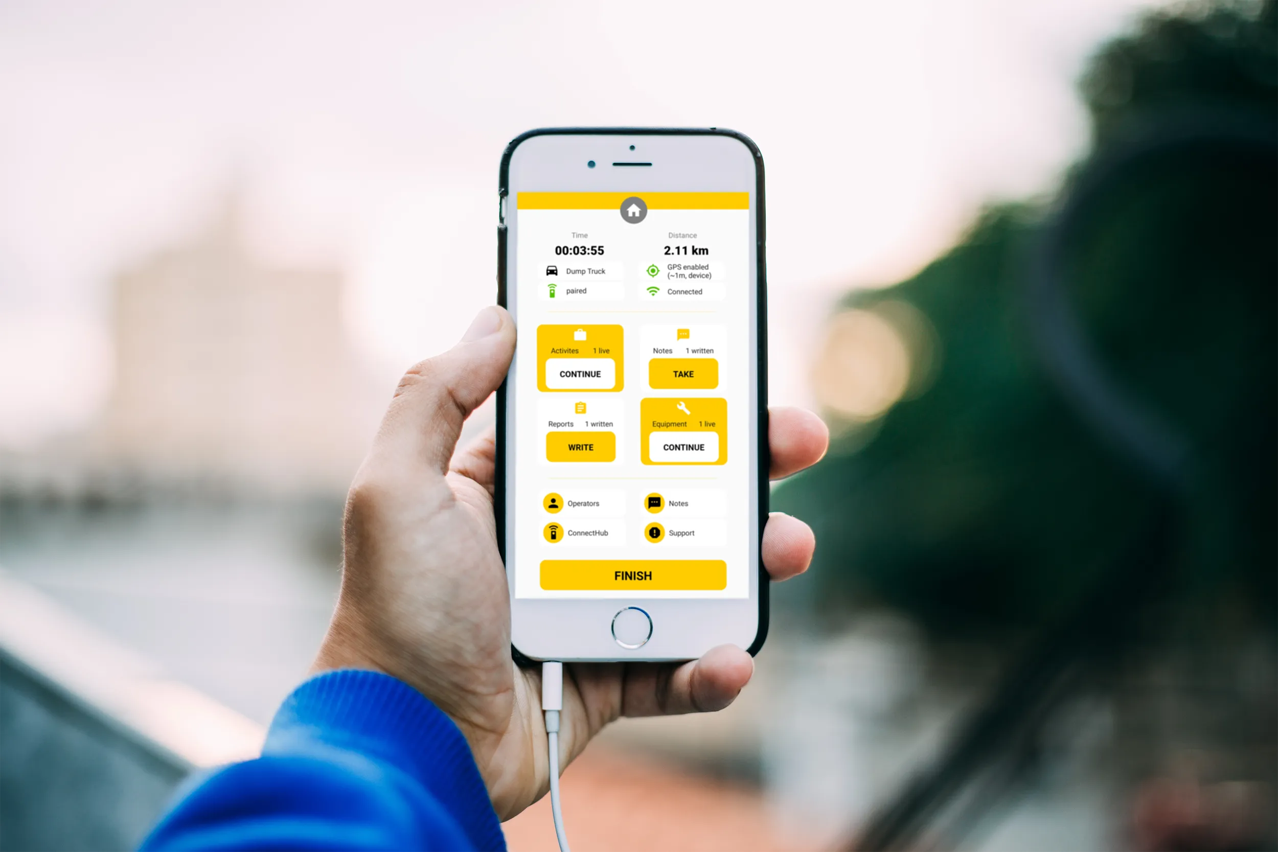
Using the bMoves app, interventions from each operator are displayed in real time on a phone, tablet or computer

With its intuitive design, bMoves allows maintenance departments of roads, airports and municipalities to improve field activity monitoring. Boschung says its innovative solution can support organisations in analytical and decision-making work.

Designed to ease the workload for maintenance departments, bMoves features tools to improve field services, onsite reporting and fleet management.

With the bMoves app, everything an operator does in the field is accurately recorded and located. The bMoves app for Android and iOS, features an easy-to use interface for efficient and reliable data acquisition. It can connect wirelessly to any vehicle and retrieve data, such as route or equipment usage.

Related Content

  • WheelRight’s John Catling says put the brakes on under-inflation
    September 30, 2016
    It’s official – Britain’s tyres are unloved and under-inflated, according to recent research. But WheelRight’s chief executive, John Catling, believes that the research results are indicative of a global problem.
  • Free flight planner app for HCSS Aerial
    April 9, 2021
    The HCSS Aerial: Drone Mission app works with most drones to capture high-resolution images.
  • World of Asphalt report from Tennessee
    May 26, 2022
    Major manufacturers are offering a range of new compaction machines and technology to the market. Mike Woof reports from the recent World of Asphalt event in Nashville, Tennessee.
  • Accurate positioning with Leica Geosystems
    June 19, 2017
    The new Zeno GG04 smart antenna from Leica Geosystems is said to increase access to GIS and boost tracking performance. This is said to deliver a versatile solution that can improve the accuracy of GNSS mobile devices with real-time Kinematic (RTK) and precise point positioning (PPP). Paired with the Zeno GG04, any Zeno or third party mobile device with Android or Windows OS can now collect precise positioning data with Leica Geosystems’ GNSS technology and 555-channel tracking performance. With PPP, users