Monitoring field activities accurately

Boschung says that its bMoves tool is a novel digital solution for managing field services.
March 14, 2022 Read time: 1 min
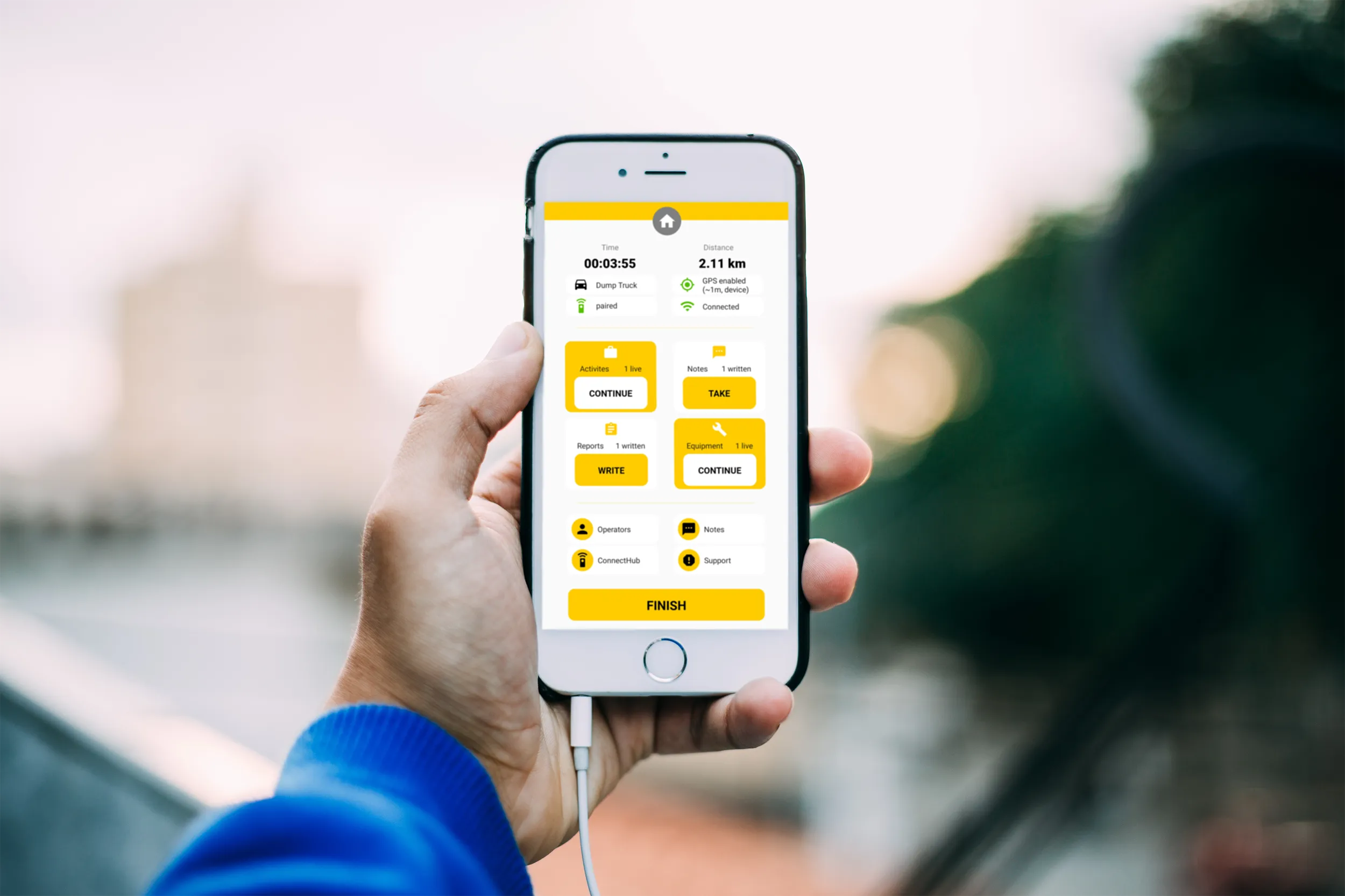
Using the bMoves app, interventions from each operator are displayed in real time on a phone, tablet or computer

With its intuitive design, bMoves allows maintenance departments of roads, airports and municipalities to improve field activity monitoring. Boschung says its innovative solution can support organisations in analytical and decision-making work.

Designed to ease the workload for maintenance departments, bMoves features tools to improve field services, onsite reporting and fleet management.

With the bMoves app, everything an operator does in the field is accurately recorded and located. The bMoves app for Android and iOS, features an easy-to use interface for efficient and reliable data acquisition. It can connect wirelessly to any vehicle and retrieve data, such as route or equipment usage.

Related Content

  • IRD joins Canadian data vault project
    April 9, 2021
    IRD has joined the “Project to Enhance the Reliability and Development of Canada’s Prairie and Northern Region Transportation Network”.
  • Measuring markings performance with on-vehicle tester
    March 9, 2017
    Technology is now available that will allow regular monitoring of the retroreflectivity of road markings. This new system can carry out the monitoring task safely and economically even when the carrier vehicle is moving at normal traffic speed. As a result this ensures that there is no interference to traffic flows, according to manufacturer Reflective Measurement Systems (RMS). The newly developed equipment can be attached to the front of a testing vehicle. The firm says that the RetroTek-M can survey six
  • Efficient aggregate production technology
    July 13, 2020
    Efficient aggregate production technology is now coming to market, offering lower cost/tonne production
  • StreetMapper cuts cost of highway surveying projects
    April 20, 2012
    Dutch surveying company Geomaat is capturing millimetre accurate measurements in record times to support a range of highway design, construction and maintenance projects. Using the mobile laser mapping system StreetMapper, and specially developed point cloud software, the company can calculate very accurate cutting, milling and asphalt figures, create as built models and undertake change detection. “In the past, these types of measurement were undertaken using total stations which was time consuming, and