Mapping improvements

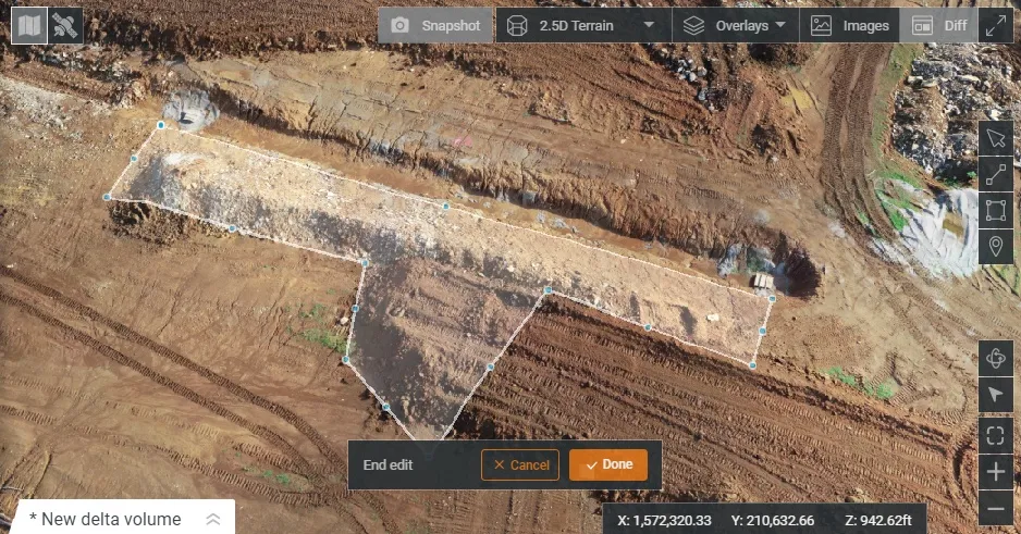
Trimble says that its Construction Manager version 2.5 package offers polygon site management and better support for CAD map overlays, using imagery provided by Google Maps. This advanced remote construction asset management solution combines GPS technology with wireless communication and Internet capabilities. The package can supply quantitative information to analyse and improve asset productivity, saving time and cutting construction project costs. The software features interpret charts, reports, and das
February 13, 2012 Read time: 1 min
2122 Trimble says that its Construction Manager version 2.5 package offers polygon site management and better support for CAD map overlays, using imagery provided by 1224 Google Maps. This advanced remote construction asset management solution combines GPS technology with wireless communication and Internet capabilities. The package can supply quantitative information to analyse and improve asset productivity, saving time and cutting construction project costs. The software features interpret charts, reports, and dashboard views, providing information for analysing and evaluating construction operations. Users can generate multi-sided polygon sites for managing equipment site entries and exits, as well as on-site machine utilisation and productivity reporting. For complex road construction and quarry sites, the package can produce site reports that allow accurate job coding and time-on-site data.

For more information on companies in this article

Related Content

  • New wheeled loaders are coming to market
    August 10, 2021
    Several improved wheeled loader models are now being offered by major manufacturers
  • Weigh-in-motion key to maximising road life
    February 24, 2012
    The market and technology for weigh-in-motion systems continues to evolve – Mike Woof writes. for both mature and developing highway infrastructure networks, traffic densities play an important role in determining road wear and life. Monitoring traffic volumes and individual vehicle weight is crucial for ensuring roads can cope in the long term and that maintenance can be planned, while the problem of overloading can be eliminated.
  • Drone system from HCSS
    October 22, 2021
    HCSS says it is offering powerful new features for its HCSS Aerial package, a drone-based data analytics platform. This includes improvements with calculations and measurements, annotation and designs, and navigation. New features are said to optimise tablet performance and improve user experience with the mobile device.
  • Trimble’s GCS900 3D system makes the grade with Bobcat
    November 20, 2015
    Trimble’s GCS900 3D system for grade control is now available as an upgrade from the 2D laser-guided and sonic/slope systems already offered by Bobcat. The Trimble GCS900 is extremely flexible and can be used on excavators, dozers, motor graders, compactors, scrapers, trimmers, and milling machines. The GSC900 cab be used both as a single unit, or as an upgrade from a GCS600 Grade Control System.