Mapping effectively with vehicle-based imaging

Yotta is offering an innovative vehicle-based imaging service that will provide accurate high-resolution panoramic street-level views of highway features. The vehicle is equipped with a 60 megapixel panoramic camera developed by Yotta and uses Applanix satellite positioning technology to log the exact location of each image. The vehicle cam improves street-level mapping operations with accurate 3D images of buildings and other highway features, such as signs, trees, barriers and fences. Called Y360, the veh
July 23, 2012 Read time: 2 mins
5153 Yotta DCL is offering an innovative vehicle-based imaging service that will provide accurate high-resolution panoramic street-level views of highway features. The vehicle is equipped with a 60 megapixel panoramic camera developed by Yotta and uses Applanix satellite positioning technology to log the exact location of each image. The vehicle cam improves street-level mapping operations with accurate 3D images of buildings and other highway features, such as signs, trees, barriers and fences. Called Y360, the vehicle's digital camera captures images every 2m, with the position calculated by combining GPS, inertial and optical tracking systems. These images are processed by Yotta software that gives the precise position and detailed information for each feature captured by the camera. According to the firm, Y360 offers a huge step forward in technology. The vehicle is being used for an array of applications including highway asset collection for local authorities, highways agencies and their contractors, and 3D mapping for utility companies.

For more information on companies in this article

Related Content

  • Trimble's ruggedised tablet for site use
    May 15, 2019
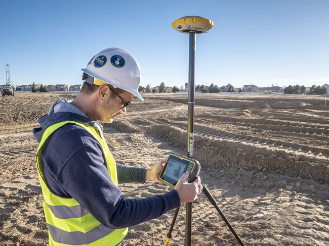
    Trimble is now offering its T7 Tablet, a rugged, lightweight and versatile device for construction surveying applications. The unit features the Trimble Siteworks Software for construction surveying, allowing it to provide real-time data to visualise cut/fill levels, calculate material volumes, check grade and communicate work orders. This can allow users to to improve productivity and decision-making. Scott Crozier, general manager for Trimble’s Civil Engineering and Construction Division said, “Surveyors
  • New Roadmap Shows Industry and Agencies How to Decarbonize Asphalt Pavements
    August 14, 2024

    In a detailed follow-up to its 2022 GHG Emissions Inventory for Asphalt Mix Production in the United States (SIP 106), the National Asphalt Pavement Association (NAPA) is providing a comprehensive roadmap for reducing greenhouse gas (GHG) emissions associated with asphalt pavements.  

  • INTERMAT launch for Topcon road profiler
    January 6, 2017
    RTP-300 is Topcon’s new high-speed road surface profiling machine that can collect surface data at speeds up to 65 mph (105 km/h) and creates an exact model of the existing surface.
  • INTERMAT launch for Topcon road profiler
    February 3, 2012
    RTP-300 is Topcon’s new high-speed road surface profiling machine that can collect surface data at speeds up to 65 mph (105 km/h) and creates an exact model of the existing surface.