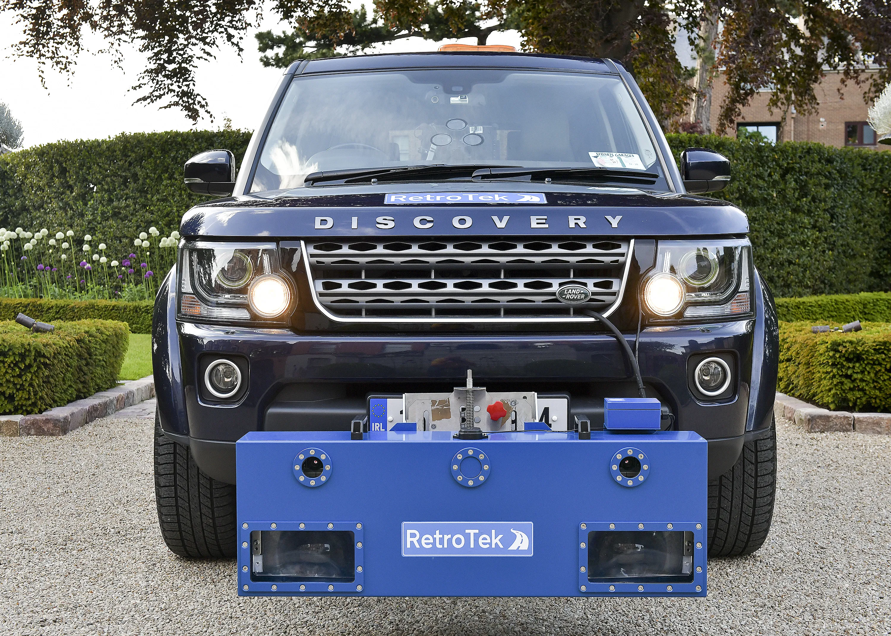
Dutch surveying company Geomaat says it is taking millimetre accurate measurements in record time to aid a range of highway design, construction and maintenance projects. Using the mobile laser mapping system StreetMapper, and specially developed point cloud software, Geomaat says it can calculate highly accurate cutting, milling and asphalt figures, create as built models and undertake change detection.

Dutch surveying company 5100 Geomaat says it is taking millimetre accurate measurements in record time to aid a range of highway design, construction and maintenance projects.
Using the mobile laser mapping system StreetMapper, and specially developed point cloud software, Geomaat says it can calculate highly accurate cutting, milling and asphalt figures, create as built models and undertake change detection.
“In the past these types of measurement were undertaken using total stations which was time consuming, and therefore costly, and had a big impact on other road users,” says Jolle Jelle de Vries, managing director of Geomaat.
“For example a 10km stretch of highway would have taken at least 20 nights to survey, each night requiring extensive traffic management or road closures. The resulting measurements would then have taken about a week to process. Using StreetMapper we can deliver a new design, from start to finish, in less than a week!”
De Vries says that Geomaat’s measurement technology can save clients up to 50 per cent in project survey measurement costs. He also says that using StreetMapper to take 3D measurements of everything within a 300metre corridor of the survey vehicle means that, unlike traditional surveying techniques, there is no need to revisit a site.
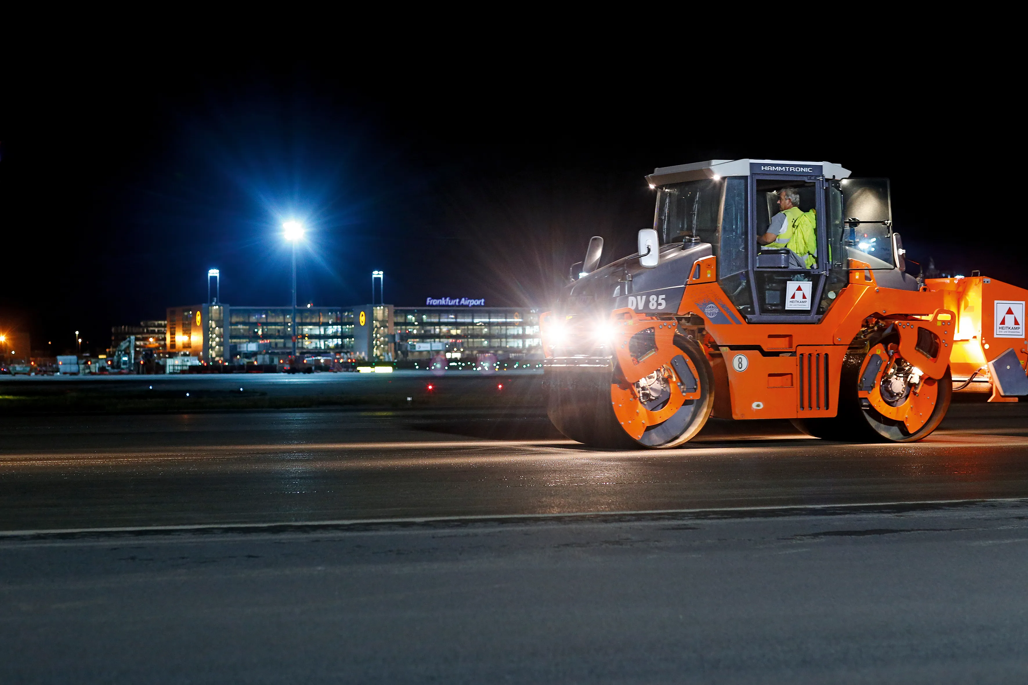
Recent projects undertaken by Geomaat said to have benefited from the use of the StreetMapper mobile mapping system include a project to upgrade the A50 between Ewijk and Valburg on behalf of the Rijkswaterstaat, an executive of the5216 Ministry of Infrastructure and Environment in The Netherlands, a project to upgrade the runway at Johan Adolf Pengel International Airport in Suriname and surveying over 500km of highway in support of LEM Contracts (Lifetime Maintenance). Using StreetMapper, Geomaat is also hoping to work with Dutch municipalities to support the introduction in 2012 of a new BGT (Basic Registration History and Topography) law in The Netherlands.
Developed by UK-based1639 3D Laser Mapping and German company IGI, StreetMapper has been specifically designed for the rapid 3D mapping of highways, runways, railways, infrastructure and buildings. Using vehicle-mounted lasers offering a 360° field of view, StreetMapper enables high precision mapping to a range of 300metres, a capacity of 550,000 measurements per second per sensor and recorded accuracies in independent real world projects of better than 10millimetres.
Using the mobile laser mapping system StreetMapper, and specially developed point cloud software, Geomaat says it can calculate highly accurate cutting, milling and asphalt figures, create as built models and undertake change detection.
“In the past these types of measurement were undertaken using total stations which was time consuming, and therefore costly, and had a big impact on other road users,” says Jolle Jelle de Vries, managing director of Geomaat.
“For example a 10km stretch of highway would have taken at least 20 nights to survey, each night requiring extensive traffic management or road closures. The resulting measurements would then have taken about a week to process. Using StreetMapper we can deliver a new design, from start to finish, in less than a week!”
De Vries says that Geomaat’s measurement technology can save clients up to 50 per cent in project survey measurement costs. He also says that using StreetMapper to take 3D measurements of everything within a 300metre corridor of the survey vehicle means that, unlike traditional surveying techniques, there is no need to revisit a site.
Recent projects undertaken by Geomaat said to have benefited from the use of the StreetMapper mobile mapping system include a project to upgrade the A50 between Ewijk and Valburg on behalf of the Rijkswaterstaat, an executive of the
Developed by UK-based