Leica Geosystems’ tools for site monitoring and handling GPR data

Leica Geosystems is offering new tools for construction firms for remote monitoring and for handling data from ground penetrating radar. With the GeoMoS Imaging package, users can stay up-to-date on remote monitoring; the live view allows observation and recording of areas of interest. A joystick provides remote access to the total station so that personnel can increase productivity and reduce time in the field.
October 11, 2017 Read time: 2 mins
265 Leica Geosystems is offering new tools for construction firms for remote monitoring and for handling data from ground penetrating radar.


With the GeoMoS Imaging package, users can stay up-to-date on remote monitoring; the live view allows observation and recording of areas of interest. A joystick provides remote access to the total station so that personnel can increase productivity and reduce time in the field.

The GeoMoS Imaging system offers automated visual inspection and enables remote observation of the site, maximising user output. With the live stream camera and the availability of repeated recorded images, users can obtain a better understanding of a project.

An automatic monitoring cycle combines monitoring data with images. Professionals can export detailed reports to observe changes of ageing infrastructure that allow for better planning.    

For large- or small-scale projects where environmental monitoring is key for safety, GeoMoS Imaging provides solutions designed for harsh and hazardous conditions.

Meanwhile the firm is also offering new utility post-processing software that delivers CAD drawings in less time. The firm says that its DX Office Vision package allows inexperienced CAD users to digitally map detected underground utilities. This utilises ground penetrating radar (GPR) data from the field in a CAD drawing. Users can obtain professional 3D CAD drawings and visualise the detected underground utilities. With DX Office Vision, post-processing for all ground penetrating data requires no add-on or third party software. The package is said to help reduce post-processing time and eliminate steps when converting data or choosing parameters. The software guides the user to create a reliable 3D map of the underground-detected utilities with minimal training.

For more information on companies in this article

Related Content

  • Effective scanning of concrete roads
    July 16, 2019
    GSSI is now offering a compact ground penetrating radar (GPR) package. The StructureScan Mini XT is the newest generation of the firm’s proven concrete inspection GPR system. To instruct users on how to get the best from the unit, the company is offering a short instruction video. The video segments include: getting started with simple steps to get the StructureScan Mini XT up and running; how to use the StructureScan Mini XT LineTrac accessory, which adds the ability to detect AC power and induced RF energ
  • GPS machine control improves construction accuracy
    February 29, 2012
    The latest GPS systems will improve the accuracy of many construction operations. Mike Woof reports. The pace of technological advancement is fast in the GPS market. Despite a market downturn, the GPS solution providers continue to invest in research and development. And there is evidence to suggest that the contracting sector is more keen than ever to employ the latest technology because of the cost benefits this can bring.
  • Wireless remote control a key feature of new concrete pavers
    March 20, 2012
    Slipform paver manufacturers are currently seeing strong business gains, Mike Woof reports The concrete slipforming sector is seeing strong business gains at present, with high demand for machines right around the globe. In Europe and the US, barrier machines are in particular demand, while in Russia airport paving is top of the agenda. All over the world, airports have to be rebuilt to cope with new large aircraft, and machines are busy operating in Asia, Europe and both North and South America on this
  • Trimble is developing smart construction site solutions
    March 7, 2016
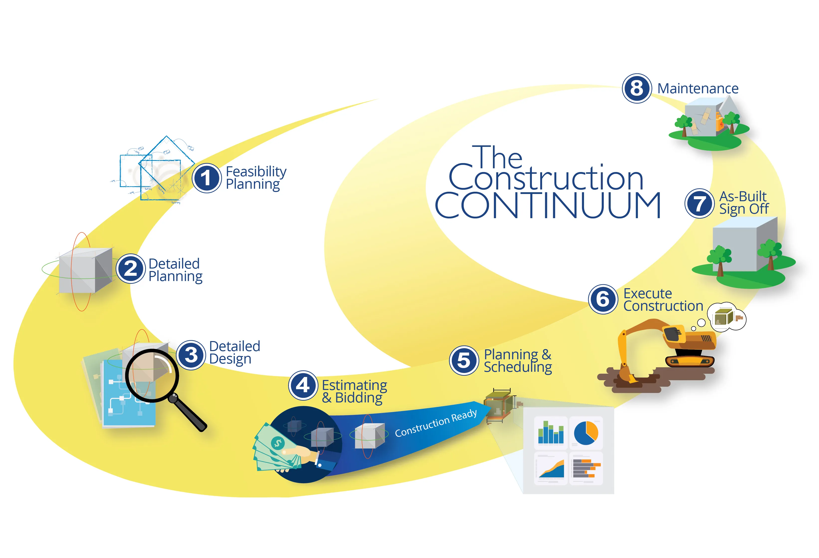
    Trimble is taking the concept of the building information model (BIM) one stage further with its development of its construction continuum concept. This is intended to show the process and benefits to building a construction-ready model embedded with intelligent data. Such a model can serve as the basis for how contractors plan and execute construction projects. With intelligent modeling, users can add and remove information in real time while simultaneously looking at multiple ways to perform construction