Leica Captivate Experience works with fifth generation of ATRplus

Leica Geosystems says its Leica Captivate Experience creates highly realistic 3D models that enables professionals to capture and manage complex data easily and accurately. With little more than a swipe, users can now navigate through customisable apps containing information for multiple projects. Advanced lining and coding provide an interactive 3D model where users can zoom, pan and orbit the rendering for optimal viewing and manipulation. “Leica Geosystems has taken a giant leap forward with Captiv
August 17, 2015 Read time: 2 mins
CrossCheck provides data visualisation
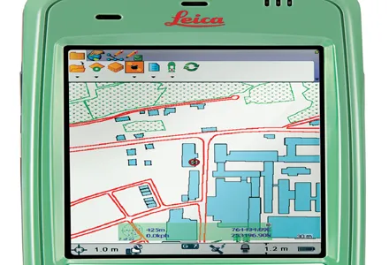
265 Leica Geosystems says its Leica Captivate Experience creates highly realistic 3D models that enables professionals to capture and manage complex data easily and accurately.

With little more than a swipe, users can now navigate through customisable apps containing information for multiple projects. Advanced lining and coding provide an interactive 3D model where users can zoom, pan and orbit the rendering for optimal viewing and manipulation.

“Leica Geosystems has taken a giant leap forward with Captivate by resembling a smartphone look and feel,” said ESE Consultants assistant regional director of surveying Shawn Crawford, a professional land surveyor with more than 20 years of experience in the field.

Crawford has beta tested Leica Captivate on the new Leica CS20 controller. He has also simulated field work such as traversing, line coding, 2D and 3D stakeouts, resections, GPS localisations, alignments, stake to DTM, as well as software functionality.

With Leica Captivate on board, the new Leica total stations and MultiStation are optimised with the fifth generation of ATRplus. Leica said these precise instruments increase efficiency and make work faster with the ability to ignore all distractions in the field and remain locked onto the sole target. They learn any environment, deliver accurate positions regardless of the most difficult conditions, and offer the fastest relock in case of interrupted line of sight. Leica has also launched the latest version of the web-based Leica CrossCheck service for GNSS reference station network integrity and deformation monitoring.

Leica said that its CrossCheck now provides innovative data visualisation and customisable reporting for faster and better decision making. It comes with enhanced visualisation and reporting options.

Customisable, automatically generated reports are easily distributed to multiple viewers. Dashboard and status views allow easy and fast interpretation of complex data of reference network coordinates and area deformation.

For more information on companies in this article

Related Content

  • Highway design software developments
    February 21, 2012
    New advanced software is being released for use by those involved in highway design as Adrian Greeman reports. The growing importance of BIM, building or project information modelling, as a design and construction process, and not just 3D modelling, is the driving force for the latest 2012 versions of Autodesk's comprehensive range of software for civil engineers. This is reflected in a new packaging of its various software tools into suites (along the lines of Microsoft's office suites) tailored to variou
  • Automated testing is safer, cheaper and more thorough
    December 12, 2018
    Automated testing is improving safety during paving and saving on testing costs. But it could also help reduce long-term maintenance costs too - Kristina Smith writes Testing pavements as they are laid can be a hazardous activity. The technician may be on their hands and knees, far behind the main gang, or reaching inside the hopper to measure the temperature of the hot mix or dodging rollers to take density readings.
  • Leica’s high-tech 5
    August 14, 2012
    The new Leica Zeno 5 is said to be an entrylevel, rugged personal digital assistant (PDA) for organisations that require a durable compact device with integrated modem and high-sensitive GPS. The Leica Geosystems technology supports field workers by combining a mobile phone with asset collection and management capabilities. The Leica Zeno 5 is said to be shock resistant, withstands a drop from to 1.8m, and is protected against water and dust. The large 9.4cm screen is optimised for sunlight readability and
  • Porokello app cuts down reindeer accidents
    March 28, 2018
    Drivers in Finland now have access to a downloadable reindeer-on-road warning app for their iOS and Android smartphones. The Porokello app – Reindeer Bell - alerts users of reindeer possibly on the road by sound and colour in real time using geographic data, according to Finland’s Centre for Economic Development, Transport and the Environment of Lapland. Tests have been carried out since June 2016 when the centre started recruiting commercial drivers to try the app. When they come across reindeer either