The upgraded ScanStation C10 laser scanning system from Leica Geosystems now offers high performance as well as increased versatility and productivity.
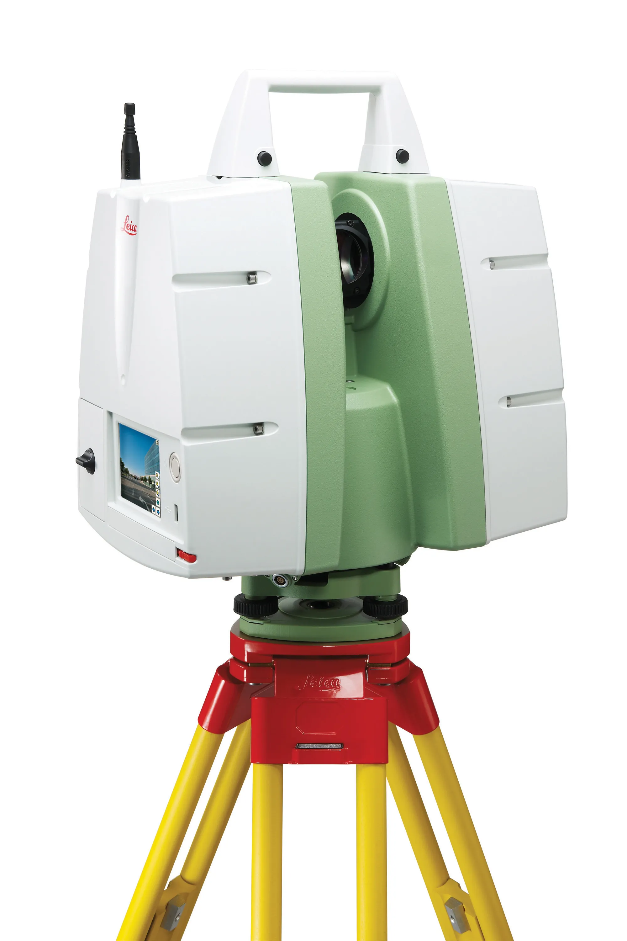
The upgraded ScanStation C10 laser scanning system from Leica Geosystems now offers high performance as well as increased versatility and productivity. The package can be used for as-built and topographic surveys and new features for the all-in-one Leica ScanStation C10 system include wireless LAN connectivity for remote scanner operation, imaging options for the embedded, parallax-free digital/video camera and expanded data management options for scan data and non-scan data. In addition the system now comes with new support for a wide range of local languages on the onboard user interface and an improved software tool for fast, convenient data transfer to any connected computer.
The wireless LAN feature allows ScanStation C10 to connect to a laptop with Cyclone software for more comprehensive scanner control and real-time quality assurance. This can make it easier to take advantage of optimal scanner positions that would otherwise be hard to access. Wireless control also lets users easily monitor scans on a laptop screen from inside a vehicle. In addition, users have an improved ability to review target scans on the onboard display right after scanning for valuable quality assurance. According to Leica Geosystems its new system is said to allow reductions in field time of 50% or more and ScanStation C10 and Cyclone software users on support agreements receive these upgrades for free.
The wireless LAN feature allows ScanStation C10 to connect to a laptop with Cyclone software for more comprehensive scanner control and real-time quality assurance. This can make it easier to take advantage of optimal scanner positions that would otherwise be hard to access. Wireless control also lets users easily monitor scans on a laptop screen from inside a vehicle. In addition, users have an improved ability to review target scans on the onboard display right after scanning for valuable quality assurance. According to Leica Geosystems its new system is said to allow reductions in field time of 50% or more and ScanStation C10 and Cyclone software users on support agreements receive these upgrades for free.