Information integration

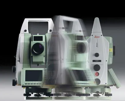
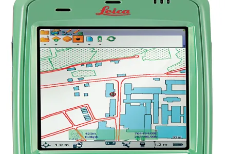
The sophisticated Leica MobileMatriX 4.1 package provides a key tool for integrating the new Leica Viva Total Stations with other technologies. Highly sophisticated, the Leica MobileMatriX package is said to be the most advanced solution available for mobile GIS applications. The system can be used in combination with GNSS, Total Stations, Level, Digital Cameras, and Laser Range Finders (LRF). Using the imaging support of the new TS15 and TS11, users of the Leica MobileMatriX package can take an image with
February 17, 2012 Read time: 1 min
The sophisticated 265 Leica MobileMatriX 4.1 package provides a key tool for integrating the new Leica Viva Total Stations with other technologies. Highly sophisticated, the Leica MobileMatriX package is said to be the most advanced solution available for mobile GIS applications. The system can be used in combination with GNSS, Total Stations, Level, Digital Cameras, and Laser Range Finders (LRF). Using the imaging support of the new TS15 and TS11, users of the Leica MobileMatriX package can take an image with a Total Station and store it directly in a GIS database. Image assisted documentation enables users to supplement GIS archives with on-site information. In addition, the Leica MobileMatriX v4.1 can be operated with the latest Leica Viva GNSS receivers as well as having the capability to import RINEX data.

For more information on companies in this article

Related Content

  • In control, with advanced technology
    August 15, 2019
    Machine control technology continues to advance, with new systems offering contractors major gains in working efficiency The latest developments in machine control technology once again push the bar in terms of advancements. The latest systems allow contractors to work even more effectively and efficiently than before. Doosan has unveiled one of the first uses globally of 5G technology to remotely control construction and quarrying machines. The firm has coined the term ‘TeleOperation’ to describe the
  • Precision pinpointing
    March 1, 2012
    Leica Geosystems says that its TS30 package is a new high precision Total Station that meets highest standards in all surveying applications. Distances can now be measured with Leica Geosystems' proven PinPoint EDM Technology with an unprecedented precision of 0.6mm + 1ppm on prisms. On natural surfaces a high accuracy of 2mm + 2ppm up to 1,000m can be achieved.
  • Bentley is building its software solutions portfolio
    May 14, 2015
    Bentley Systems continues to develop its portfolio of software solutions - Mike Woof writes One of the leaders in the field of construction software, Bentley Systems is developing its array of solutions for industry users. The company is growing both by acquisition and organically, using its financial strength to buy up smaller niche firms as well as developing the capabilities of its in-house software further. The company has recently made three key acquisitions, for EADOC, Acute3D and C3global. The
  • Leica’s high-tech 5
    August 14, 2012
    The new Leica Zeno 5 is said to be an entrylevel, rugged personal digital assistant (PDA) for organisations that require a durable compact device with integrated modem and high-sensitive GPS. The Leica Geosystems technology supports field workers by combining a mobile phone with asset collection and management capabilities. The Leica Zeno 5 is said to be shock resistant, withstands a drop from to 1.8m, and is protected against water and dust. The large 9.4cm screen is optimised for sunlight readability and