Improved survey data handling

Leica Geosystems says that its Leica MobileMatriX v3.0 package can be used to synchronise survey data with an enterprise geodatabase, transfer digital images taken from a mobile phone via Bluetooth and link it with a feature, in addition to many other improvements. The firms says that its MobileMatriX v3.0 package offers a flexible and powerful mobile GIS application and can be used in both large projects and small projects involving only a few field crews. Survey data can be replicated within the editing p
August 2, 2012 Read time: 2 mins
265 Leica Geosystems says that its Leica MobileMatriX v3.0 package can be used to synchronise survey data with an enterprise geodatabase, transfer digital images taken from a mobile phone via Bluetooth and link it with a feature, in addition to many other improvements. The firms says that its MobileMatriX v3.0 package offers a flexible and powerful mobile GIS application and can be used in both large projects and small projects involving only a few field crews.

Survey data can be replicated within the editing process for customers using ArcGIS to manage spatial data. This allows users to extend their geospatial applications to their colleagues in the field, creating unprecedented data management capabilities. By implementing Leica MobileMatriX 3.0 survey data synchronization in the project workflow, a client can now connect to an enterprise database and modify or re-compute the survey measurements. This improves the workflow between field and office and can provide time and cost savings up to 50%. With Leica MobileMatriX 3.0, the subcontractor can provide a finished geodatabase to the client, without resorting to a conversion process and current analysis has shown a potential time/cost savings of up to and beyond 30-50%.

For more information on companies in this article

Related Content

  • Highway design software developments
    February 21, 2012
    New advanced software is being released for use by those involved in highway design as Adrian Greeman reports. The growing importance of BIM, building or project information modelling, as a design and construction process, and not just 3D modelling, is the driving force for the latest 2012 versions of Autodesk's comprehensive range of software for civil engineers. This is reflected in a new packaging of its various software tools into suites (along the lines of Microsoft's office suites) tailored to variou
  • Information technology and transport development
    April 12, 2012
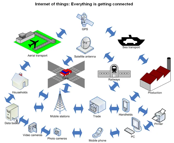
    A team of eminent Russian specialists* introduce exciting new information technologies, such as the Internet of Things, and foresee their promising applications in the field of transport infrastructure development. Global economic growth, combined with explosive digital technology proliferation, brings new challenges to the field of transport infrastructure. Technical advances such as Intelligent Transportation Systems (ITS), vehicle to infrastructure interfaces, global positioning, electronic toll collecti
  • Information technology and transport development
    February 16, 2012
    A team of eminent Russian specialists* introduce exciting new information technologies, such as the Internet of Things, and foresee their promising applications in the field of transport infrastructure development
  • Weigh-in-motion key to maximising road life
    February 24, 2012
    The market and technology for weigh-in-motion systems continues to evolve – Mike Woof writes. for both mature and developing highway infrastructure networks, traffic densities play an important role in determining road wear and life. Monitoring traffic volumes and individual vehicle weight is crucial for ensuring roads can cope in the long term and that maintenance can be planned, while the problem of overloading can be eliminated.