Improved construction software from Topcon

Topcon Positioning is introducing the latest version of its software package for construction and survey professionals: MAGNET 7.
June 22, 2021 Read time: 2 mins
Topcon is now offering its latest MAGNET 7 software package

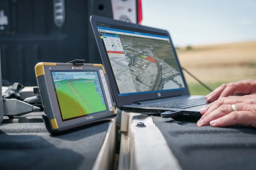
The firm says that this package benefits from cloud-based connectivity for streamlining workflows through GNSS receivers, total stations, and other positioning tools and instruments. The company says that the new version of the software addresses needs to increase productivity, efficiency, and profitability levels across the jobsite spectrum. The software also improves accuracy while managing data and collaboration with the project team in real time.

Topcon says that the package comprises field software, cloud services, integrated office software and third-party integrations. Upgrades in the field version of the software improve 3D model support, reporting, and interactivity in working directly on a visual map. Additionally, there are improvements in data handling for large and complex 3D projects.

Productivity-driven features within the upgraded office solution include an ability to connect to the newest version of the Sitelink3D jobsite monitoring and management system. This enables office personnel to send machine models to machines onsite via the web portal. The new connection also allows access to the Haul Truck app, which improves efficiency in the mass haul environment by sending real-time data directly to the master schedule.

Additional benefits in the office include a new capability for calculating International Roughness Index (IRI) for resurfacing projects. For added efficiency, IRI data exports directly to ProVAL formats, commonly used in the paving industry, to report and validate road surface smoothness against guidelines set by government transportation departments. The package has improved terrain modeling capabilities for surveyors and an increase in file-type capabilities.

For more information on companies in this article

Related Content

  • MOBA's advanced positioning systems
    November 15, 2012
    MOBA Mobile Automation says it now offers excavator control systems for a range of requirements, with the introduction of its Easy Dig basic system, the LINK expansion stage and the high-end Vision 3D version. The new Easy Dig package is said to provide an affordable and easy-to-install excavator control system that measures depth, incline angle and range. Target and actual values are compared and displayed in real-time on the screen. The LINK offers a combination of 2D and 3D functions and is the most in
  • Help is on hand from Roadtec’s Guardian Telematics
    August 17, 2015
    Telematics is giving contractors a greater oversight of the location and performance of their machinery In simple terms, telematics is any integrated use of telecommunications and ICT (information and communications technology). It concerns the sending, receiving and storing of information via telecommunication devices. Typically, this is in conjunction with machine or device control and includes use of global positioning systems, or GPS.
  • New BIM compatibility from Topcon and Autodesk
    March 9, 2016
    Topcon Positioning says that its DS-200i direct-aiming motorised imaging station is compatible with the new Autodesk BIM 360 Layout app for the Apple iPad. The DS-200i is the second total station solution that Autodesk and Topcon have collaborated on for contractors. Topcon says that the BIM 360 Layout app’s connectivity with the DS-200i offers a reflectorless solution along with imaging and increased vertical range over previous systems. The DS-200i has an electronic distance measurement (EDM) range of
  • Mobile mapping innovation
    June 1, 2022
    There are millions of kilometres of roads and features that need to be mapped in today’s world. We see a strong vision and application for the future, therefore Leica Geosystems, part of Hexagon, recently announced the introduction of the reality capture mobile mapping system Leica Pegasus TRK, introducing artificial intelligence, autonomous workflows and intuitive interfaces. This technology goes beyond the capabilities of what’s already been done, making it the perfect companion for today’s mobile mapping requirements.