Highway condition monitoring move

Geospatial surveying specialist Yotta DCL now has a contract with Southampton City Council for road surface condition monitoring and is using its advanced laser technology. Yotta DCL is surveying 300km of the city's roads using its sophisticated ARAN survey vehicle which uses innovative laser scanning and precision GPS systems. These surveys are operating as part of a UK Government-specified programme called Surface Condition Assessment for the National Network of Roads (SCANNER). This will provide the city
August 2, 2012 Read time: 2 mins
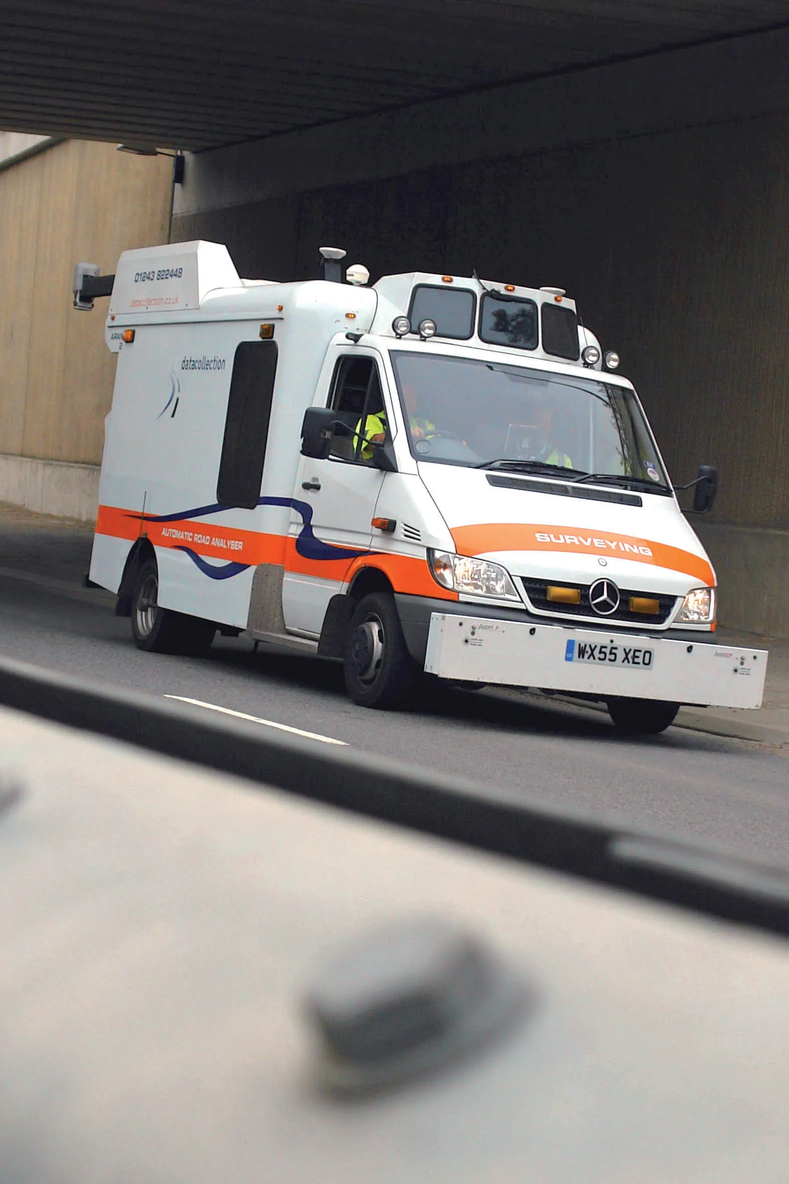
Yotta's sophisticated, Canadian-developed pavement monitoring technology can identify road repair needs quickly
Geospatial surveying specialist 5153 Yotta DCL now has a contract with 3548 Southampton City Council for road surface condition monitoring and is using its advanced laser technology. Yotta DCL is surveying 300km of the city's roads using its sophisticated ARAN survey vehicle which uses innovative laser scanning and precision GPS systems. These surveys are operating as part of a UK Government-specified programme called Surface Condition Assessment for the National Network of Roads (SCANNER). This will provide the city with accurate data that will allow the highway team to plan maintenance programmes and budgets more effectively. The highly specialised ARAN vehicle is an Anglo-Canadian development equipped with an advanced surface laser scanner that captures surface data with its precise location identified by a military-grade satellite positioning system. The accurate location information allows the survey data to be matched with other highways data such as records from on-foot highways defects surveys. Data captured by the ARAN vehicle shows defects such as wheelpath rutting, edge deterioration and cracks as well as the road geometry and longitudinal profile.

For more information on companies in this article

Related Content

  • Confirm OnDemand used to maintain Southampton's highways
    March 2, 2012
    Pitney Bowes Business Insight has announced that Balfour Beatty WorkPlace has chosen Confirm OnDemand – PBBI’s on-demand-based infrastructure asset maintenance and management system – to support its US$158 million Highways Services Partnership with Southampton City Council in the UK.
  • Klimator to monitor Swedish road conditions
    September 14, 2022
    The project will use Klimator's detection technology called AHEAD which will combine with friction information from floating car data – FCD - to improve the understanding and interpretation of FCD on multiple lanes during winter.
  • Innovative GIS advances from Bluesky
    July 18, 2012
    Aerial survey specialist Bluesky is funding research into the development and use of a new system to map the UK’s cities and towns at night. Bluesky has teamed up with the University of Leicester to look at solutions using new high sensitivity camera sensor technology. Mounted on survey aircraft, the new system can record the location of street lights, illuminated road signs and other night-time sources of light. This can deliver an accurate resource for asset inventories, light pollution assessment and ene
  • Pavement profile checks
    February 23, 2012
    Accurate pavement profiling can be achieved with the new Selcom RoLine 1130 laser sensor from Canadian firm LMI Technologies. It uses laser line sensing for accurate profiling of all pavement geometries on high-speed profilers at any vehicle speed and the unit is said to suit pavement profiling of both concrete and asphalt surfaces on roads and bridges.