GPS system for trenching

Mastenbroek has developed a sophisticated GPS-controlled system for use in drainage trenching applications in partnership with Trimble Germany. The package is based on Trimble's Field Level II technology and is said to offer key benefits over existing laser-based technology. Surveying times can be slashed while drainage costs can be cut through more accurate deployment of gravel fill. An on-board computerised touch-screen display records every detail of the job, which can be downloaded for analysis and bill
February 7, 2012 Read time: 2 mins
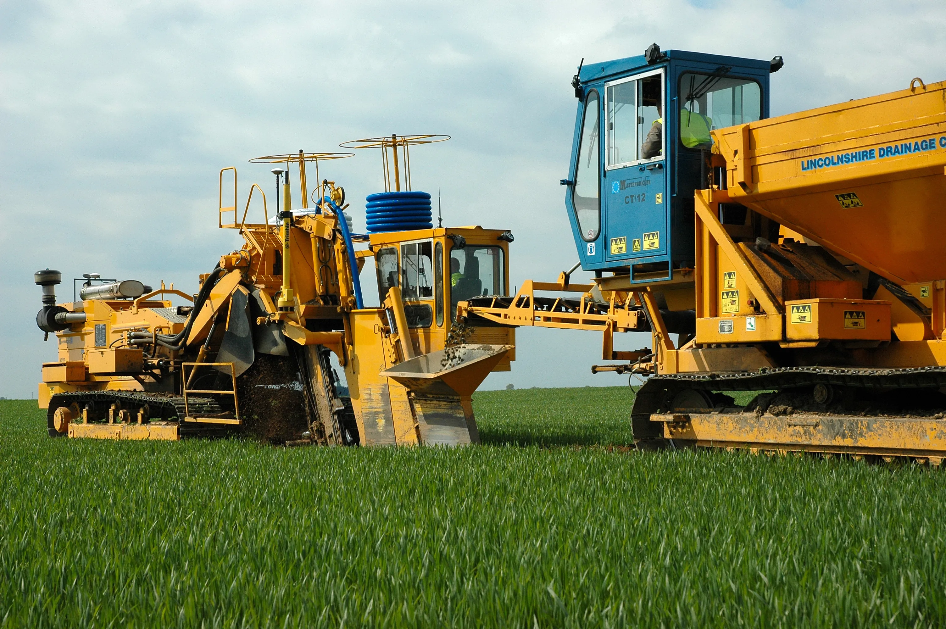
A sophisticated control system allows fast and accurate construction of roadside drainage trenches
2383 Mastenbroek has developed a sophisticated GPS-controlled system for use in drainage trenching applications in partnership with 2122 Trimble Germany.

The package is based on Trimble's Field Level II technology and is said to offer key benefits over existing laser-based technology.

Surveying times can be slashed while drainage costs can be cut through more accurate deployment of gravel fill. An on-board computerised touch-screen display records every detail of the job, which can be downloaded for analysis and billing.

There are other benefits to the GPS, over laser systems. There is no need for regular calibration and there are no issues arising from dust, rain, fog or other weather conditions. The system has undergone extensive field trials over the last year in a variety of site conditions and with a number of operators and surveyors.

Mastenbroek will continue to offer existing laser technology with its trenching equipment. But GPS affords greater accuracy and Mastenbroek believes the new system will rapidly gain market acceptance.

On recent trials field surveying times were shown to be markedly lower than with comparative laser systems taking, in once instance, two hours instead of two working days. Survey work was carried out using a GPS system mounted on a quad-bike to produce a three-dimensional map. The system plans the depth of each run of pipe, which is followed in real time by the trencher operator with no need to carry out calculations in the office. All of the information gained from the survey is immediately at hand to the trencher operator on a touch-screen interface located within the cab.

For more information on companies in this article

Related Content

  • GPS machine control boosts productivity
    February 23, 2012
    New technology can allow more productive and more cost-effective earthmoving jobs. Mike Woof reports
  • Machine guidance and asset management aid fleet utilisation
    July 16, 2012
    Integrating Caterpillar's latest machine guidance and asset management tools offers efficiency gains for contractors in a competitive market. Mike Woof reports Caterpillar has been a leader in the development of GPS machine control systems through its partnership with Trimble. The manufacturer has rolled out a series of AccuGrade packages for various machines in its line-up, starting with the dozers and graders and then spreading to other machines such as scrapers, excavators and soil compactors. Caterpilla
  • Machine control advances boosting quality
    June 12, 2017
    The latest developments in machine control technology will deliver major gains in quality and productivity. Machine control technology plays an increasingly important role in construction. The pace of development has been fast, with new systems offering major gains in both productivity and quality across a range of applications. At the recent CONEXPO-CON/AGG 2017 exhibition in Las Vegas, key advances were unveiled in machine control technologies suited to markets such as earthmoving, concrete paving and pil
  • Powerful machine control technology
    February 14, 2012
    THE TRIMBLE TSC3 handheld controller for construction is said to offer powerful and rugged control capabilities. This hand-held unit is aimed at duties with heavy and highway contractors and features builtin GPS, 3G, Wi-Fi and a 5 megapixel digital camera. The unit is said to allow site workers to stay connected and also provides accurate positioning and digital design information. Using this unit allows engineers to locate, measure and record information anywhere on the construction site with a single devi