GPS system for trenching

Mastenbroek has developed a sophisticated GPS-controlled system for use in drainage trenching applications in partnership with Trimble Germany. The package is based on Trimble's Field Level II technology and is said to offer key benefits over existing laser-based technology. Surveying times can be slashed while drainage costs can be cut through more accurate deployment of gravel fill. An on-board computerised touch-screen display records every detail of the job, which can be downloaded for analysis and bill
February 7, 2012 Read time: 2 mins
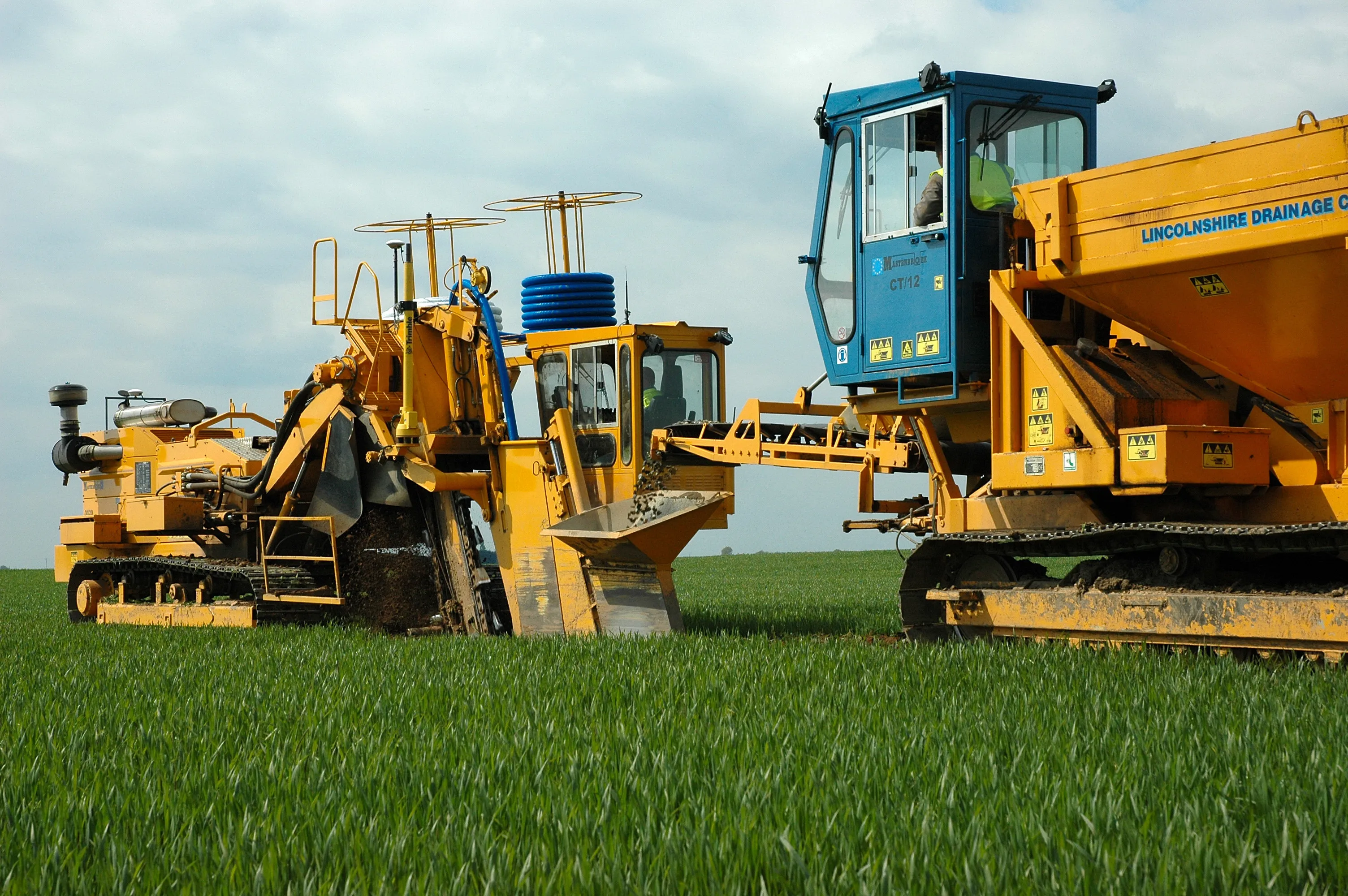
A sophisticated control system allows fast and accurate construction of roadside drainage trenches
2383 Mastenbroek has developed a sophisticated GPS-controlled system for use in drainage trenching applications in partnership with 2122 Trimble Germany.

The package is based on Trimble's Field Level II technology and is said to offer key benefits over existing laser-based technology.

Surveying times can be slashed while drainage costs can be cut through more accurate deployment of gravel fill. An on-board computerised touch-screen display records every detail of the job, which can be downloaded for analysis and billing.

There are other benefits to the GPS, over laser systems. There is no need for regular calibration and there are no issues arising from dust, rain, fog or other weather conditions. The system has undergone extensive field trials over the last year in a variety of site conditions and with a number of operators and surveyors.

Mastenbroek will continue to offer existing laser technology with its trenching equipment. But GPS affords greater accuracy and Mastenbroek believes the new system will rapidly gain market acceptance.

On recent trials field surveying times were shown to be markedly lower than with comparative laser systems taking, in once instance, two hours instead of two working days. Survey work was carried out using a GPS system mounted on a quad-bike to produce a three-dimensional map. The system plans the depth of each run of pipe, which is followed in real time by the trencher operator with no need to carry out calculations in the office. All of the information gained from the survey is immediately at hand to the trencher operator on a touch-screen interface located within the cab.

For more information on companies in this article

Related Content

  • Trimble is launching new machine control technology
    November 9, 2016
    Trimble is introducing a range of new technology options for customers that will boost working efficiency across a range of duties. The firm has also scored a major deal with one of China’s largest equipment manufacturers, XCMG.
  • Brisbane’s Airport: Innovative Management of One of the World’s Busiest Runways
    June 26, 2014
    When it comes to runways, there are few busier then Brisbane’s main runway. Servicing both domestic and international travel, with over 200,000 movements per year, operating without a curfew Brisbane’s main runway is the busiest in Australia. For maintenance, crews only have a limited period of time to determine the pavement condition, normally during the night, making the detection of pavement faults difficult. To resolve this issue, a new high speed pavement scanner was used to rapidly survey the pavem
  • Intermat innovation for machine control systems
    June 23, 2015
    Improving technologies for machine control systems continue to deliver increases in efficiency for contractors - Mike Woof writes Machine control technologies have continued to develop as the specialist suppliers in this fiercely fought sector seek to find a competitive advantage over their rivals. The key players, Leica Geosystems, MOBA, Topcon and Trimble, have all been pushing the boundaries with their latest technologies. Although the systems these firms are introducing are aimed at a number of differen
  • Trimble's ruggedised tablet for site use
    May 15, 2019
    Trimble is now offering its T7 Tablet, a rugged, lightweight and versatile device for construction surveying applications. The unit features the Trimble Siteworks Software for construction surveying, allowing it to provide real-time data to visualise cut/fill levels, calculate material volumes, check grade and communicate work orders. This can allow users to to improve productivity and decision-making. Scott Crozier, general manager for Trimble’s Civil Engineering and Construction Division said, “Surveyors