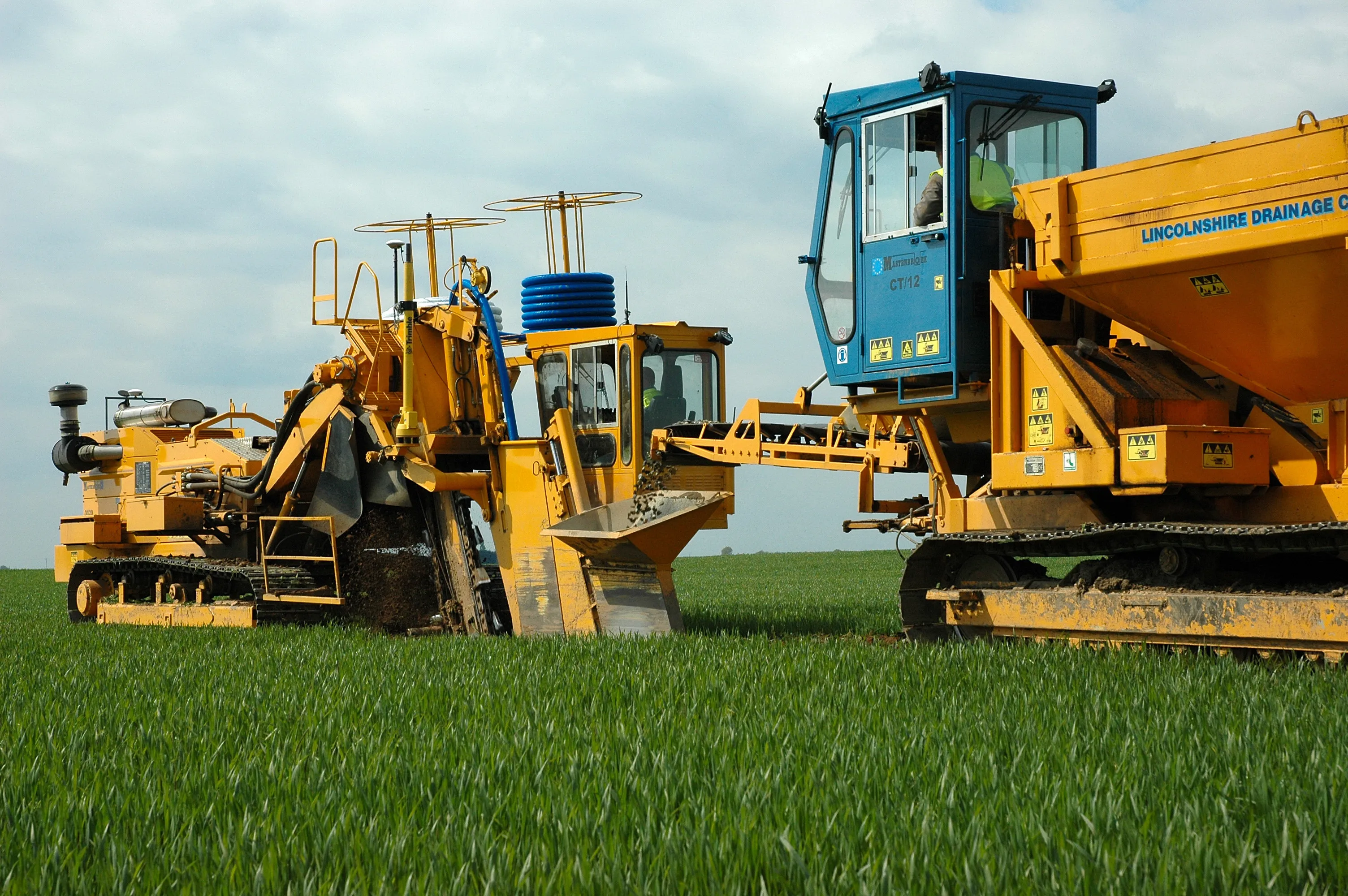
Mastenbroek has developed a sophisticated GPS-controlled system for use in drainage trenching applications in partnership with Trimble Germany. The package is based on Trimble's Field Level II technology and is said to offer key benefits over existing laser-based technology. Surveying times can be slashed while drainage costs can be cut through more accurate deployment of gravel fill. An on-board computerised touch-screen display records every detail of the job, which can be downloaded for analysis and bill
The package is based on Trimble's Field Level II technology and is said to offer key benefits over existing laser-based technology.
Surveying times can be slashed while drainage costs can be cut through more accurate deployment of gravel fill. An on-board computerised touch-screen display records every detail of the job, which can be downloaded for analysis and billing.
There are other benefits to the GPS, over laser systems. There is no need for regular calibration and there are no issues arising from dust, rain, fog or other weather conditions. The system has undergone extensive field trials over the last year in a variety of site conditions and with a number of operators and surveyors.
Mastenbroek will continue to offer existing laser technology with its trenching equipment. But GPS affords greater accuracy and Mastenbroek believes the new system will rapidly gain market acceptance.
On recent trials field surveying times were shown to be markedly lower than with comparative laser systems taking, in once instance, two hours instead of two working days. Survey work was carried out using a GPS system mounted on a quad-bike to produce a three-dimensional map. The system plans the depth of each run of pipe, which is followed in real time by the trencher operator with no need to carry out calculations in the office. All of the information gained from the survey is immediately at hand to the trencher operator on a touch-screen interface located within the cab.