This new package can be used on excavators equipped with 2D or 3D excavator guidance solutions from
“We have developed this new function for three reasons,” said Marcus Grevelshøj, product specialist for excavating and wheeled loader solutions at Leica Geosystems. “First, to improve the productivity of experienced excavator operators using tilt rotator attachments; next, to decrease the learning curve of less experienced operators; and finally, to decrease fatigue and stress for all operators as they operate a large machine like an excavator.”
The automatic tilt function for SVAB Quantum is now available on all Quantum platforms, and former versions of Machine Control System (MACS) platforms can be updated to support the functionality. Tiltrotator brands supported by Quantum and Leica iCON iXE22D solution and Leica iCON iXE3 3D solution will have the possibility to connect to the function.
“This new functionality is totally in line with our strategy of creating more efficient and innovative solutions for how to control an excavator,” said Fredrik Eriksson, CEO, SVAB. “Our latest platform Quantum together with Leica Geosystems products give us possibilities to add new dimensions on how to operate an excavator.”
Excavator guidance system from Leica Geosystems
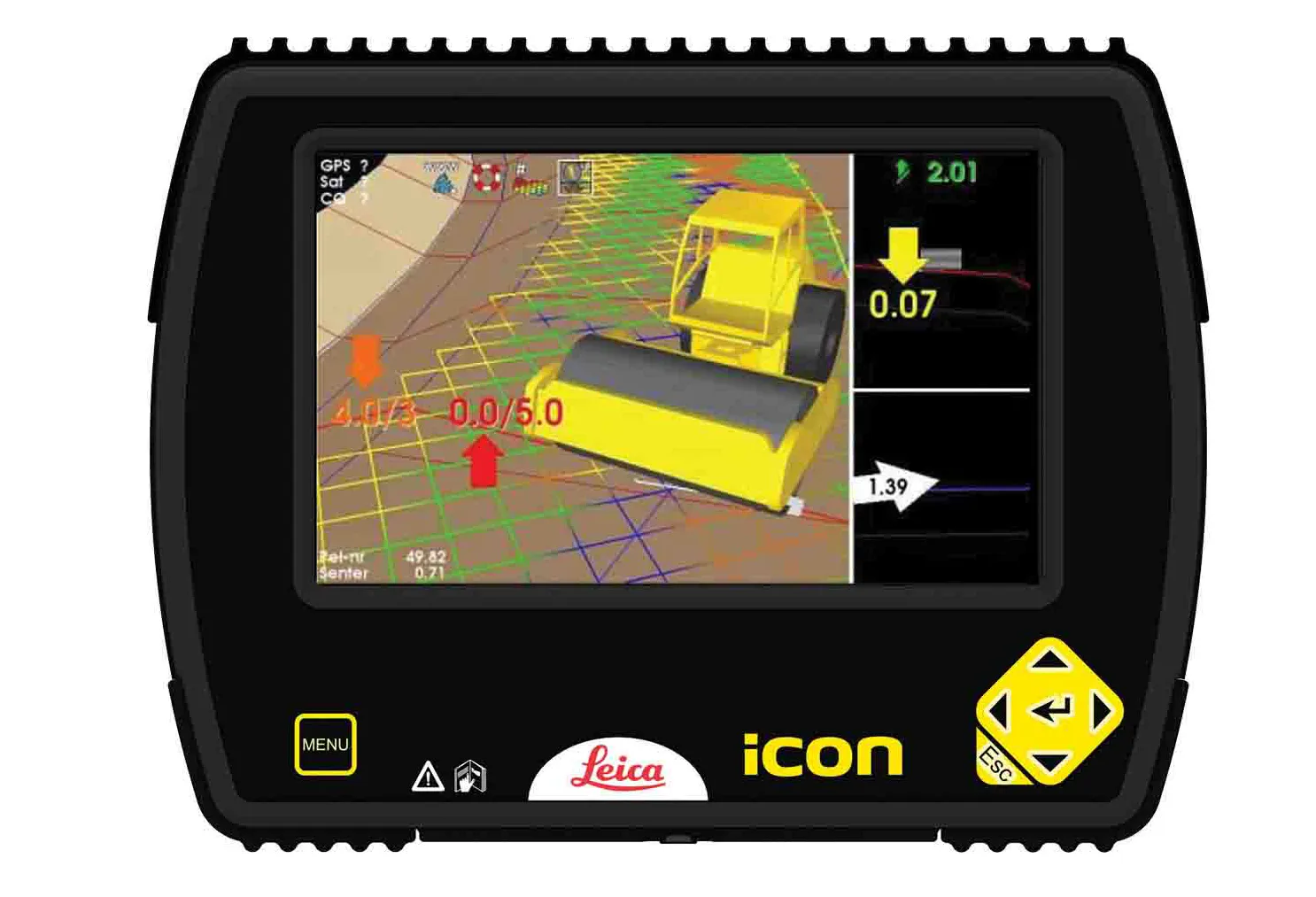
Leica Geosystems is now offering a new iCON iXE solution aimed at boosting the versatility of excavators. The package allows the tilt function on a tilt rotator to be handled automatically, increasing versatility and accuracy.
This new package can be used on excavators equipped with 2D or 3D excavator guidance solutions from Leica Geosystems and tilt rotators supported by SVAB Quantum. The iXE CoPilot package means that the tilt will automatically be adjusted so it is held parallel to the surface as the o
Leica Geosystems is now offering a new iCON iXE solution aimed at boosting the versatility of excavators. The package allows the tilt function on a tilt rotator to be handled automatically, increasing versatility and accuracy.