A new portable tool from GSSI offers fast and accurate analysis of concrete structures. The firm’s latest handheld ground penetrating radar (GPR) can be used for concrete inspection Industry.
The StructureScan Mini series is a handheld, all-in-one GPR system for locating rebar, conduits, post-tension cables and voids. The unit can also be used to determine concrete slab thickness in real time. The firm offers the product in two models, the standard StructureScan Mini and the high resolution StructureSca
June 17, 2016
Read time: 2 mins

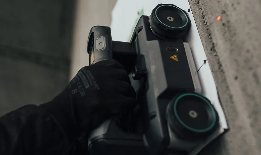
A new portable tool from 8095 GSSI offers fast and accurate analysis of concrete structures. The firm’s latest handheld ground penetrating radar (GPR) can be used for concrete inspection Industry.
The StructureScan Mini series is a handheld, all-in-one GPR system for locating rebar, conduits, post-tension cables and voids. The unit can also be used to determine concrete slab thickness in real time. The firm offers the product in two models, the standard StructureScan Mini and the high resolution StructureScan Mini HR version.
The StructureScan Mini operates at 1,600MHz and can reach depths of up to 500mm. The StructureScan Mini HR meanwhile has a 2600MHz antenna for high-resolution data and can reach depths of up to 400mm. Both units can locate metallic and non-metallic targets, with an auto target feature that marks the detection of features of interest. Both the standard and HR systems are available with either standard 2D capabilities, or 3D for an x-ray-like image. The lasers on the side of the unit indicate the exact location of the center of target for accurate marking of targets embedded in the concrete.
The StructureScan Mini series’ compact design allows concrete inspection in tight spaces or above the head survey locations, while the ruggedised plastic casing and wheels provide durability and mobility. The series features an all-in-one concrete inspection tool, with the antenna, positioning system and control unit combined into one easy-to-manoeuvre package. The StructureScan Mini Series has no cables, no boxes, and no heavy equipment, allowing users to move quickly between job sites. Features allow target detection with advanced software solutions, which visualise targets as a small dot when rebar or conduit are identified.


