Autodesk has launched a specialist training and certification package for civil engineers to bring them up to speed on modem BIM (information modelling) workflows. The Autodesk Official Training Guide, is not just teaching the functionality of the programs says the company, but aims to show how the Autodesk infrastructure software workflows "can help owners and service providers on roads and highways improve productivity, optimise designs, and accelerate project approvals." The course simulates a roadways p
August 22, 2013
Read time: 1 min
685 Autodesk has launched a specialist training and certification package for civil engineers to bring them up to speed on modem BIM (information modelling) workflows. The Autodesk Official Training Guide, is not just teaching the functionality of the programs says the company, but aims to show how the Autodesk infrastructure software workflows "can help owners and service providers on roads and highways improve productivity, optimise designs, and accelerate project approvals." The course simulates a roadways project from planning and design through visual communication and construction documentation using an integrated BIM workflow using the latest 3282 AutoCAD Civil 3D, Autodesk InfraWorks, Autodesk InfraWorks 360, and Autodesk Navisworks Manage software. The Autodesk Infrastructure Design Suite 2014: BIM Workflow for Roads and Highways guide is available in hard copy or eBook format by online purchase from Ascent publishing (%$Linker: 2External<?xml version="1.0" encoding="utf-16"?><dictionary />000oLinkExternalwww.ASCENTed.comwww.ASCENTed.comfalsehttp://www.ascented.com/falsefalse%>).
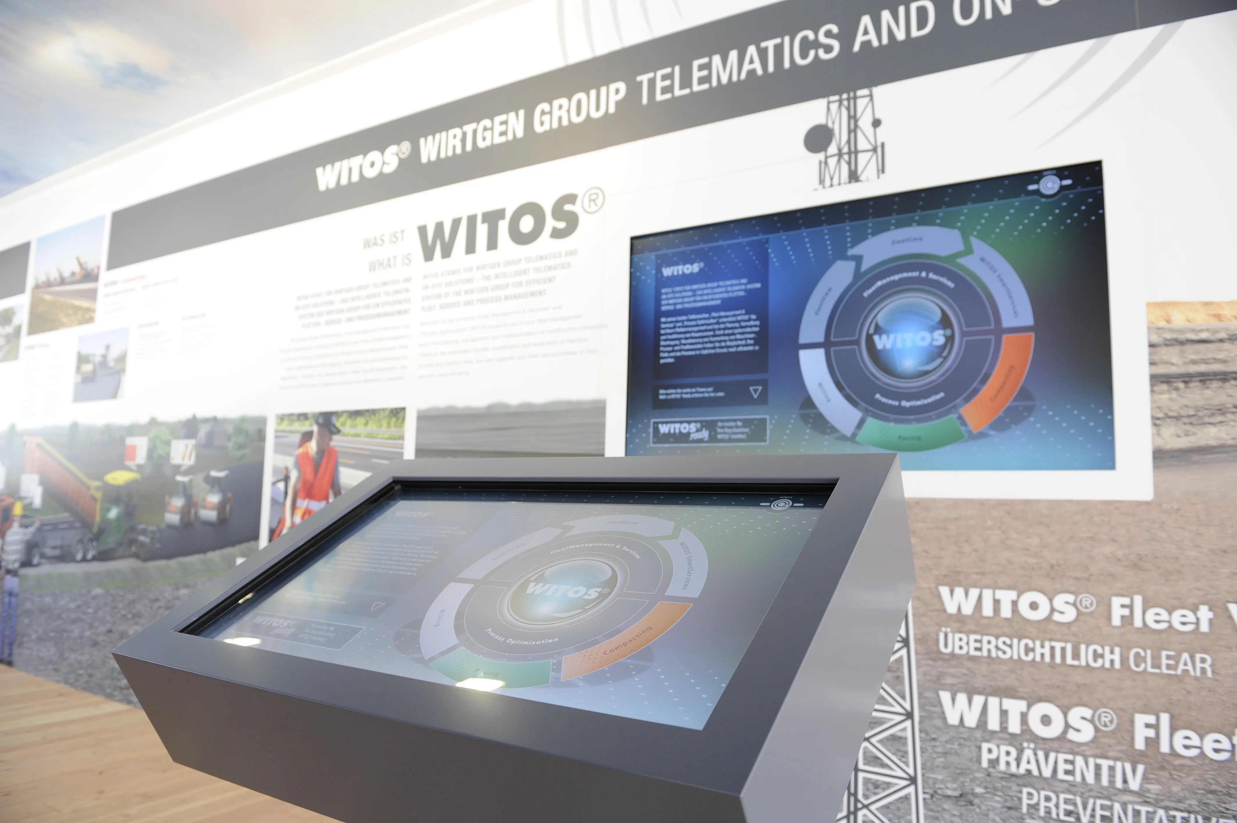
The Wirtgen Group is presenting a glimpse of the future of road construction at this year's bauma. Wirtgen Group telematics and on-site solutions (WITOS) combines a telematics fleet management solution with a high-performance software system for process optimisation. WITOS is a modular software system that supports fleet and service management but also enables new approaches to process optimisation. This makes it possible to apply the just-in-time principle to organising construction processes and to optimi
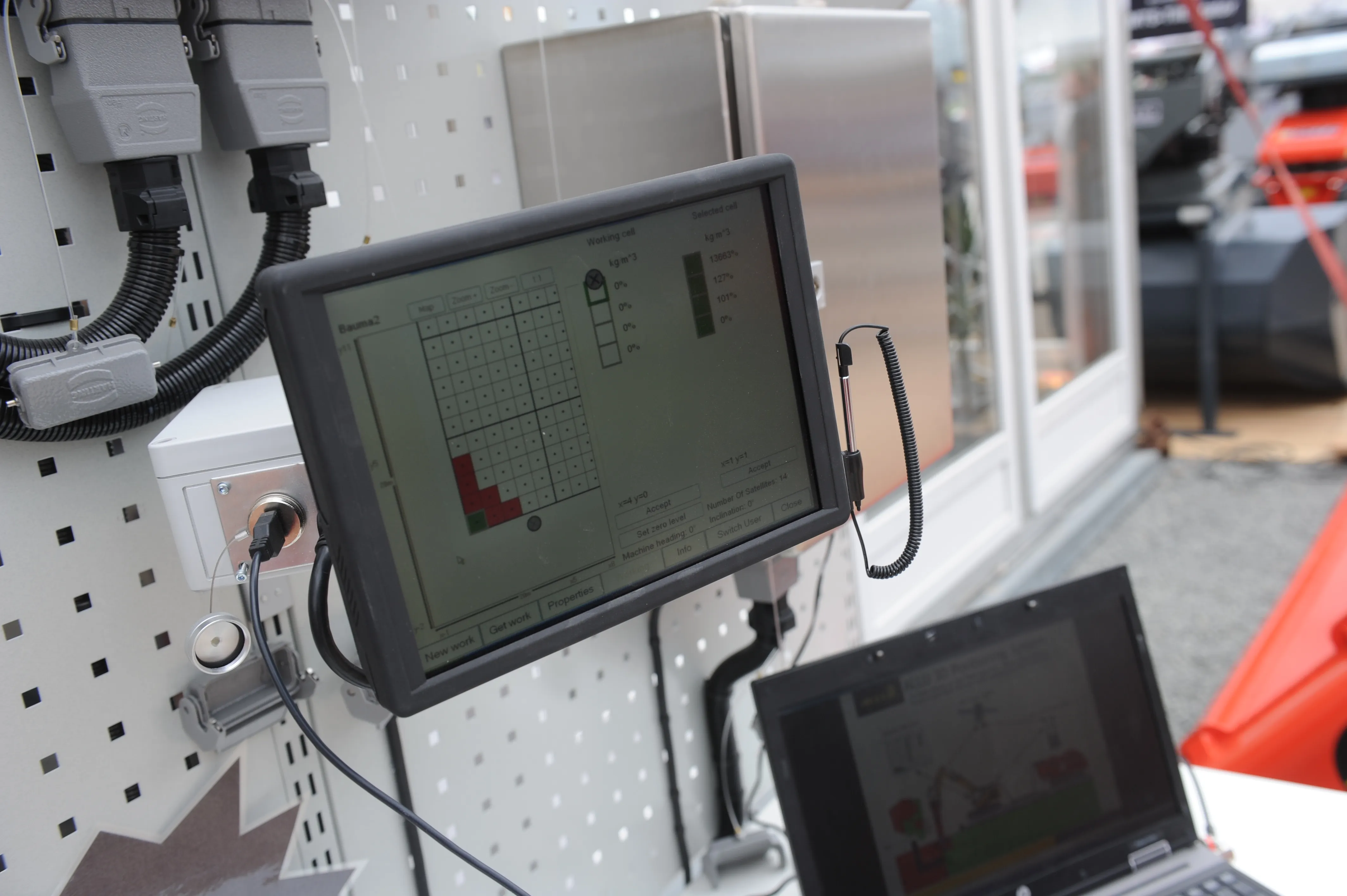
The Allu 3D Positioning System will make ground stabilisation works more efficient and more cost-effective, according to the Finnish manufacturer. The GPS-guided system works in conjunction with Allu’s PMX mixing head, which is mounted on an excavator. It is made up from four modules – computer unit with software, touch screen, base station and GPS antennas positioned on the mixing unit. Often used in road construction to firm up soft ground, the ground stabilisation process sees the binder material fed in
The Allu 3D Positioning System will make ground stabilisation works more efficient and more cost-effective, according to the Finnish manufacturer. The GPS-guided system works in conjunction with Allu’s PMX mixing head, which is mounted on an excavator. It is made up from four modules – computer unit with software, touch screen, base station and GPS antennas positioned on the mixing unit. Often used in road construction to firm up soft ground, the ground stabilisation process sees the binder material fed in
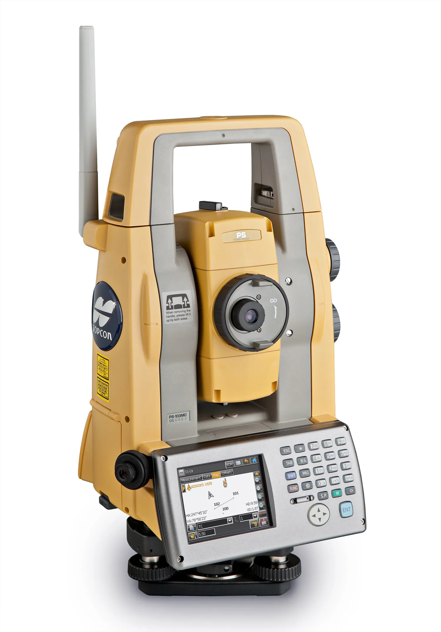
Topcon Europe Positioning’s (TEP) new auto-tracking robotic total station series for the construction market on show at bauma 2013 will “set a new industry standard”, according to Leighton Davies, the company’s survey products sales manager for Europe. With what is said to be its combination of the latest tracking, motorised turning, angle accuracy and software technology, the new PS-AS series instruments are designed for applications such as stakeout and as a key component of a Local Positioning System, us