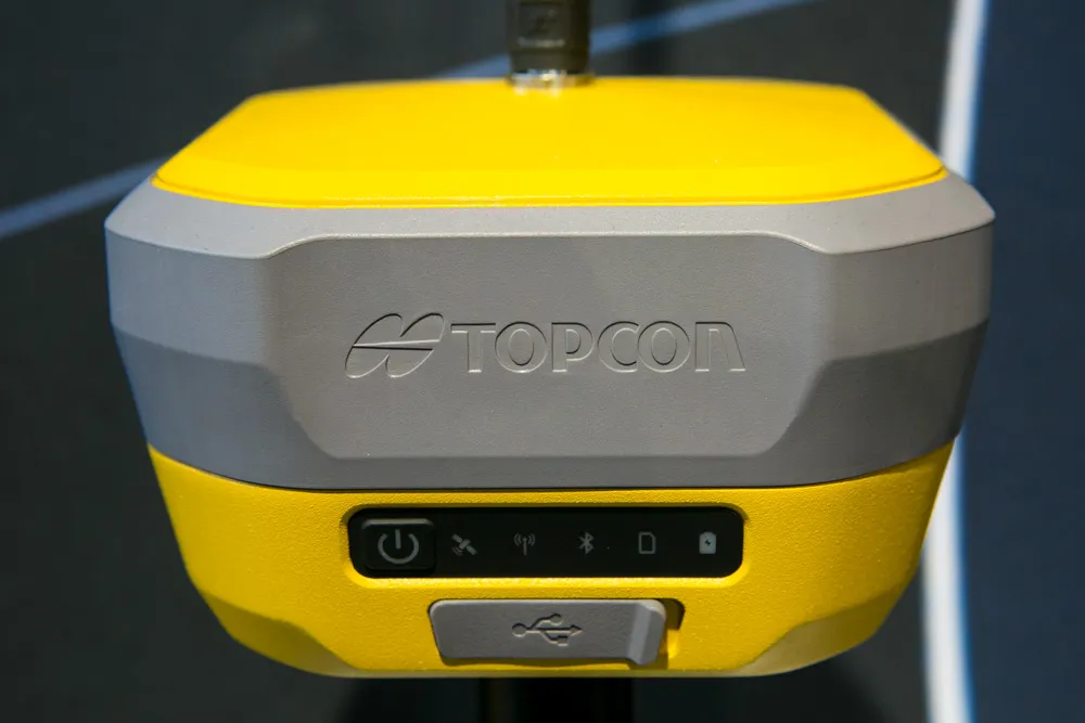
Advanced GNSS capabilities from Topcon

Topcon claims that its HiPer VR GNSS receiver is compact, light and benefits from advanced GNSS technology. The firm says that the rugged design is built to withstand harsh construction environments. Using Topcon’s sophisticated GNSS chipset with Universal Tracking Channels technology, the HiPer VR tracks every satellite signal. The compact, rugged design also features an integrated IMU and eCompass. The HiPer VR can be used for static or kinematic GNSS post-processed surveys: as a network RTK rover with
May 15, 2019 Read time: 2 mins
Topcon claims that its HiPer VR GNSS receiver is compact, light and benefits from advanced GNSS technology. The firm says that the rugged design is built to withstand harsh construction environments.


Using 342 Topcon’s sophisticated GNSS chipset with Universal Tracking Channels technology, the HiPer VR tracks every satellite signal. The compact, rugged design also features an integrated IMU and eCompass.

The HiPer VR can be used for static or kinematic GNSS post-processed surveys: as a network RTK rover with the FC-5000's internal 4G/LTE cellular modem; as a UHF/Longlink jobsite RTK rover; and also in Topcon’s patented Hybrid Positioning solution.

Key features include universal tracking technology for all satellites and constellations (GPS, GLONASS, Galileo, Beidou, IRNSS, QZSS, SBAS) covering all modernised signals, as well as a compact form factor ideal for Millimeter GPS and Hybrid Positioning. They also include a novel 9-axis IMU and ultra-compact 3-axis eCompass, as well as an integrated 400 MHz UHF Tx/Rx Radio Modem and an ultra-compact 3-axis eCompass that compensates for mis-levelled field measurements out of plumb up to 15°.

For more information on companies in this article

Related Content

  • Machine control technology boosting efficiency
    December 15, 2017
    Hemisphere says that its new S321+ and C321+ GNSS smart antennae are well-suited to mounting on construction equipment to offer machine control technology. The multi-frequency S321+ and C321+ systems offer Athena RTK and Atlas GNSS global corrections and are upgrades to their previous versions. The new units have additional capabilities and are powered by the Eclipse P326 OEM board, supporting 394 channels. These can simultaneously track all satellite signals including GPS, GLONASS, BeiDou, Galileo, and QZS
  • GPS technology developments
    June 13, 2012
    The use of GPS-inclusive technology is proving invaluable to contractors responsible for major transport-related construction projects across the globe. Guy Woodford looked at some of the latest and imminent site solutions featuring GPS Staff at Trimble Heavy Construction based in Sunnyvale, California recently finished developing three new solutions for connecting the construction site. The Trimble Connected Office, the Trimble Connected Controller and the Trimble Connected Machine, are all now available t
  • Advanced GNSS capabilities with Topcon
    April 9, 2025

    Topcon Positioning says that its new HiPer XR offers more capabilities for GNSS duties. The HiPer receivers suit duties in survey applications, including engineering design, and cadastral projects. These versatile tools can also be used for construction site layout/stakeout, grade checking, and material volume calculations. HiPer receivers can also be paired with robotic total stations for Hybrid Positioning

  • Latest GIS and software tools improve operations
    February 24, 2012
    Innovative GIS and software solutions are coming to market from the three key market players - Mike Woof reports Competition is strong in the field for GIS and surveying systems as well as the associated software. The three major players in the sector, Leica Geosystems, Topcon and Trimble, all invest heavily in research and development and continue to roll out new solutions for construction customers that will boost the efficiency of surveying as well as overall project implementation.