Accurate positioning with Topcon

By Topcon March 13, 2024 Read time: 1 min
Topcon says that its new Hybrid Positioning package offers versatility for positioning and optical robotic measurements

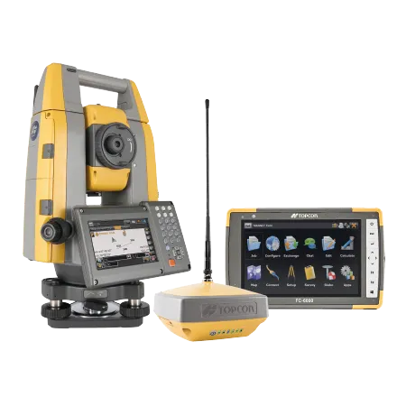
The new Hybrid Positioning system from Topcon is said to perform faster in the field than stand-alone robotic systems and is more versatile than RTK-only solutions. The latest Hybrid Positioning technology combines GNSS positioning and optical robotic measurements on one rover pole.

The unit offers a robotic total station and a lightweight GNSS receiver in a single package and is said to allow faster field work than stand-alone robotic or GNSS solutions. The system has a hybrid lock for rapid prism acquisition in dense areas and a hybrid switch for bouncing between optical measurements and GNSS positioning, as well as a hybrid resection to start set up at a safe and convenient location.

The system is compatible with all Topcon robotic total stations and allows the user to reacquire targets even in challenging conditions. A user can can select safe, convenient locations and define the unknown point of the instrument from GNSS measurements. The firm says that for maximum efficiency, users can pair the Hybrid Positioning technology with MAGNET Field data-collection software.
 

For more information on companies in this article

Related Content

  • Data handling for efficient machine control
    October 16, 2012
    The rapid increase in information availability is transforming the construction sector. Conventional methods used for sourcing geographic data based on maps and localised sampling meant that there was often a lack of accurate information relating to ground conditions at specific areas where work was planned, often resulting in unwelcome surprises for construction companies along with additional costs for projects.
  • Wider range of survey software functionality
    February 9, 2012
    Leica Geosystems is offering a broad spread of new packages and hardware that will deliver improved performance to users. The firmware 2.0 product is said to add powerful new capabilities to the Leica ScanStation C10, the industry's most popular 3D laser scanner for as-built and topographic surveys. This further increases the productivity and versatility of the fully integrated, cable-less ScanStation C10. A new Setup facility lets users take advantage of known survey points and backsighting, while remote,
  • Sophisticated slipformer control from Wirtgen
    August 10, 2018
    Wirtgen is now offering a new version of its concrete slipformer control package. This new tool offers additional capabilities and improved performance over the earlier version. The company claims that its upgraded Wirtgen AutoPilot 2.0 package can deliver a higher paving accuracy along with lower costs. Newly-developed, this package is said to produce a wide array of offset and inset profiles, while also delivering these more economically and precisely than with the previous version. The 3D system can eit
  • Surveying efficiency
    February 7, 2012
    Spectra Precision is widening its line of optical survey solutions. There are two additional FOCUS 30 Total Stations now in the range, the new LockNGo and StepDrive models. The LockNGo instrument uses a passive tracking technique that constantly tracks the instrument to the range pole and this is said to improve efficiency by enabling the instrument to constantly lock onto the prism.