Accurate positioning with Leica Geosystems

The new Zeno GG04 smart antenna from Leica Geosystems is said to increase access to GIS and boost tracking performance. This is said to deliver a versatile solution that can improve the accuracy of GNSS mobile devices with real-time Kinematic (RTK) and precise point positioning (PPP). Paired with the Zeno GG04, any Zeno or third party mobile device with Android or Windows OS can now collect precise positioning data with Leica Geosystems’ GNSS technology and 555-channel tracking performance. With PPP, users
June 19, 2017 Read time: 2 mins
The new smart antenna from Leica Geosystems offers increased tracking accuracy
The new Zeno GG04 smart antenna from Leica Geosystems is said to increase access to GIS and boost tracking performance.


This is said to deliver a versatile solution that can improve the accuracy of GNSS mobile devices with real-time Kinematic (RTK) and precise point positioning (PPP).

Paired with the Zeno GG04, any Zeno or third party mobile device with 1223 Android or Windows OS can now collect precise positioning data with 265 Leica Geosystems’ GNSS technology and 555-channel tracking performance. With PPP, users can collect data even in areas without cellular coverage. The bring-your-own-device (BYOD) functionality enables any smart device to collect survey-grade data, delivering centimetre results.

With the Zeno Connect app, any third-party app is compatible with the Zeno GG04 smart antenna. The Zeno Mobile, Zeno Connect or 212 Esri’s Collector for ArcGIS apps provide an easy and familiar platform for non-surveying professionals to collect and analyse data. Organisations can integrate and optimise data in real time from different sources to collect all details of any project from anywhere in the world.

For more information on companies in this article

Related Content

  • Extended Traffic Control in 2014 and beyond
    April 3, 2014
    One leading traffic control solution company has announced a major acquisition to broaden its customer offer, while the delivery of an ambitious real-time journey information service for Scotland’s motorists is well on track. Guy Woodford reports Kapsch’s TrafficCom says its high-profile recent US$16 million acquisition of Transdyn will enable it to offer current and future customers worldwide an extended end-to-end product and solution portfolio for intelligent transport systems (ITS). The acquisitio
  • Advanced machine control solutions
    February 15, 2012
    Trimble has developed an array of smart solutions for GPS machine control applications, which can now be installed on a wide variety of machines from different manufacturers. The company has long had a close relationship with Caterpillar but can also install units on machines from a range of manufacturers including Case, John Deere, Komatsu, Liebherr, Roadtec and Volvo. The firm's range has developed beyond just the GPS hardware though and includes sophisticated software, which can be loaded onto a hand-hel
  • Conference focuses on road design software
    February 23, 2012
    Trimble Dimensions 2009 takes a hard look at opportunities in a tough economy If attendance is the standard by which user conferences are measured, then Trimble Dimensions 2009 should be considered a success. The conference, which took place from 23-25 February at the Mirage Hotel in Las Vegas, USA, hosted more than 2,400 attendees, slightly exceeding last year. The strong attendance, in the face of global economic concerns, was seen by Trimble CEO Steven Berglund as a show of support for the company's tech
  • Florida gets one.network closure
    November 14, 2022
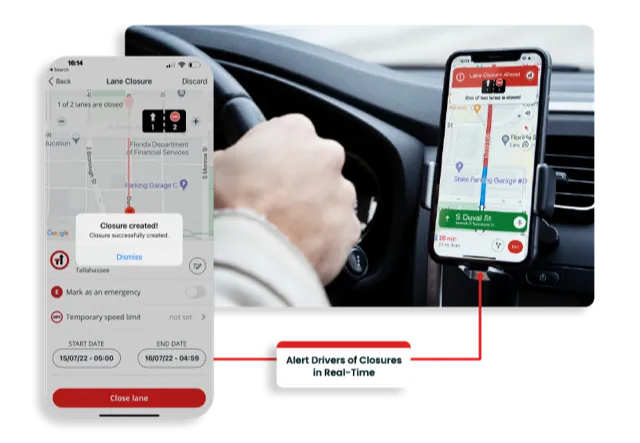
    Road crews in the US state of Florida can now post lane closure information to GPS providers from their mobile phones while working on site