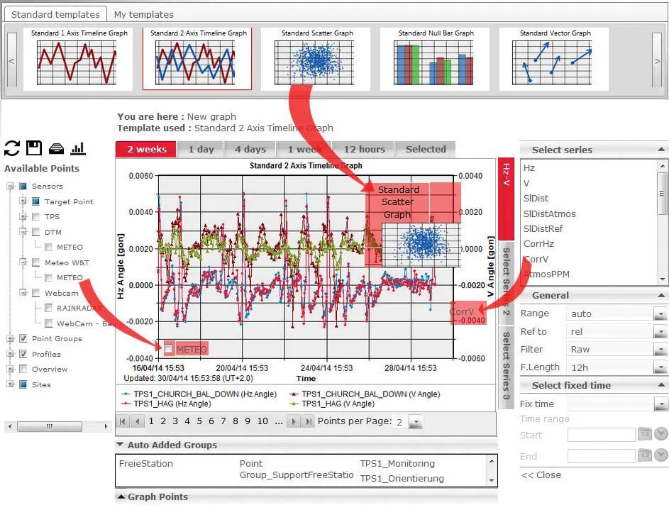
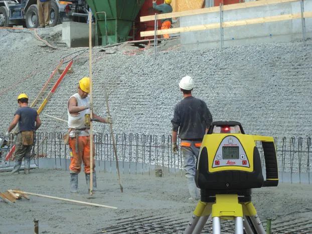
Rugged and durable, the new Rugby 260SG, 270SG and 280DG lasers from Leica Geosystems are said to suit a wide range of construction duties. These multipurpose horizontal/vertical grade lasers can be used for flat and grade applications and are equipped with a large LCD display and a five button key pad.
Rugged and durable, the new Rugby 260SG, 270SG and 280DG lasers from 265 Leica Geosystems are said to suit a wide range of construction duties. These multipurpose horizontal/vertical grade lasers can be used for flat and grade applications and are equipped with a large LCD display and a five button key pad.
Leica Rugby 260SG is a single grade laser for general construction with a rugged casing, full LCD display, a highly visible red beam laser, a semi-automatic levelling mode and a working range of up to 600m. The more sophisticated Leica Rugby 270SG is based on the same platform as the Rugby 260SG but also offers full automatic levelling and an extended working range of up to 700m. The Leica Rugby 280DG is a multipurpose laser with full automatic, dual-grade capabilities. Features include a red bright beam, a plumb beam, scan mode, horizontal and vertical self-levelling, a dual grade up to 15% and is available with a two-way remote control.
Leica Rugby 260SG is a single grade laser for general construction with a rugged casing, full LCD display, a highly visible red beam laser, a semi-automatic levelling mode and a working range of up to 600m. The more sophisticated Leica Rugby 270SG is based on the same platform as the Rugby 260SG but also offers full automatic levelling and an extended working range of up to 700m. The Leica Rugby 280DG is a multipurpose laser with full automatic, dual-grade capabilities. Features include a red bright beam, a plumb beam, scan mode, horizontal and vertical self-levelling, a dual grade up to 15% and is available with a two-way remote control.