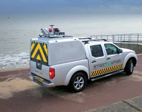
Geospatial engineering company Coastway has completed an as-built survey of the final section of the M8 motorway in Ireland using the StreetMapper mobile mapping system.
Geospatial engineering company 2857 Coastway has completed an as-built survey of the final section of the M8 motorway in Ireland using the StreetMapper mobile mapping system.
StreetMapper has been developed by UK-based1639 3D Laser Mapping in conjunction with German-based guidance and navigation specialist IGI.
Collecting billions of highly accurate measurements in a fraction of the time it would take using traditional survey techniques the resulting 3D models are compared to the digital road design and will be used as a base line record against which future surveys can be compared.
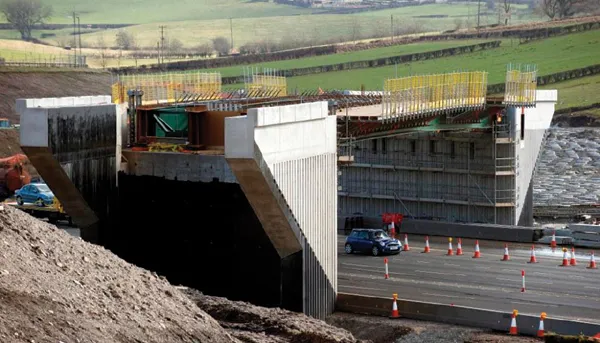
Opened in May, the 41km M7 Portlaoise-Castletown and M8 Portlaoise-Cullahill sections completes the Dublin to Cork interurban route.
“StreetMapper appeared to be the only logical way to complete such a large survey in a timely and cost effective way,” said Mark Hudson, director and co-founder of Coastway.
Using StreetMapper, and working on behalf of the Portlaoise Joint Venture, Coastway mobile mapped both carriageways on each side of the newly-constructed motorway, including slip roads, recording as-built road levels, utilities and structures.
StreetMapper has been developed by UK-based
Collecting billions of highly accurate measurements in a fraction of the time it would take using traditional survey techniques the resulting 3D models are compared to the digital road design and will be used as a base line record against which future surveys can be compared.
Opened in May, the 41km M7 Portlaoise-Castletown and M8 Portlaoise-Cullahill sections completes the Dublin to Cork interurban route.
“StreetMapper appeared to be the only logical way to complete such a large survey in a timely and cost effective way,” said Mark Hudson, director and co-founder of Coastway.
Using StreetMapper, and working on behalf of the Portlaoise Joint Venture, Coastway mobile mapped both carriageways on each side of the newly-constructed motorway, including slip roads, recording as-built road levels, utilities and structures.