
Locating underground utilities accurately with Trimble

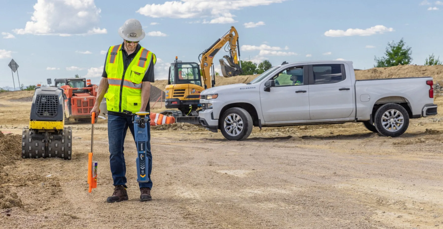
A highly advanced prototype system Trimble is working on is based on the Earthworks package and is intended to reduce the risk of contractors hitting buried utilities when carrying out digging operations. Scott Crozier is general manager of Trimble’s general construction division. He said that this mixed reality solution is an emerging technology that will be available in the near future. The package is integrated into the machine display and provides a visual reference for the operator where buried utiliti
December 11, 2018 Read time: 1 min

A highly advanced prototype system 2122 Trimble is working on is based on the Earthworks package and is intended to reduce the risk of contractors hitting buried utilities when carrying out digging operations. Scott Crozier is general manager of Trimble’s general construction division. He said that this mixed reality solution is an emerging technology that will be available in the near future. The package is integrated into the machine display and provides a visual reference for the operator where buried utilities lie. An object avoidance system that physically limits the machine from digging further to prevent hitting a utility line is slightly further away however.

For more information on companies in this article

Related Content

  • Trimble helps bring Indonesia up to speed on the latest heavy construction technology
    March 28, 2014
    Indonesian infrastructure investment is seeing major highway expansion - Simon Gould writes Over the next 12 years, Indonesia has planned some massive infrastructure investments, under a master plan aimed at bringing it up to developed country status by 2025. Its Government’s Masterplan for Acceleration and Expansion of Indonesia's Economic Development (MP3EI) envisages infrastructure spending of US$400 billion between 2011 and 2025 to help achieve this (see sidebar for more on MP3EI). With limited funds of
  • Sophisticated new loaders
    March 10, 2021
    Sophisticated new wheeled loaders are now coming to market from key suppliers
  • More accurate mapping
    July 31, 2024

    Trimble and Radiodetection have established a collaboration to improve the technology used in the utility measurement and mapping process. Through the integration of the Trimble Catalyst DA2 GNSS system and Radiodetection’s RD MapTM+ application and precision locator products, the software and hardware integration streamlines utility-locating workflows. This can provide high-accuracy measurement capabilities for the generation of underground utilities maps in a single field operation. 

  • Data handling for efficient machine control
    October 16, 2012
    The rapid increase in information availability is transforming the construction sector. Conventional methods used for sourcing geographic data based on maps and localised sampling meant that there was often a lack of accurate information relating to ground conditions at specific areas where work was planned, often resulting in unwelcome surprises for construction companies along with additional costs for projects.