Accurate grading for Caterpillar using Leica Geosystems technology

Accurate grading is possible for Caterpillar machines using Leica Geosystems technology.
By MJ Woof October 2, 2023 Read time: 2 mins
Combining technology from Leica Geosystems with the Cat 2D grade Control package can boost earthmoving efficiency

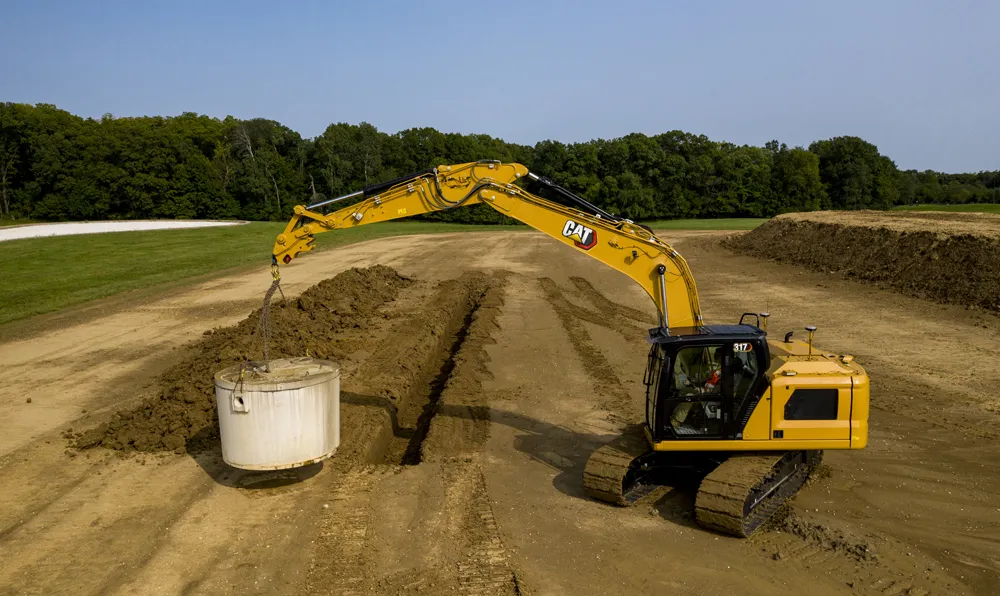
A new package for Caterpillar machines is available from Leica Geosystems, which will boost grading accuracy. Using the Cat Grade 2D Assist system in combination with the Leica MC1 3D package will extend capabilities.

The Cat Grade 2D Assist system allows accurate grading and levelling in two dimensions (horizontal plane). However, adding the Leica MC1 3D machine control system extends this functionality into the vertical plane. With 3D machine control, operators can create, cut, and verify designs horizontally and also at various depths and slopes.

This capability ensures precise and efficient earthmoving and construction tasks, transforming grading and excavation. Complex grading tasks, such as shaping surfaces with varying slopes or creating intricate contours, can now be completed with accuracy, reducing the need for costly rework.

Marcel Schleiss, owner of Schleiss AG in Switzerland, who has already benefited from this offer, shared his experience using the technology on the company’s latest earthwork project: "We have eagerly anticipated this new compatibility offer for some time. We are delighted to collaborate with top-notch suppliers of construction technology, as well as with the exceptionally supportive teams at both Leica Geosystems and the Cat dealer, Avesco."

"As an excavator operator, I've experienced first-hand how the combination of Cat Grade 2D Assist and Leica MC1 3D machine control empowers us to deliver superior results.” said Fabian Stadelmann, excavator operator at Schleiss AG. “It not only optimises our productivity but also minimises material waste, ultimately contributing to more cost-effective and successful construction projects." Leica Geosystems remain committed to pushing the boundaries of innovation and technology in the construction and earthmoving sector to increase interoperability, providing customers with cutting-edge solutions that enhance productivity, precision, and overall project success.

The Leica MC1 3D machine control system is available through authorised Leica Geosystems dealers. Customers can inquire about minimum compatibility requirements for 3D machine control solutions for Caterpillar Next Gen 2D excavators at their local Cat dealer. 
 

For more information on companies in this article

Related Content

  • Caterpillar has a Vision that includes total project site overview
    April 5, 2016
    Caterpillar may be on its financial back foot, but a recent event showed the company has a vision far beyond this or the next financial year – David Arminas reports. Many construction machinery manufacturers have some data collection and analysis systems for their heavy equipment. For a good decade, manufacturers have been moving in this direction, first as retrofit packages on machines in the field and increasingly as standard on newer models. Caterpillar is no exception among manufacturers that are movin
  • Get paid faster for your work by being efficient, optimised, and careful with resources… get connected now
    September 1, 2023
    In this, the third roundtable meeting in World Highways’ series of Connected Construction discussions, Guy Woodford discusses the implications of developments in artificial intelligence (AI) and machine control with world-class experts in their field. Find out what Elwyn McLachlan, vice president of Civil Solutions at Trimble, Murray Lodge, senior vice president and general manager of Construction at Topcon Positioning Group, and Magnus Thibblin, vice president Heavy Construction at Hexagon Geosystems have to say about how you should be positioning your company for a successful future.
  • Danish digging for Leica Geosystems’ 3D machine control
    October 26, 2017
    In Denmark’s northern Jutland, Leica Geosystems’ equipment is being used to help build a 40km motorway, one of the fastest-built such projects in the country’s history. The Danish Road Directorate is the client for the €5.4 million motorway between the two Danish cities of Herning, to the south with around 50,000 people, and Holstebro, a city of about 35,000 people, north of Herning. Preliminary ground investigations were made in 2013 and work started in 2015 with completion set for 2018.
  • Improved excavator models available
    September 7, 2021
    Improved excavator models are now being made available for customers wanting higher performance