Yotta develops new tools for sophisticated GIS package

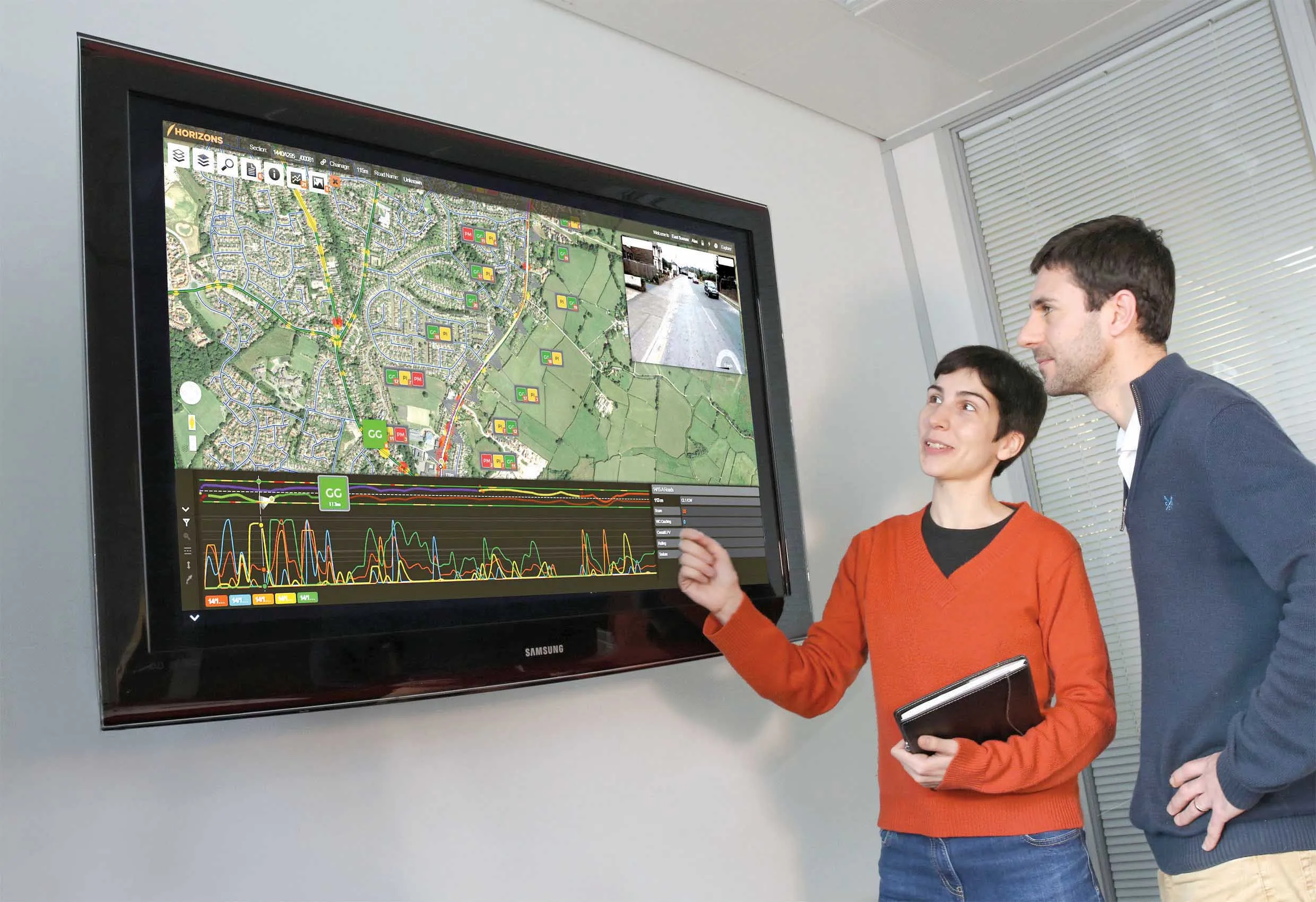
Highway technology and services company Yotta DCL has announced new features for Horizons. The web-based platform integrates GIS, pavement and asset management for highways authorities and agencies to use in a visualised asset management system. The new version 2.3 adds features and functionality across three modules: Explorer, Analysis and Management. Explorer allows users to view, load and visualise a range of datasets, including base network data, their condition in fine detail, plus relevant asset or co
April 25, 2013 Read time: 2 mins

New features are boosting the capabilities of Yotta’s Horizons software

Highway technology and services company Yotta DCL has announced new features for Horizons.

The web-based platform integrates GIS, pavement and asset management for highways authorities and agencies to use in a visualised asset management system. The new version 2.3 adds features and functionality across three modules: Explorer, Analysis and Management.

Explorer allows users to view, load and visualise a range of datasets, including base network data, their condition in fine detail, plus relevant asset or construction information. A new “deep linking” feature shares connections to the exact location of assets and associated data

New features are boosting the capabilities of Yotta’s Horizons software using unique web addresses. The data-analysis enhancements allow users to streamline the creation of optimised forward works plans with modelling of non-deteriorated parameters such as footway network survey (FNS) data. There is also a new “Reduce By Treatment” effect in the treatment options and a CO2 impact option can be summarised in the data analysis reports. The management module now features “Layer Upload/ Import” and a layer building functionality for easy customisation and creation of data sub-sets.

The northern UK town of Rochdale is targeting priority highways maintenance schemes with strategic support from road asset specialist 5153 Yotta DCL. Consultants from this highway technology and survey company used Horizons, its visualised asset management software based on the web, to create works programmes for the town’s carriageway and footway network. This latest contract builds on previous work done by the company including coarse visual inspections (CVI), scanner surveys, footway network surveys and Video Asset Inventory Collection. Horizons provides GIS, pavement management and asset management systems. All of the Borough Council’s previously captured survey data is used by the system to accurately score defects and prioritise work schemes.

Graphics addition

2614 Bricsys, which makes the dwg engineering design software BricsCAD has added the graphics rendering software provider Lightworks to its BricsCAD Solution Store. The Artisan rendering application from Lightworks can be trial downloaded or purchased. In BricsCAD Pro and Platinum editions, designers working in 3D can render high quality virtual reality images.

For more information on companies in this article

Related Content

  • Yotta upgrades asset management package
    May 19, 2015
    Yotta is now offering the latest version of its Horizons visualised asset management platform. Version 2.6 of the package is said to provide a better user experience with improved visualisation. The latest version of the cloud-based solution also offers improved transparency with upgraded reporting providing clear and auditable work trails. Users of Horizons 2.6 can now directly link documents and images in Horizons, improving access to detailed information about a specific asset through the use of phot
  • Yotta’s Horizons and Mayrise create a route map of the world
    September 14, 2016
    Simon Topp, director of international business at software developer Yotta, explained the need for having the best possible plan in place. Highways agencies and departments the world over face a raft of complex and difficult challenges when it comes to managing and maintaining their infrastructure assets. In some countries, where natural disasters or extreme weather events are endemic, good asset management will need to be supplemented by risk and resilience planning. In the US, for example, the Feder
  • Latest GIS and software tools improve operations
    February 24, 2012
    Innovative GIS and software solutions are coming to market from the three key market players - Mike Woof reports Competition is strong in the field for GIS and surveying systems as well as the associated software. The three major players in the sector, Leica Geosystems, Topcon and Trimble, all invest heavily in research and development and continue to roll out new solutions for construction customers that will boost the efficiency of surveying as well as overall project implementation.
  • Software innovations boosting construction efficiency
    February 6, 2017
    Software innovations can help road construction and asset management – Mike Woof writes New developments in construction software offer major benefits for civil engineers, contractors and maintenance firms. The latest advances will help optimise the construction process, while also allowing easier monitoring of existing assets. In terms of construction, Bentley Systems is again pushing the bar with regard to advanced software solutions. Its latest OpenRoads ConceptStation package is said to combine en