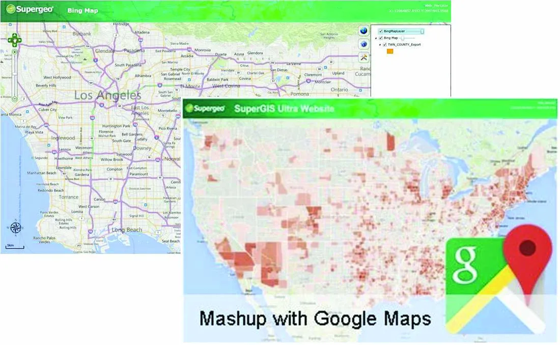
Highway technology and services company Yotta DCL has announced new features for Horizons. The web-based platform integrates GIS, pavement and asset management for highways authorities and agencies to use in a visualised asset management system. The new version 2.3 adds features and functionality across three modules: Explorer, Analysis and Management. Explorer allows users to view, load and visualise a range of datasets, including base network data, their condition in fine detail, plus relevant asset or co

Highway technology and services company Yotta DCL has announced new features for Horizons.
The web-based platform integrates GIS, pavement and asset management for highways authorities and agencies to use in a visualised asset management system. The new version 2.3 adds features and functionality across three modules: Explorer, Analysis and Management.Explorer allows users to view, load and visualise a range of datasets, including base network data, their condition in fine detail, plus relevant asset or construction information. A new “deep linking” feature shares connections to the exact location of assets and associated data
New features are boosting the capabilities of Yotta’s Horizons software using unique web addresses. The data-analysis enhancements allow users to streamline the creation of optimised forward works plans with modelling of non-deteriorated parameters such as footway network survey (FNS) data. There is also a new “Reduce By Treatment” effect in the treatment options and a CO2 impact option can be summarised in the data analysis reports. The management module now features “Layer Upload/ Import” and a layer building functionality for easy customisation and creation of data sub-sets.
The northern UK town of Rochdale is targeting priority highways maintenance schemes with strategic support from road asset specialist
Graphics addition