Yotta develops new tools for sophisticated GIS package

Highway technology and services company Yotta DCL has announced new features for Horizons. The web-based platform integrates GIS, pavement and asset management for highways authorities and agencies to use in a visualised asset management system. The new version 2.3 adds features and functionality across three modules: Explorer, Analysis and Management. Explorer allows users to view, load and visualise a range of datasets, including base network data, their condition in fine detail, plus relevant asset or co
April 25, 2013 Read time: 2 mins
New features are boosting the capabilities of Yotta’s Horizons software

Highway technology and services company Yotta DCL has announced new features for Horizons.

The web-based platform integrates GIS, pavement and asset management for highways authorities and agencies to use in a visualised asset management system. The new version 2.3 adds features and functionality across three modules: Explorer, Analysis and Management.

Explorer allows users to view, load and visualise a range of datasets, including base network data, their condition in fine detail, plus relevant asset or construction information. A new “deep linking” feature shares connections to the exact location of assets and associated data

New features are boosting the capabilities of Yotta’s Horizons software using unique web addresses. The data-analysis enhancements allow users to streamline the creation of optimised forward works plans with modelling of non-deteriorated parameters such as footway network survey (FNS) data. There is also a new “Reduce By Treatment” effect in the treatment options and a CO2 impact option can be summarised in the data analysis reports. The management module now features “Layer Upload/ Import” and a layer building functionality for easy customisation and creation of data sub-sets.

The northern UK town of Rochdale is targeting priority highways maintenance schemes with strategic support from road asset specialist 5153 Yotta DCL. Consultants from this highway technology and survey company used Horizons, its visualised asset management software based on the web, to create works programmes for the town’s carriageway and footway network. This latest contract builds on previous work done by the company including coarse visual inspections (CVI), scanner surveys, footway network surveys and Video Asset Inventory Collection. Horizons provides GIS, pavement management and asset management systems. All of the Borough Council’s previously captured survey data is used by the system to accurately score defects and prioritise work schemes.

Graphics addition

2614 Bricsys, which makes the dwg engineering design software BricsCAD has added the graphics rendering software provider Lightworks to its BricsCAD Solution Store. The Artisan rendering application from Lightworks can be trial downloaded or purchased. In BricsCAD Pro and Platinum editions, designers working in 3D can render high quality virtual reality images.

For more information on companies in this article

Related Content

  • Ontario opts for Power InRoads design tools
    June 12, 2012
    One of Canada's largest provinces, Ontario, has decided to go with the latest Power InRoads suite of design tools now being offered by Bentley Systems as a complete stand-alone version As well as the Inroads tools, that means Ontario's Ministry of Transportation will use drafting and document production by the MicroStation CAD tool, and mapping and GIS functionality from Bentley Map. It previously used InRoads for highways work but on an AutoCAD platform. The whole new package is also designed to work co
  • Efficient stockpile and site monitoring
    October 23, 2017
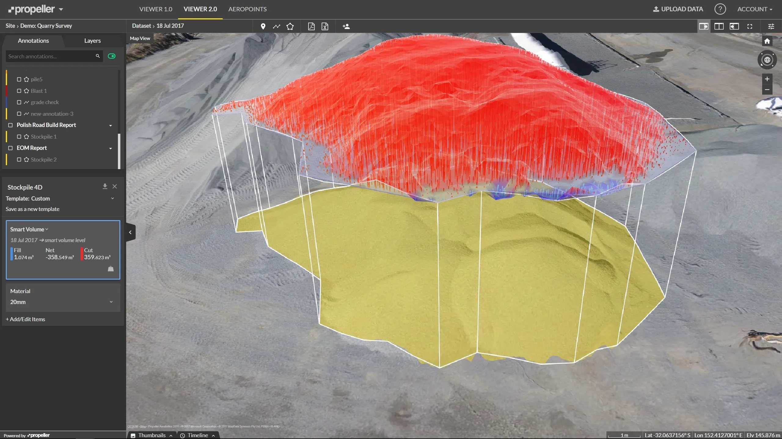
    Effective monitoring of aggregates stockpiles as well as face excavation can deliver greater quarrying efficiency. One of the latest innovations in quarrying is the use of drones, which provide major benefits for optimising operations. The use of affordable drone hardware and software solutions can help reduce stockpile inventory time by as much as 70%. Through the recent partnership between Trimble and Propeller, drone data can now be an everyday tool in quarries by proving a transformational impact
  • Sharing point cloud data with Topcon
    March 12, 2018
    A new package from Topcon Positioning Group can help with collaboration and sharing for 3D point cloud data. This web-based service is for integration with the MAGNET Collage desktop mass data processing software — MAGNET Collage Web. According to the firm, the MAGNET Collage Web allows users to access data through a web browser that integrates with the MAGNET Collage Office version. The package means that users can publish and share mass data maps in a user-friendly and intuitive 3D web-based environment
  • NDT sensor fusion in structural pavement condition surveys
    February 27, 2017
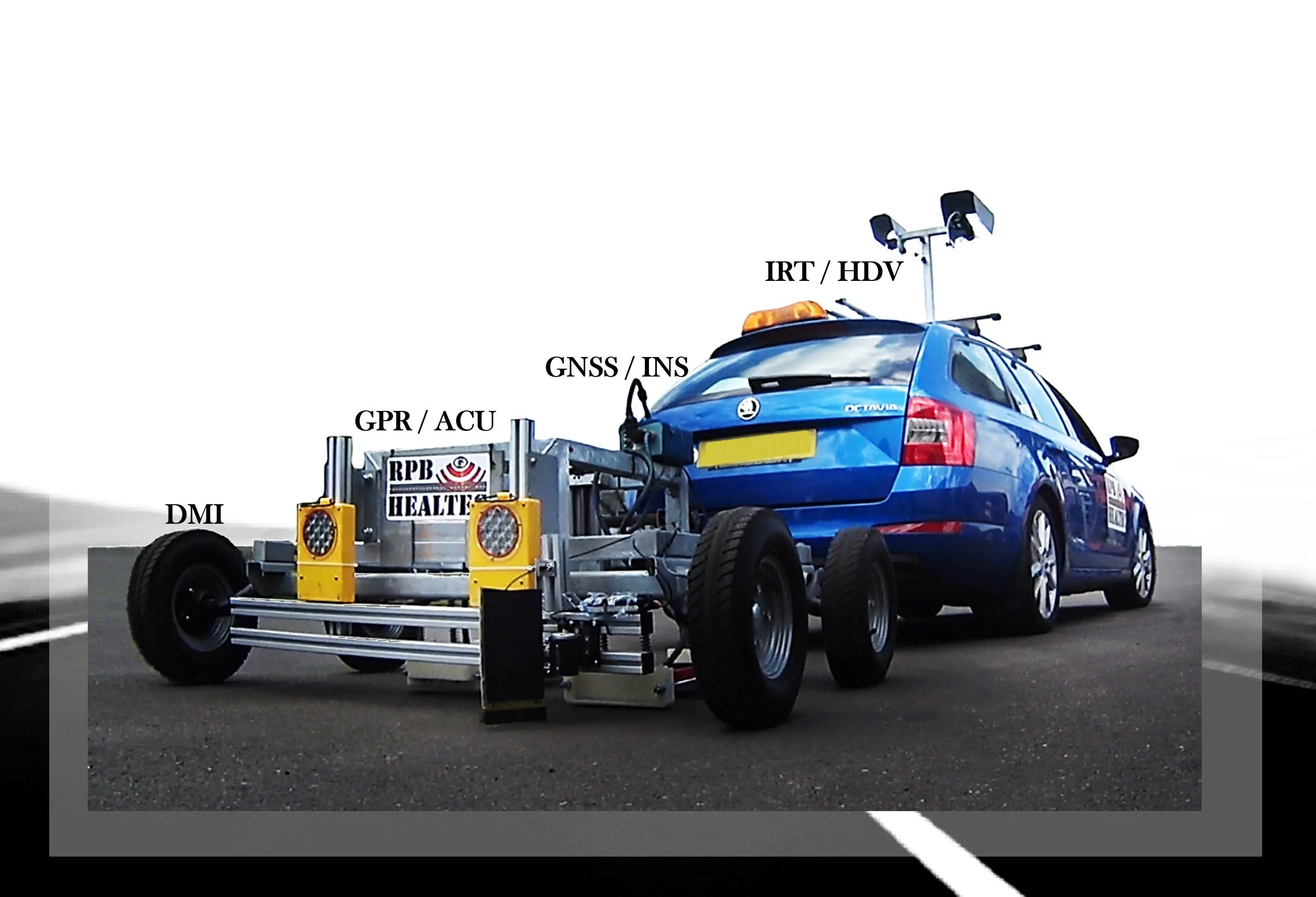
    Early detection of pavement defects and the causes of deterioration is essential for effective maintenance planning, writes Dr Alena Uus* There is a need for optimisation and development of UK highway survey methods that would provide comprehensive information on the surface and subsurface pavement condition and operate at traffic speed, which eliminates the requirement for lane closures. Performance of non-destructive testing (NDT) methods commonly employed in pavement condition surveys can be potent