The introduction of millimetre GPS systems to the sector is raising the bar in this construction segment. Concrete surfaces are generally durable, but they cannot last forever, ageing and surface wear due to use will have an effect. Discolouration, scaling, crazing, cracking, or curling will sometimes occur due to a poor ready-mix batch, inadequate curing procedure, subgrade settlement, or improper bonding of the finish-layer.
Concrete paving is complex and achieving quality, long-lasting results requires skill, the right equipment, and advanced technology. These pavements are typically stronger and more durable than other types of surfaces and they can be grooved for skid resistance. A disadvantage is that they are generally more time-consuming to construct. As a result, concrete contractors have turned to technology to boost quality and productivity.
According to the American Concrete Pavement Association, technology has been significant for the concrete paving segment: "Since 1892 - when the very first concrete pavement was placed in America - concrete pavement technology has been changing, continually evolving to meet current and future needs."
Technology has improved productivity and quality. "We're seeing progressive contractors...early adopters embracing technology today, and the others realising they will have to follow or settle for not being competitive," said Brian Lingobardo, systems manager, 3D road construction,
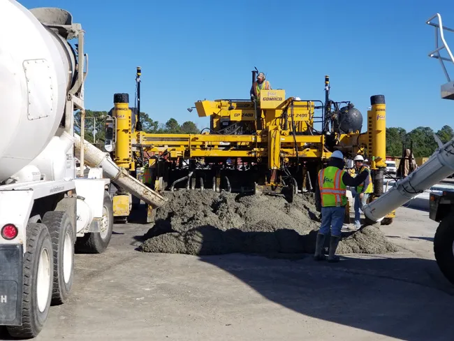
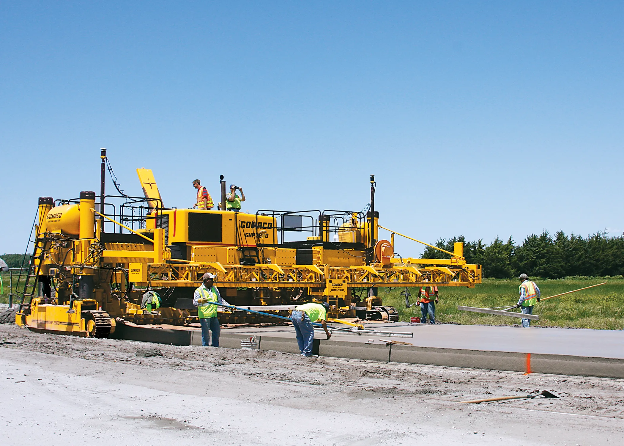
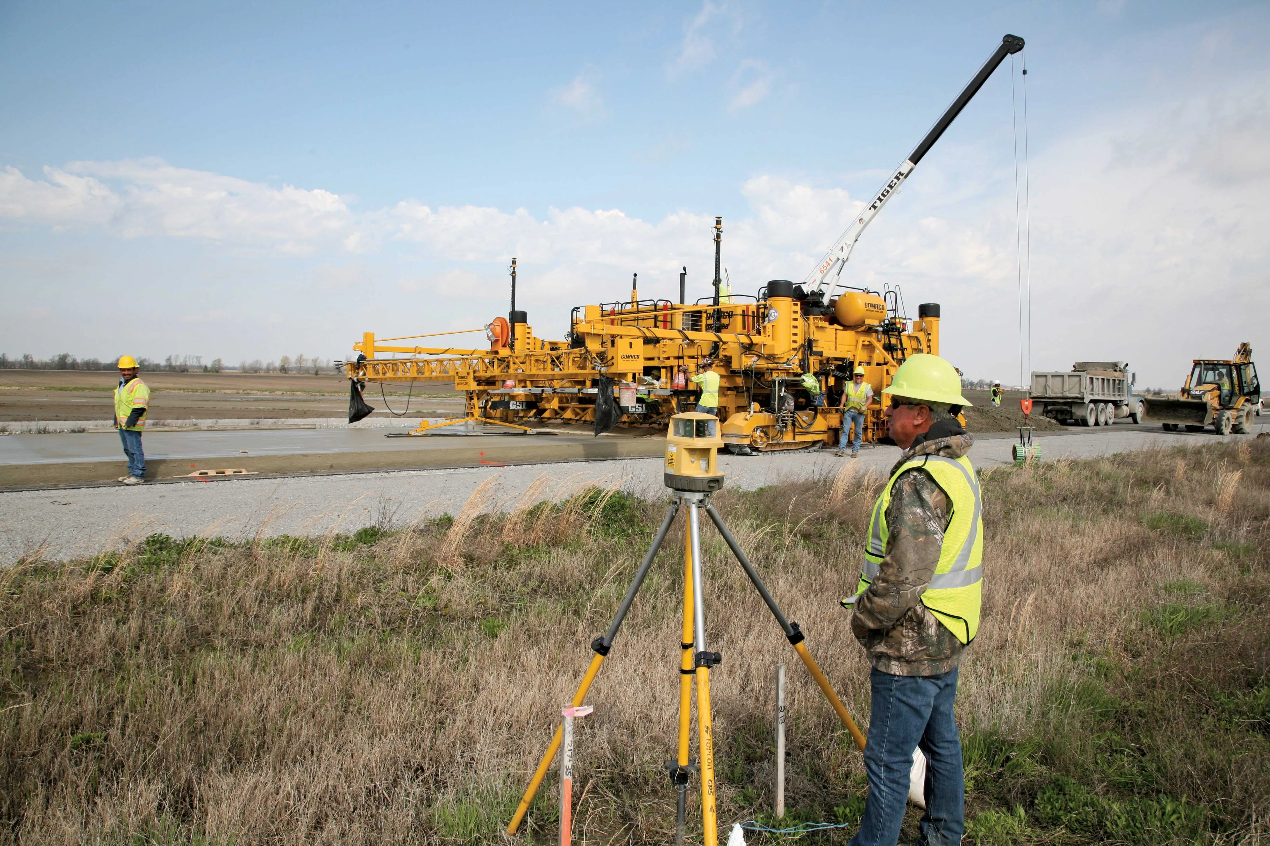
Slipform pavers offer efficiency in the production of concrete road pavements, airport runways, and other large surface sites. Controlling their performance to ensure desired results is crucial for optimising quality and productivity.
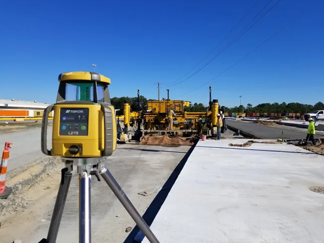
Topcon Positioning Systems offers a 3D paving capability through its Millimetre GPS paver system. The system uses satellite positioning together with a zone laser reference and has a screen that displays machine position, and the sensors being used to control the left and right side of the pan, as well as elevation and slope. The system has machine control positioning-zone laser receivers with integrated GPS antenna mounted on the rear of the paver. Other components on the paver include the machine control GNSS receiver and slope sensors to control the front of the paver.
The Topcon Millimetre GPS paver system features a laser that transmits a signal. Unlike a standard rotating laser that only works in a flat plane, the Topcon LZ-T5 transmits a Laser Zone signal that creates a measuring area 10m in height. Positioned anywhere within the Laser Zone, the Millimeter GPS paver system’s machine control sensor computes the precise vertical information. There is no need for a moveable mast, the technology is designed to determine elevation automatically, even if the site has an elevation variance of 10m. For sites with significant elevations or large areas, up to four LZ-T5 Lazer Zone transmitters can be linked to cover larger areas and elevations.
"Since we are free of stringlines, we like the efficiencies provided by the Millimetre GPS paver system," stated Kevin Gehring, owner/operator at Gehring Construction & Ready Mix, Nebraska. "We're not needing to wait and pay for surveyors to be scheduled and pound hubs in ground. And we're no longer waiting and paying employees to set stringline."
Gehring believes the firm is achieving better paving alignment and rideability because it is able to use actual radius data for horizontal and vertical curves instead of short tangent string- line sections.
Agreeing, Scott Murchison, PE. LEED AP, and chief engineer for RC Construction, Mississippi said the firm recently paved a new runway at Joint Base Andrews in Prince George's County, Maryland, for Air Force One. The runway had a specified 111mm/km profilograph testing tolerance. But with the system the firm achieved a profilograph smoothness rating of less than 8mm/km.
The Topcon Millimeter GPS paver system appears to help with paving accuracy, both in material usage and concrete lay down.
"Our yields have been much better than expected," said Jacob Headrick, paving/3D manager, GLF Construction Corp, Florida. "We're dialed into the exact amount of material we need, which saves on material costs and eliminates rework.”
Headrick also cites savings and return on his technology investment as benefits: "With our first project, we saved enough to cover the cost of the Topcon system."
The package clearly offers benefits and the Federal Highway Administration (FHA) has several ongoing programs that intend to ensure "…innovative technologies that improve the safety and performance of the transportation system are deployed and implemented."