One of Canada's largest provinces, Ontario, has decided to go with the latest Power InRoads suite of design tools now being offered by Bentley Systems as a complete stand-alone version
As well as the Inroads tools, that means Ontario's Ministry of Transportation will use drafting and document production by the MicroStation CAD tool, and mapping and GIS functionality from Bentley Map. It previously used InRoads for highways work but on an AutoCAD platform. The whole new package is also designed to work co
One of Canada's largest provinces, Ontario, has decided to go with the latest Power InRoads suite of design tools now being offered by Bentley Systems as a complete stand-alone version
As well as the Inroads tools, that means Ontario's Ministry of Transportation will use drafting and document production by the MicroStation CAD tool, and mapping and GIS functionality from Bentley Map. It previously used InRoads for highways work but on an AutoCAD platform.
The whole new package is also designed to work completely interoperably and can tie-in with Bentley's ProjectWise V8i system of collaboration servers and services. Designs and models can be pulled together for dynamic project review using the Navigator V8i software.
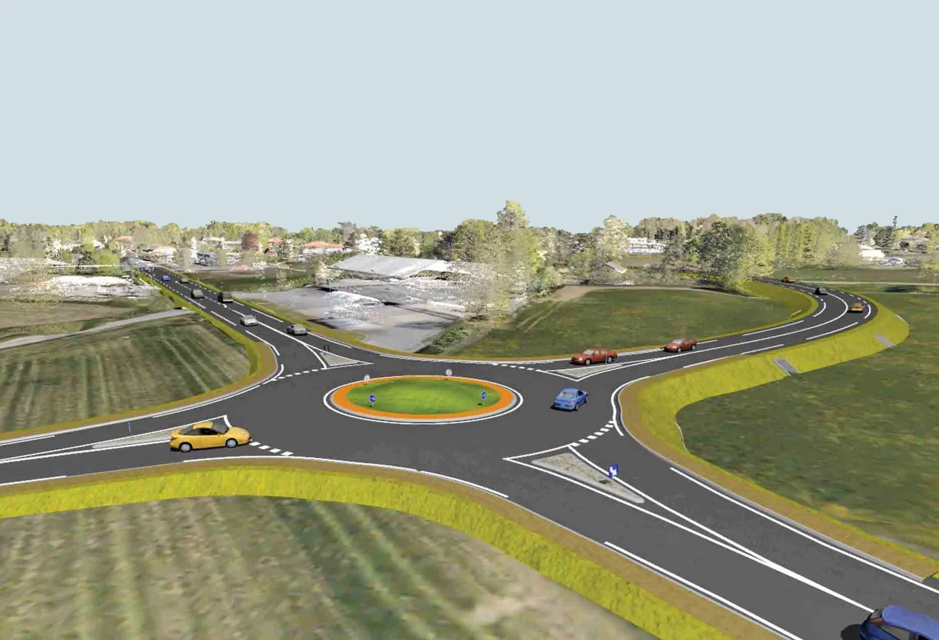
The province's head of Highway Engineering Systems, Hanna Hanna, said the decision to use Power InRoads will give the ministry a single easily deployed application. Advantages include new capacities such as roundabout design, site modelling, and advanced visualisation and animation techniques.
Bentley said the software’s "spectrum of easy-to-use tools complements MTO’s existing workflows with capabilities for survey data reduction and analysis, map analysis and production, transportation design automation,and team collaboration in a total-project context."
Power InRoads has a single-installation or upgrade process which eliminates CADapplication synchronisation issues, it added.
Ron Gant, Bentley global marketing director said, “Power InRoads is the only product needed for new infrastructure design as well as resurfacing, restoration, and rehabilitation needs."
Bentley adds that the software will give the ministry comprehensive CAD capabilities, a range of data acquisition tools, including point cloud data, intelligent, constraint-driven 3D modelling, comprehensive storm drainage modelling and analysis, extensive reporting and quantity estimation, integration with mapping and GIS, built-in rendering and inherent 3D visualisation, and context sensitive, customisable menus.