Data handling for efficient machine control - Mike Woof reports
The rapid increase in information availability is transforming the construction sector. Conventional methods used for sourcing geographic data based on maps and localised sampling meant that there was often a lack of accurate information relating to ground conditions at specific areas where work was planned, often resulting in unwelcome surprises for construction companies along with additional costs for projects.But this previous lack of data has now been replaced by a huge wave of new information, provided by recently developed technologies. Engineering firms and construction firms now face the problem of how to handle all the data that has become available, not to mention analysing this information and coming up with civil engineering solutions. And that wave of data looks set to increase in scale as technologies become still more efficient and accurate.
The number of earth observation satellites is rising, with China having launched four satellites in one week. Meanwhile unmanned aerial reconnaissance is becoming more widely available for mapping purposes, a spin-off from military technology. One of the biggest changes has been with the development of LiDAR, an optical remote sensing technology. Used together with conventional two-dimensional imagery, this can deliver a highly accurate view of a specific area of interest. This data can be collected both quickly and efficiently but while availability has increased, so has the cost of the technology decreased. The use of point cloud technology has further added to the quantity of data available, providing enormous quantities of information for specific geographic features for example. This new technology delivers precise models of the as-built environment and 3D data capture with high accuracy.
Geospatial data is now used across industries and applications but when using this information to make decisions, it is important to first understand an area of interest from all angles.
Conventional mapping and spatial analysis methods are increasingly unable to cope with the number crunching required and instead, more sophisticated tools are required. The latest construction software does offer considerable benefits for handling and analysing this information, and there are major firms in the sector such as
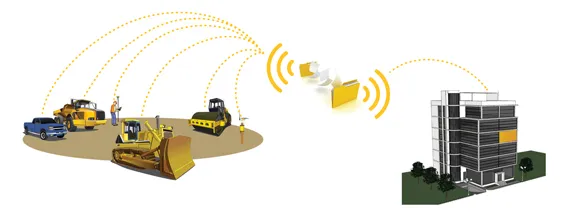
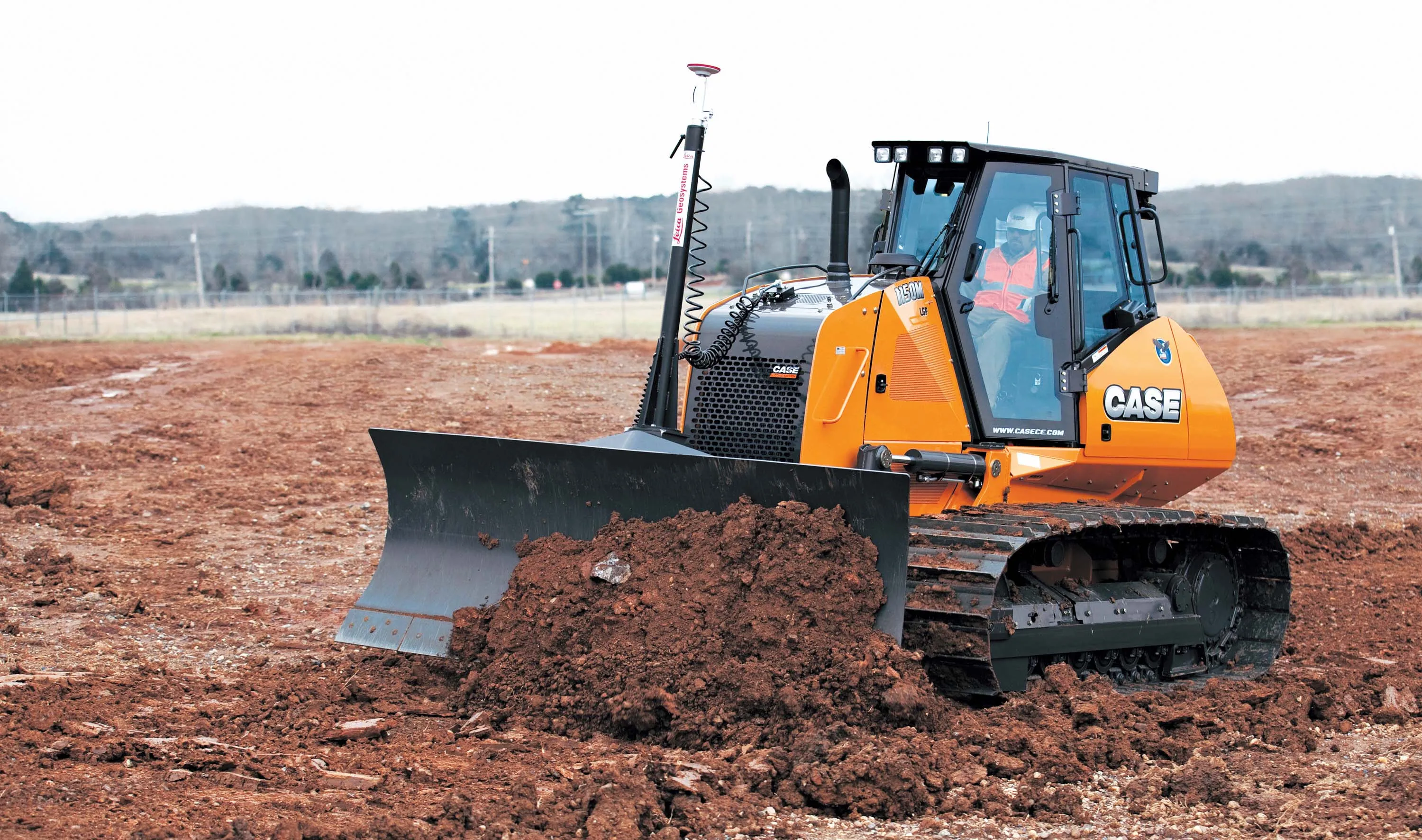
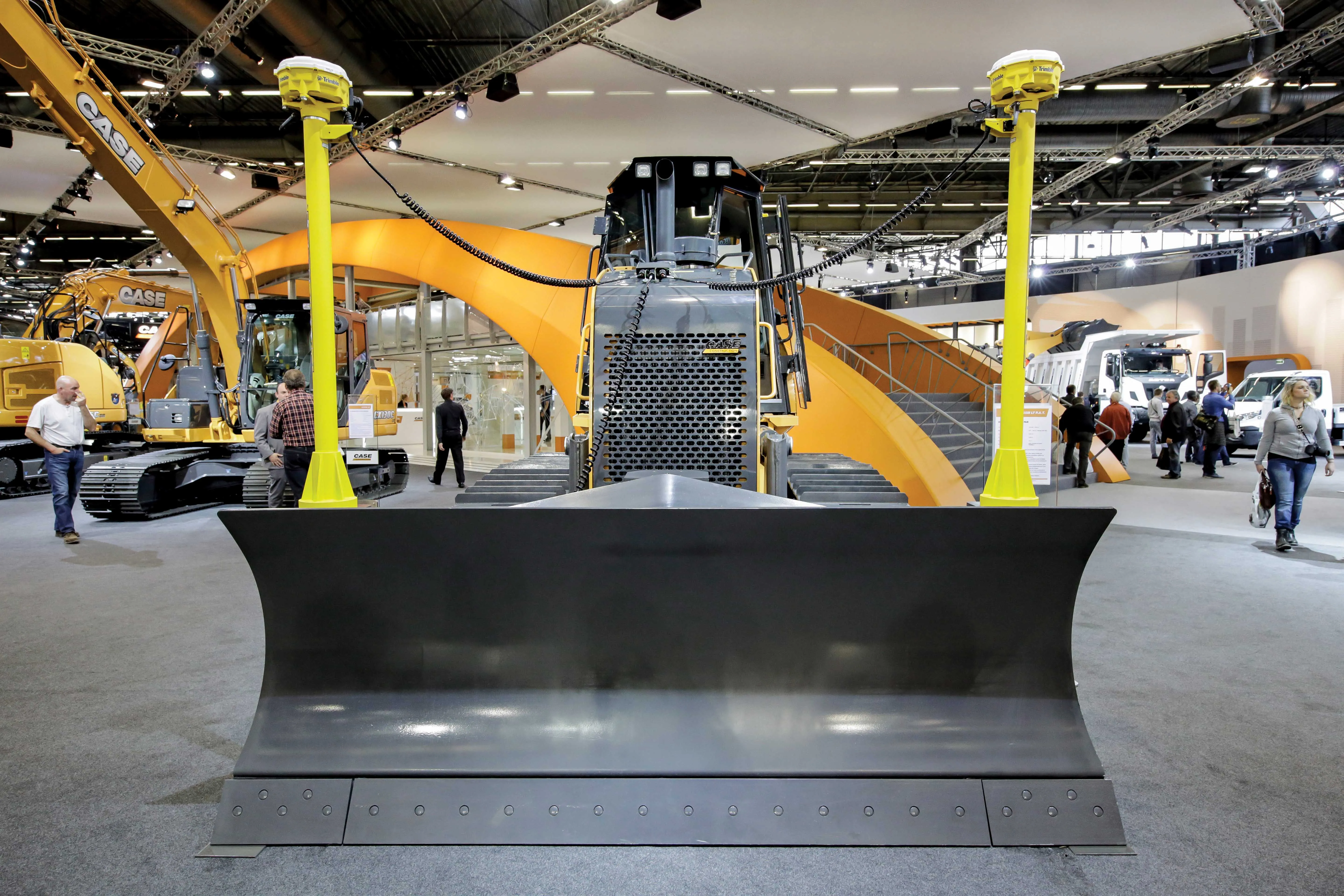
For machine control purposes, technology has come a long way from the laser guided systems developed originally. Contractors can now use satellite positioning technology such as the US GPS, Russian Glonass and Chinese Compass networks, with the European system set to come on-line in future years. The accuracy of the positioning signals has also increased and combined with laser systems allow a much higher degree of positioning accuracy for machines.
The array of machine control systems on the market has proliferated with three major firms
Agreements between Leica Geosystems, Topcon and Trimble with software firms such as Autodesk and Bentley Systems have broadened the capabilities available to the user. The machine control systems are now better integrated with the software, which makes more efficient use of the vast quantities of data available. The acquisitions and agreements made by Leica Geosystems, Topcon and Trimble have allowed machine control technology to become part of a much wider field. Trimble for example offers the Connected Site, which takes integration of software and machine controls to a much higher level of sophistication, linking whole fleets with access to design information and allowing speedy analysis of data recovered in real-time.
Data Preparation from Leica Geosystems
Leica Geosystems is offering its iCON package, which allows for complete data preparation, editing and reporting duties. The Leica iCON office allows communication with instruments and external field computers for transmitting and receiving data.
The office software communicates with the Leica iCON CC50 and CC60/61 field controller, and the MPC1310 machine control computer. As standard, Leica iCON office contains all necessary features to prepare and process data including surveying and stake-out, coordinate calculation, graphical editing, drawings and 3D graphics.
The integrated graphic tool allows editing of baselines, offsets, intersections, and area and volume calculations. Leica iCON office also provides sophisticated drawing functions, allowing it to work directly with AutoCAD files. Users can display files with height information in a 3D view including road lines with height profile, terrain models, cross-sections and AutoCAD files, while design data can be visualised on Google Earth. In addition, the data import and export provides easy-to-use routines to convert files to a variety of formats. The import/export function supports formats such as AutoCAD DXF/DWG, SOSI, MX Genio, Atlas 2000, AutoKa PC, KOF, Ispol, Bever, AnPakke and LandXML. Leica iCON office works with a range of different design models that users can send to all construction machines and sensors from one single software package.
Leica iCON office supports digitising hardware, such as Summagraphics, Ushikata, Calcomp. Users can digitise drawings and receive immediately results - graphically or numerically. Contractors will also benefit from calculating as-built cost estimates using volume analysis. This module can also be used to create terrain profiles and cross-sections. Besides the standard functions, Leica iCON office offers supplementary modules for applications such as tunnels, roads, terrain and volume calculations, in order to meet operations-specific requirements. Contractors can buy a tailor-made module system and pay for the functions they need.
Trimble Acquisition
Trimble is to acquire WinEstimator, (WinEst), a provider of construction cost estimating and cost-modelling software. The deal is expected to be completed in the third quarter of 2012 and WinEst will be integrated into the operations of Meridian Systems, a wholly-owned subsidiary within Trimble's Engineering and Construction segment.
WinEst offers estimating and cost modelling solutions, which can be used in all stages of the engineering process, from initial project feasibility to detailed final estimate. WinEst also provides Modelogix, a solution for capital projects to develop accurate conceptual cost models based on cost-history data from multiple sources. The acquisition will extend Meridian's capabilities for general contractor and owner customers to develop, manage and leverage their construction cost information to support their core business. In addition, WinEst solutions will support the integration of cost data into other applications, including Meridian's Prolog and Proliance software, allowing the adoption of BIM and integrated project delivery (IPD) business practices.
The acquisition will allow Meridian to provide a broader range of solutions to general contractors according to Meridian Systems. The firm says that industry trends such as BIM and IPD are driving more innovation in construction management software solutions, and now we are better positioned to support our customers and markets.