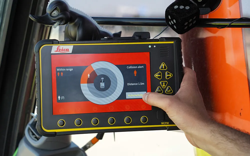
The contractor used a GPS-enabled in-cab crane location and warning system to avoid power lines located above a bridge. The firm used a combination of 3D models and dual mast receivers to track and map crane boom, jib and body within 30mm accuracy to ensure the safety of construction personnel.
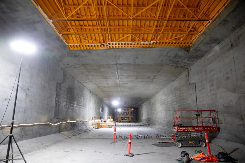
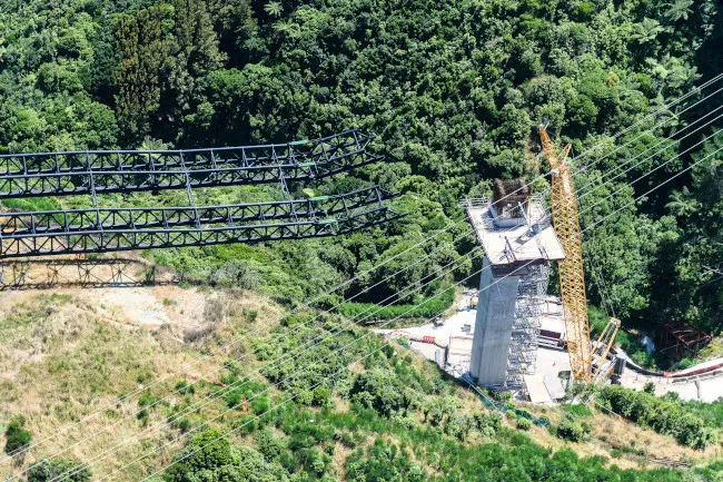
Built to demanding specifications, the Transmission Gully motorway project is complex, with difficult and steep terrain requiring large-scale earthworks during construction. In all, 25 new structures totalling more than 1km are being built along the route. The largest of these, the Cannons Creek Bridge, is 230m long and reaches a height of 60m above the valley floor.
The $850 million Transmission Gully motorway is being delivered as a PPP by Wellington Gateway Partnership in partnership with the New Zealand Government. A key part of the Wellington Northern Corridor, the project is one of the most important stretches of new road in the North Island. When complete the Cannons Creek Bridge will be 24.5m wide, carrying two lanes in either direction and will require the use of 10,000m3 of concrete. A total of 44 steel girders, each 1.8m wide and 3m deep, make up the framework of the bridge deck, supported by two abutments and two piers.
However, the roadway and bridge lie below high voltage power lines. The contractor opted for incremental launching to install bridge girder assemblies over the open space between the piers. The sections are assembled in the launch yard and then moved onto rockers to be slid onto the piers. The project uses cranes in the launch yard, and in close proximity to high voltage power lines. Per regulations, contractors are required to stay outside a 10m exclusion zone during normal lifts and 6m during critical lifts. To keep the team safe, CPB HEB JV CP needed an innovative solution.
“We thought we might use a spotter on the ground but that wasn’t going to give us the assured reliability, particularly in the high winds that are common in Wellington,” said the JV’s survey manager. “We needed a way to relay immediate information to the crane operator. There was no off-the-shelf solution that we could find.”
Familiar with
![lquEQgDA[2].jpg](/sites/wh/files/inline-images/lquEQgDA%5B2%5D_0.jpg)
To ensure safety, CPB HEB JV worked with Transpower New Zealand to develop a 3D model of the power lines and the envelope around the overhead transmission lines. The model simulated sway or sag of the power lines in varying wind and temperature conditions. The crane company also provided a 3D model of its machine, including all elements that could potentially contact the overhead lines.
“Once the essential elements were modeled, we were able to define an exclusion zone based on extreme conditions of the overhead power lines, as well as the crane’s maximum boom height above the cab,” said CPB HEB JV’s survey manager. “With that model and the associated algorithm, we had a real-time solution.”
Initially, one crawler crane was equipped with dual mast GPS receivers, one on the back of the crane cab and one on the top, with sensors added to the main boom. Inside the cab, a touchscreen provides a 3D view of the crane boom as it moves and its virtual proximity to the closest powerline exclusion zone. The algorithms in the program continually adjust the 3D visualisation by using real-time kinematic (RTK) GPS, mapping position and orientation of the crane boom to around 30mm accuracy. Before critical lifts, the survey team carried out testing to confirm that the coordinates of the GPS antenna on the boom tip matched the coordinates measured by the surveyor. The in-built custom alarms available in the Trimble Marine Construction (TMC) software were configured to provide progressive alerts.
“We did a lot of field testing to verify the alarm operations and to check issues related to losing satellite lock, particularly at the bottom of the gully,” added the survey manager. “But we never had a problem and the alarm system worked extraordinarily well.”
Soon after, the CPB HEB JV team installed the GPS-enabled crane location solution on a second crane.
Work on the Cannons Creek bridge began in 2018 and will be complete in early 2020. Completion of the Transmission Gully project is on track and scheduled for 2020.
• All images courtesy of Mark Coote Photography