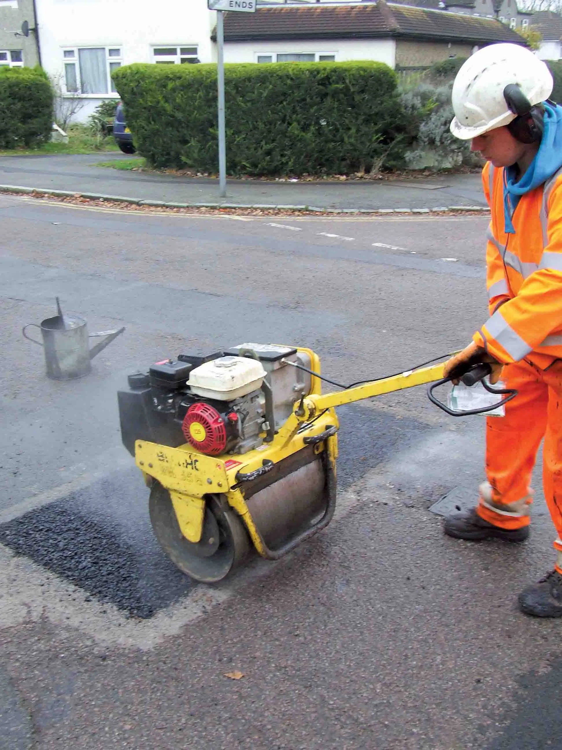
The integration of software tools, users and data was an important factor in a major highway project
The giant High Five interchange in Texas, USA, emerged as a key winner in Bentley Systems' software awards this year. It won both the Innovation in Road and Bridge category and, significantly, Connecting Project Teams.
The awards, a feature of the annual exhibition/conference organised by the software house, attract increasing interest from industry, and competition has become widespread, not least bec
RSS4019 Bentley Systems' software awards this year. It won both the Innovation in Road and Bridge category and, significantly, Connecting Project Teams.
The awards, a feature of the annual exhibition/conference organised by the software house, attract increasing interest from industry, and competition has become widespread, not least because Bentley Systems' various software tools are among the leading and best known for infrastructure work.
In highways work its Inroads, MX and Geopak dominate and its GIS tools are leading contenders for "engineering geospatial" and civils mapping work.
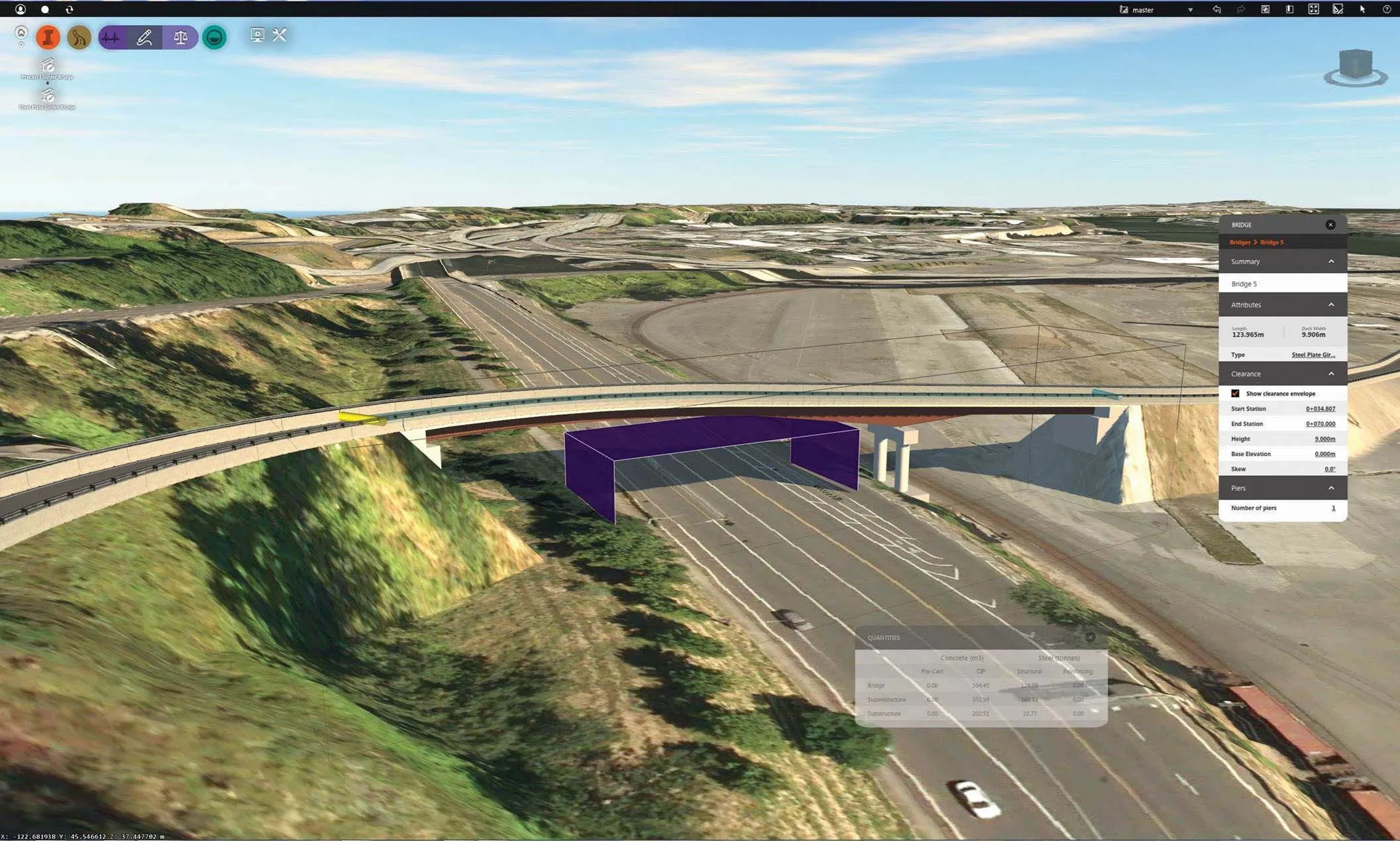
Another strong contender in the awards was the under-construction Stonecutters Bridge, Hong Kong, designed by consultant Arup, and with a 1,080m span, the second longest cable stay bridge in the world.
Typhoon wind loadings and complex gusting had been a major factor in design, involving advanced analysis of vibration and wind pulsing, possible in Bentley's Bridge RM software which was acquired from Austria last year. RM is now being integrated with road and bridge software.
But2418 HDR, the consultant for the five-level Interstate interchange in Texas (3260 World Highways July/August 2003) was more in tune with Bentley's overall strategy of integration of software tools, users and data.
For High Five it installed a comprehensive ProjectWise server system which is Bentley's own collaboration software, tailored to engineering rather than general document management. It synchronises engineering drawing and document users across dispersed offices, searches documents by engineering categories, and calls up various associated programs and tools, as well as connecting into databases.
For the enormous High Five, consisting of nine connectors, 15 slip ramps, and a cross street underpass linking two major highways and subsidiary roads in the Dallas-Fort Worth urban area, a host of subconsultants and various clients had to be linked.
"A very aggressive 18-month design timetable meant they all had to be able to work together from offices spread far across the US," said HDR's project team leader John Quintero.
HDR established network and server software for its own 12 offices and for 40 subconsultant team members, using ProjectWise. HDR visited all the offices and trained all the various parties in its use. ProjectWise has slowly been finding a place in a market with many more general collaboration tools, but seems to be making headway after several years of what one Bentley executive called "banging our heads on the wall", but "the wait has been worth it." The seamless use of assorted tools and calculation programmes by engineers has been a growing part of the Bentley strategy for some years, as the once fairly basic CAD tool of Microstation has been developed into the complex 3D drafting programme.
Many additional functions have been built around its central platform, by direct development and even more by acquisition of a now wide-ranging portfolio of specialist architectural and engineering sector programs. The aim is life-cycle software.
For highways and rail, Bentley is now coining the term BrIM, (Bridge Information Management) to stand alongside the established BIM or Building Information Model in which 3D design work and structural analysis, clash detection, and installation of multiple services, all use and add to essentially the same 3D model.
685 Autodesk, just launched. Reuse of survey and design data for construction, commissioning and then operations is increasingly important. The 2009 software begins with a new look, introducing a task-based menu system, akin to the 'ribbon' introduced in 2794 Microsoft's 2007 office suite. The full range of commands appropriate for the task in hand is displayed.
Automation without programming knowledge is also possible with recording of standard tasks.
In Map-3D there is a strong emphasis on productivity, in particular simplification of the sequences for using FDOs (Feature Data Objects) that allow connection to a wide variety of database sources and file formats. Objects can now be used directly from various CAD commands with no check-in. Database access is improved with "views" or specialised sets of data for the particular task now made within the database rather than by the Map3D software. Databases do this much quicker internally. A new tool allows land parcels to be divided, and a corresponding merge tool lets them be combined. These changes are also in Civil 3D which is built on Map 3D. But there are more.
A variety of methods allow users around previous data set limits. Survey surfaces of 5 million rather than 1 million points can be handled with bigger capacity promised beyond that. Larger surfaces meanwhile can be 'clipped' to a manageable size, by using only the data extending 100m from a road line, for example.
A new collaboration tool called Data Shortcuts extends data sharing functions already familiar in3282 AutoCAD as Xref which allows Civil 3D models to be annotated across drawings. This also allows data to be referenced and the control of object display across drawings
RSS
The integration of software tools, users and data was an important factor in a major highway project
The giant High Five interchange in Texas, USA, emerged as a key winner inThe awards, a feature of the annual exhibition/conference organised by the software house, attract increasing interest from industry, and competition has become widespread, not least because Bentley Systems' various software tools are among the leading and best known for infrastructure work.
In highways work its Inroads, MX and Geopak dominate and its GIS tools are leading contenders for "engineering geospatial" and civils mapping work.
Another strong contender in the awards was the under-construction Stonecutters Bridge, Hong Kong, designed by consultant Arup, and with a 1,080m span, the second longest cable stay bridge in the world.
Typhoon wind loadings and complex gusting had been a major factor in design, involving advanced analysis of vibration and wind pulsing, possible in Bentley's Bridge RM software which was acquired from Austria last year. RM is now being integrated with road and bridge software.
But
For High Five it installed a comprehensive ProjectWise server system which is Bentley's own collaboration software, tailored to engineering rather than general document management. It synchronises engineering drawing and document users across dispersed offices, searches documents by engineering categories, and calls up various associated programs and tools, as well as connecting into databases.
For the enormous High Five, consisting of nine connectors, 15 slip ramps, and a cross street underpass linking two major highways and subsidiary roads in the Dallas-Fort Worth urban area, a host of subconsultants and various clients had to be linked.
"A very aggressive 18-month design timetable meant they all had to be able to work together from offices spread far across the US," said HDR's project team leader John Quintero.
HDR established network and server software for its own 12 offices and for 40 subconsultant team members, using ProjectWise. HDR visited all the offices and trained all the various parties in its use. ProjectWise has slowly been finding a place in a market with many more general collaboration tools, but seems to be making headway after several years of what one Bentley executive called "banging our heads on the wall", but "the wait has been worth it." The seamless use of assorted tools and calculation programmes by engineers has been a growing part of the Bentley strategy for some years, as the once fairly basic CAD tool of Microstation has been developed into the complex 3D drafting programme.
Many additional functions have been built around its central platform, by direct development and even more by acquisition of a now wide-ranging portfolio of specialist architectural and engineering sector programs. The aim is life-cycle software.
For highways and rail, Bentley is now coining the term BrIM, (Bridge Information Management) to stand alongside the established BIM or Building Information Model in which 3D design work and structural analysis, clash detection, and installation of multiple services, all use and add to essentially the same 3D model.
Autodesk's new software
Coordinated digital design information is a central theme in the new 2009 versions of software fromAutomation without programming knowledge is also possible with recording of standard tasks.
In Map-3D there is a strong emphasis on productivity, in particular simplification of the sequences for using FDOs (Feature Data Objects) that allow connection to a wide variety of database sources and file formats. Objects can now be used directly from various CAD commands with no check-in. Database access is improved with "views" or specialised sets of data for the particular task now made within the database rather than by the Map3D software. Databases do this much quicker internally. A new tool allows land parcels to be divided, and a corresponding merge tool lets them be combined. These changes are also in Civil 3D which is built on Map 3D. But there are more.
A variety of methods allow users around previous data set limits. Survey surfaces of 5 million rather than 1 million points can be handled with bigger capacity promised beyond that. Larger surfaces meanwhile can be 'clipped' to a manageable size, by using only the data extending 100m from a road line, for example.
A new collaboration tool called Data Shortcuts extends data sharing functions already familiar in
RSS