
Trimble Civil Construction: Data soaring through the cloud

February 21, 2025

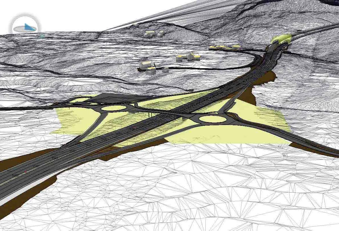
Putting Lima, Peru on the map as a major hub in South America via a $2 billion airport rebuild was serious business. This 270,000 square meter challenge at Jorge Chávez International would require 7,000 collaborators to work from the same page — avoiding errors and rework that could jeopardise their timeline and budget.

For Sacyr Infrastructure, making sure all the lofty project expectations landed solid was a must, with next-level workflows and serious connectivity. Communication back and forth from office to field had to be seamless, for better accuracy, productivity and efficiency on the fly. The key? Accurate data, soaring through the cloud.

Learn more at: https://trimble.com/en/through-the-cloud

Exhibitions

For more information on companies in this article

Related Content

  • Vietnam-Laos expressway under consideration
    October 11, 2021
    A new expressway linking Vietnam and Laos is under consideration.
  • Freedonia: Global off-road equipment demand to rise 5.4% in 2021
    May 10, 2021
    Freedonia reports that global off-road equipment demand is to rise 5.4% to US$439 billion in 2021.
  • Quantm is making Trimble one of the world’s leading BIM market challengers
    December 19, 2016
    When Trimble first launched its Quantm software system a decade or so ago, the company was making an important step into end-to-end BIM modelling. The rules of the game were changing fast. Adrian Greeman reports When survey and machine control equipment maker Trimble bought the Australian road planning software system Quantm in 2006 it might not have realised quite what it was leading to. A decade later, Quantm is helping to put Trimble among the big players in the BIM (building information modelling) en
  • Rapid adoption of GPS machine control
    April 5, 2012
    The high sophistication of GPS machine control systems has resulted in a fast pace of technological advancement. The three major players in the machine control sector, Leica Geosystems, Topcon and Trimble have all made major gains in recent years. The sophistication of the latest systems can combine satellite position data from the GPS and GLONASS networks with information from total stations to provide precise, high speed machine operation. Further more the firms have also prepared themselves for the intro