Using robotic total stations and Millimeter GPS, Topcon’s ZS100 combines two existing technologies to give operators fewer set-ups, fewer instruments – and a much simpler job site
Topcon Positioning Group is applying its technology to haul trucks, the company announced on Wednesday.
“Our objective has always been to automate a construction site as much as possible,” said Kris Maas, manager of machine control product marketing for Topcon. “We know we can’t, or at least shouldn’t, remotely operate any vehicle. But, we can and should do the next best thing—manage and track the whereabouts and payload of site material. That’s what HT-30 does.”
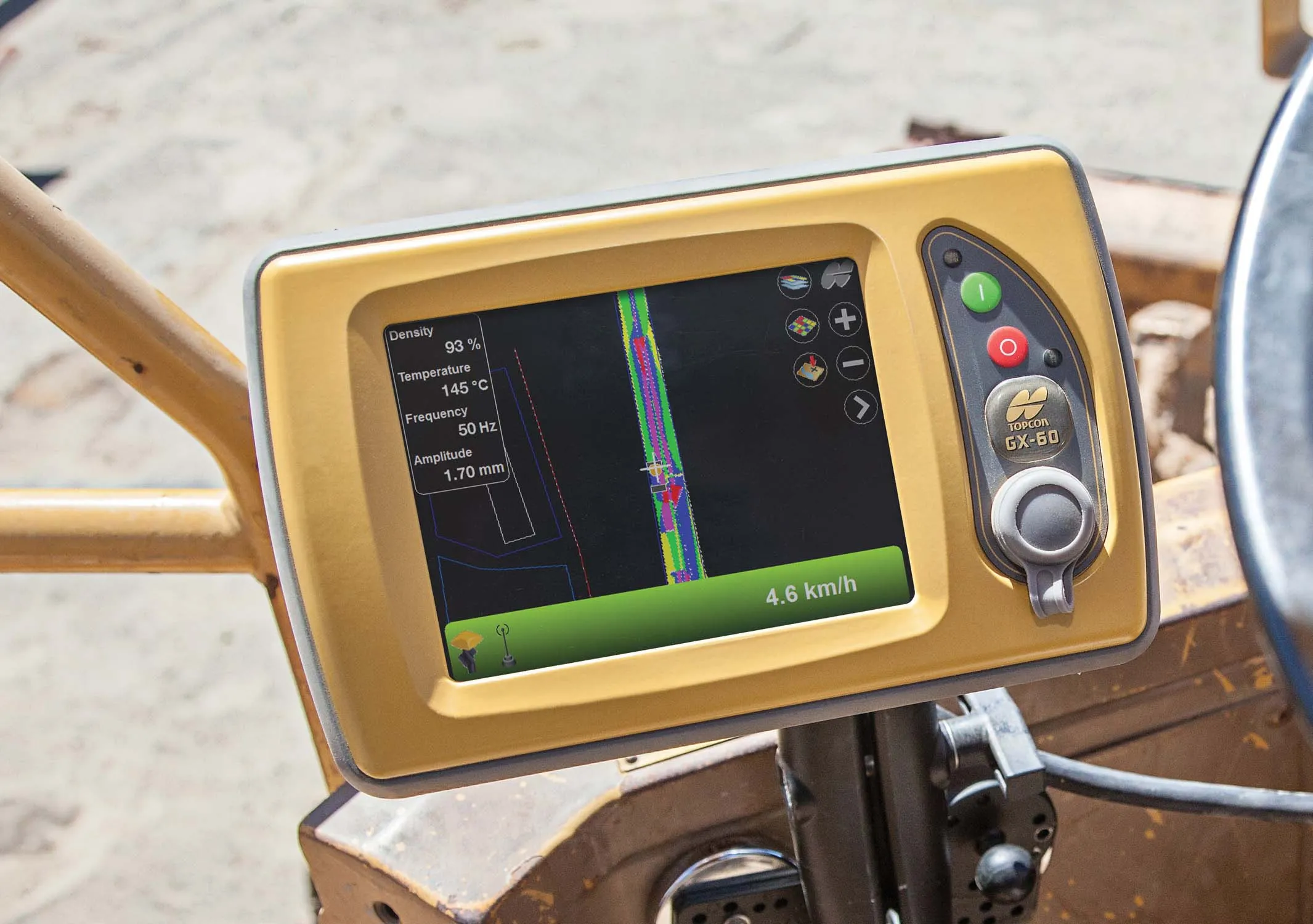
Innovative GIS and software solutions are coming to market from the three key market players - Mike Woof reports
Competition is strong in the field for GIS and surveying systems as well as the associated software. The three major players in the sector, Leica Geosystems, Topcon and Trimble, all invest heavily in research and development and continue to roll out new solutions for construction customers that will boost the efficiency of surveying as well as overall project implementation.
Topcon Positioning is introducing the C-63 GPS/GNSS indicator system designed specifically for use with compactors. The package can help deliver precise compaction and features the firm’s novel GNSS technology and graphical display, providing real-time positioning and plan data and ensuring optimum compaction is achieved where required. Compaction is important for soil or asphalt applications but monitoring surfaces is difficult with existing technologies. Over- or under-compaction of asphalt in particular