
Topcon SmoothRide

April 15, 2016

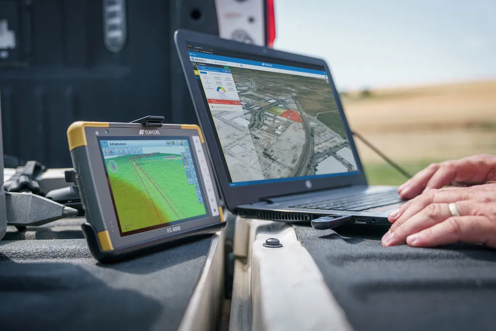
Topcon Positioning Group’s new road scanning concept SmoothRide can gather highway asset data at highway speeds with no need for lane closures, crash trucks or escorts. SmoothRide is a vehicle-mounted resurfacing solution for paving and milling projects that can help to deliver smooth surfaces and to calculate accurately the quantity of material needed for each project.

Exhibitions

Related Content

  • Topcon technology expanded to include haul trucks
    January 6, 2017
    Topcon Positioning Group is applying its technology to haul trucks, the company announced on Wednesday. “Our objective has always been to automate a construction site as much as possible,” said Kris Maas, manager of machine control product marketing for Topcon. “We know we can’t, or at least shouldn’t, remotely operate any vehicle. But, we can and should do the next best thing—manage and track the whereabouts and payload of site material. That’s what HT-30 does.”
  • Topcon technology expanded to include haul trucks
    March 11, 2014
    Topcon Positioning Group is applying its technology to haul trucks, the company announced on Wednesday. “Our objective has always been to automate a construction site as much as possible,” said Kris Maas, manager of machine control product marketing for Topcon. “We know we can’t, or at least shouldn’t, remotely operate any vehicle. But, we can and should do the next best thing—manage and track the whereabouts and payload of site material. That’s what HT-30 does.”
  • Improved construction software from Topcon
    June 22, 2021
    Topcon Positioning is introducing the latest version of its software package for construction and survey professionals: MAGNET 7.
  • Positioning tools continue to improve
    July 16, 2012
    Topcon says that its new IP-S2 package combines GNNS positioning capabilities with inertial sensors, while the firm also has a solution for customers wanting to mix and match receiver components. The IP-S2 is a vehicle-mounted, mobile 3D tool that offers precision mapping and surveying capabilities. The package collects data using 3D laser scanners, LIDAR, and/or cameras, and this is then integrated, time-stamped and geo-referenced. The customer can use this assembled data to combine LIDAR point cloud and d