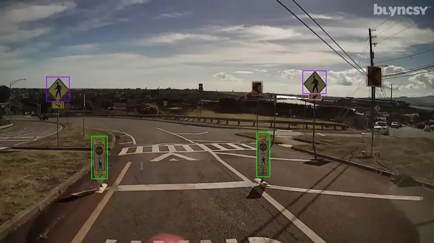
Blyncsy, part of Bentley Systems, has published a comprehensive public map of all interstate highways in the United States. This shows key roadway assets such as guardrails, speed limit signs, and work zones to support roadway safety and maintenance conditions. This data is now available to all state US Department of Transportation (DOT) agencies. The information allows the states to better address safety, maintenance, and repair operations of deteriorating and at-risk roads more efficiently and cost-effectively, especially during times of natural disasters.
The new Blyncsy interstate highway map uses crowdsourced dash camera imagery from over 1 million vehicles in use. When coupled with Blyncsy’s powerful AI image analysis toolset, the system can detect over 40 different road conditions and asset inventory issues in near-real time. These issues include potential roadway safety hazards from guardrail damage, missing signage, and lack of proper road striping to roadway vulnerabilities from crashes, natural disasters, and work zone areas.
Blyncsy’s AI-powered crowdsourced data is delivered through an open API, providing state DOTs a solution that is infinitely scalable and more cost-efficient when compared to other manual data collection technologies like LiDAR, or traditional road inspection methods, which require road maintenance crews to be dispatched.
"The application of advanced technologies like AI, combined with new sources of data, are transforming the transportation sector, giving us better information as we make investments in safety and mobility,” said Laura Chace, President and CEO of ITS America. "We applaud companies like Blyncsy for deploying these forward-thinking technologies and making this digital infrastructure data available to the public in an accessible format. We're excited to see how Blyncsy's data launch will support the core values of safety and equity while furthering the digital infrastructure movement on a national scale.
“With increasing workloads and smaller budgets, state DOTs need a way to improve roadway safety and operational efficiencies,” said Mark Pittman, Blyncsy CEO and Bentley’s Director of Transportation AI. “Today, we’re supporting a national digital infrastructure vision and democratising roadway data by publishing an open dataset of U.S. highways to help state DOTs better prepare, maintain, and repair more miles and create safer environments for maintenance crews and drivers, alike.”